Fontiers-Cabardès
| Fontiers-Cabardès | ||
|---|---|---|
| Commune | ||
 | ||
| ||
 Fontiers-Cabardès Location within Occitanie region  Fontiers-Cabardès | ||
| Coordinates: 43°22′14″N 2°14′55″E / 43.3706°N 2.2486°ECoordinates: 43°22′14″N 2°14′55″E / 43.3706°N 2.2486°E | ||
| Country | France | |
| Region | Occitanie | |
| Department | Aude | |
| Arrondissement | Carcassonne | |
| Canton | La Malepère à la Montagne Noire | |
| Intercommunality | Cabardès Montagne Noire | |
| Government | ||
| • Mayor (2008–2014) | Yves Bonnafous | |
| Area1 | 8.46 km2 (3.27 sq mi) | |
| Population (2008)2 | 426 | |
| • Density | 50/km2 (130/sq mi) | |
| Time zone | UTC+1 (CET) | |
| • Summer (DST) | UTC+2 (CEST) | |
| INSEE/Postal code | 11150 /11390 | |
| Elevation | 438–803 m (1,437–2,635 ft) | |
|
1 French Land Register data, which excludes lakes, ponds, glaciers > 1 km2 (0.386 sq mi or 247 acres) and river estuaries. 2 Population without double counting: residents of multiple communes (e.g., students and military personnel) only counted once. | ||
.svg.png)
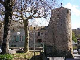
Fontiers-Cabardès is a commune in the Aude department in southern France.
Population
| Historical population | ||
|---|---|---|
| Year | Pop. | ±% |
| 1962 | 105 | — |
| 1968 | 205 | +95.2% |
| 1975 | 245 | +19.5% |
| 1982 | 307 | +25.3% |
| 1990 | 306 | −0.3% |
| 1999 | 324 | +5.9% |
| 2008 | 426 | +31.5% |
See also
References
| Wikimedia Commons has media related to Fontiers-Cabardès. |
This article is issued from
Wikipedia.
The text is licensed under Creative Commons - Attribution - Sharealike.
Additional terms may apply for the media files.