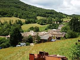
Saint-Jean-de-Paracol
| Saint-Jean-de-Paracol | |
|---|---|
| Commune | |
 | |
 Saint-Jean-de-Paracol Location within Occitanie region  Saint-Jean-de-Paracol | |
| Coordinates: 42°56′12″N 2°06′53″E / 42.9367°N 2.1147°ECoordinates: 42°56′12″N 2°06′53″E / 42.9367°N 2.1147°E | |
| Country | France |
| Region | Occitanie |
| Department | Aude |
| Arrondissement | Limoux |
| Canton | La Haute-Vallée de l'Aude |
| Intercommunality | Aude en Pyrénées |
| Government | |
| • Mayor (2008–2014) | Serge Weinberg |
| Area1 | 7.08 km2 (2.73 sq mi) |
| Population (2008)2 | 114 |
| • Density | 16/km2 (42/sq mi) |
| Time zone | UTC+1 (CET) |
| • Summer (DST) | UTC+2 (CEST) |
| INSEE/Postal code | 11346 /11260 |
| Elevation |
316–726 m (1,037–2,382 ft) (avg. 600 m or 2,000 ft) |
|
1 French Land Register data, which excludes lakes, ponds, glaciers > 1 km2 (0.386 sq mi or 247 acres) and river estuaries. 2 Population without double counting: residents of multiple communes (e.g., students and military personnel) only counted once. | |
Saint-Jean-de-Paracol is a commune in the Aude department in southern France.
Population
| Historical population | ||
|---|---|---|
| Year | Pop. | ±% |
| 1962 | 101 | — |
| 1968 | 103 | +2.0% |
| 1975 | 95 | −7.8% |
| 1982 | 93 | −2.1% |
| 1990 | 83 | −10.8% |
| 1999 | 94 | +13.3% |
| 2008 | 114 | +21.3% |
See also
References
| Wikimedia Commons has media related to Saint-Jean-de-Paracol. |
This article is issued from
Wikipedia.
The text is licensed under Creative Commons - Attribution - Sharealike.
Additional terms may apply for the media files.