Mirepeisset
| Mirepeisset | ||
|---|---|---|
| Commune | ||
 | ||
| ||
 Mirepeisset Location within Occitanie region  Mirepeisset | ||
| Coordinates: 43°17′10″N 2°53′51″E / 43.2861°N 2.8975°ECoordinates: 43°17′10″N 2°53′51″E / 43.2861°N 2.8975°E | ||
| Country | France | |
| Region | Occitanie | |
| Department | Aude | |
| Arrondissement | Narbonne | |
| Canton | Le Sud-Minervois | |
| Intercommunality | Canal du Midi en Minervois | |
| Government | ||
| • Mayor (2008–2014) | André Ratia | |
| Area1 | 5.19 km2 (2.00 sq mi) | |
| Population (2008)2 | 741 | |
| • Density | 140/km2 (370/sq mi) | |
| Time zone | UTC+1 (CET) | |
| • Summer (DST) | UTC+2 (CEST) | |
| INSEE/Postal code | 11233 /11120 | |
| Elevation |
26–47 m (85–154 ft) (avg. 37 m or 121 ft) | |
|
1 French Land Register data, which excludes lakes, ponds, glaciers > 1 km2 (0.386 sq mi or 247 acres) and river estuaries. 2 Population without double counting: residents of multiple communes (e.g., students and military personnel) only counted once. | ||
.svg.png)
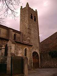
Mirepeisset is a commune in the Aude department in southern France.
Population
| Historical population | ||
|---|---|---|
| Year | Pop. | ±% |
| 1962 | 351 | — |
| 1968 | 359 | +2.3% |
| 1975 | 326 | −9.2% |
| 1982 | 324 | −0.6% |
| 1990 | 410 | +26.5% |
| 1999 | 451 | +10.0% |
| 2008 | 741 | +64.3% |
See also
References
| Wikimedia Commons has media related to Mirepeisset. |
This article is issued from
Wikipedia.
The text is licensed under Creative Commons - Attribution - Sharealike.
Additional terms may apply for the media files.