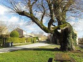
Brousses-et-Villaret
| Brousses-et-Villaret | ||
|---|---|---|
| Commune | ||
 | ||
| ||
 Brousses-et-Villaret Location within Occitanie region  Brousses-et-Villaret | ||
| Coordinates: 43°20′35″N 2°15′15″E / 43.3431°N 2.2542°ECoordinates: 43°20′35″N 2°15′15″E / 43.3431°N 2.2542°E | ||
| Country | France | |
| Region | Occitanie | |
| Department | Aude | |
| Arrondissement | Carcassonne | |
| Canton | La Malepère à la Montagne Noire | |
| Intercommunality | Cabardès Montagne Noire | |
| Government | ||
| • Mayor (2008–2014) | Danièle Nicolaou | |
| Area1 | 11.16 km2 (4.31 sq mi) | |
| Population (2008)2 | 315 | |
| • Density | 28/km2 (73/sq mi) | |
| Time zone | UTC+1 (CET) | |
| • Summer (DST) | UTC+2 (CEST) | |
| INSEE/Postal code | 11052 /11390 | |
| Elevation |
229–599 m (751–1,965 ft) (avg. 400 m or 1,300 ft) | |
|
1 French Land Register data, which excludes lakes, ponds, glaciers > 1 km2 (0.386 sq mi or 247 acres) and river estuaries. 2 Population without double counting: residents of multiple communes (e.g., students and military personnel) only counted once. | ||
Brousses-et-Villaret is a commune in the Aude department in southern France.
Population
| Historical population | ||
|---|---|---|
| Year | Pop. | ±% |
| 1856 | 477 | — |
| 1861 | 504 | +5.7% |
| 1866 | 438 | −13.1% |
| 1872 | 450 | +2.7% |
| 1876 | 455 | +1.1% |
| 1881 | 448 | −1.5% |
| 1886 | 446 | −0.4% |
| 1891 | 393 | −11.9% |
| 1896 | 352 | −10.4% |
| 1901 | 324 | −8.0% |
| 1906 | 330 | +1.9% |
| 1911 | 343 | +3.9% |
| 1921 | 272 | −20.7% |
| 1926 | 280 | +2.9% |
| 1931 | 269 | −3.9% |
| 1936 | 261 | −3.0% |
| 1946 | 266 | +1.9% |
| 1954 | 232 | −12.8% |
| 1962 | 190 | −18.1% |
| 1968 | 207 | +8.9% |
| 1975 | 227 | +9.7% |
| 1982 | 222 | −2.2% |
| 1990 | 254 | +14.4% |
| 1999 | 307 | +20.9% |
| 2008 | 315 | +2.6% |
See also
References
External links
| Wikimedia Commons has media related to Brousses-et-Villaret. |
This article is issued from
Wikipedia.
The text is licensed under Creative Commons - Attribution - Sharealike.
Additional terms may apply for the media files.