Fengning Manchu Autonomous County
| Fengning County 丰宁县 ᡶᡝᠩᠨᡳᠩ ᠰᡳᠶᠠᠨ | |
|---|---|
| Autonomous county | |
|
丰宁满族自治县 ᡶᡝᠩᠨᡳᠩ ᠮᠠᠨᠵᡠ ᠪᡝᠶᡝ ᡩᠠᠰᠠᠩᡤᠠ ᠰᡳᠶᠠᠨ | |
 The former temporary palace of Genghis Khan on north grassland of the county. | |
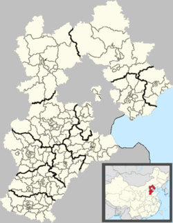 Fengning Location in Hebei | |
| Coordinates: 41°12′N 116°39′E / 41.200°N 116.650°ECoordinates: 41°12′N 116°39′E / 41.200°N 116.650°E | |
| Country | People's Republic of China |
| Province | Hebei |
| Prefecture-level city | Chengde |
| Township-level divisions |
9 towns 16 townships 1 ethnic township |
| County seat | Dage (大阁镇) |
| Area | |
| • Total | 8,765 km2 (3,384 sq mi) |
| Elevation | 662 m (2,172 ft) |
| Population (2004) | |
| • Total | 380,000 |
| • Density | 43/km2 (110/sq mi) |
| Time zone | UTC+8+8 (China StandardChina Standard) |
| Postal code | 068300 |
| Area code(s) | 0314 |
| Website |
fn |
Fengning Manchu Autonomous County (simplified Chinese: 丰宁满族自治县; traditional Chinese: 豐寧滿族自治縣; pinyin: Fēngníng Mǎnzú Zìzhìxiàn; Manchu: ᡶᡝᠩᠨᡳᠩ ᠮᠠᠨᠵᡠ ᠪᡝᠶᡝ ᡩᠠᠰᠠᠩᡤᠠ ᠰᡳᠶᠠᠨ; Mölendroff: fengning manju beye dasangga siyan) is a Manchu autonomous county of northern Hebei province, bordering Beijing to the southwest and Inner Mongolia to the north, and lying under the administration of Chengde City.
It is the second-largest county of Hebei in terms of area, after the neighbouring Weichang Manchu and Mongol Autonomous County.
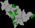
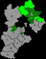
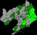
Administrative divisions
The county has 9 towns, 16 townships, and one ethnic township under its administration.[1]
|
Towns:
|
Townships:
|
Geography
Geology
Fossil-bearing rocks of the Mesozoic Huajiying Formation and/or Yixian Formation occur on the surface. The prehistoric bird Paraprotopteryx was found in such a deposit.
Climate
Fengning has a rather dry, monsoon-influenced humid continental climate (Köppen Dwa), with long, very cold and dry winters, and hot, humid summers, and the elevation depresses temperatures. The monthly 24-hour mean temperature in January is −11.2 °C (11.8 °F), and in July it is 22.4 °C (72.3 °F), while the annual mean is 6.83 °C (44.3 °F). More than half of the annual precipitation occurs in July and August alone.
| Climate data for Fengning County (1971−2000) | |||||||||||||
|---|---|---|---|---|---|---|---|---|---|---|---|---|---|
| Month | Jan | Feb | Mar | Apr | May | Jun | Jul | Aug | Sep | Oct | Nov | Dec | Year |
| Record high °C (°F) | 9.2 (48.6) |
17.8 (64) |
22.4 (72.3) |
32.6 (90.7) |
35.9 (96.6) |
37.6 (99.7) |
40.5 (104.9) |
36.8 (98.2) |
33.4 (92.1) |
26.2 (79.2) |
19.8 (67.6) |
13.7 (56.7) |
40.5 (104.9) |
| Average high °C (°F) | −3 (27) |
0.7 (33.3) |
7.6 (45.7) |
17.0 (62.6) |
23.5 (74.3) |
27.1 (80.8) |
28.2 (82.8) |
26.8 (80.2) |
22.3 (72.1) |
15.6 (60.1) |
5.7 (42.3) |
−1.1 (30) |
14.2 (57.6) |
| Daily mean °C (°F) | −11.2 (11.8) |
−7.3 (18.9) |
0.1 (32.2) |
9.3 (48.7) |
16.1 (61) |
20.4 (68.7) |
22.4 (72.3) |
20.6 (69.1) |
14.7 (58.5) |
7.6 (45.7) |
−1.8 (28.8) |
−8.9 (16) |
6.8 (44.2) |
| Average low °C (°F) | −17.5 (0.5) |
−14.2 (6.4) |
−7.2 (19) |
1.2 (34.2) |
8.2 (46.8) |
13.5 (56.3) |
17.1 (62.8) |
15.2 (59.4) |
8.0 (46.4) |
0.9 (33.6) |
−7.7 (18.1) |
−14.9 (5.2) |
0.2 (32.4) |
| Record low °C (°F) | −27.4 (−17.3) |
−28.5 (−19.3) |
−26 (−15) |
−11.9 (10.6) |
−3.7 (25.3) |
4.0 (39.2) |
8.8 (47.8) |
0.5 (32.9) |
−3.3 (26.1) |
−10.5 (13.1) |
−23.6 (−10.5) |
−26.8 (−16.2) |
−28.5 (−19.3) |
| Average precipitation mm (inches) | 1.5 (0.059) |
3.7 (0.146) |
6.4 (0.252) |
15.6 (0.614) |
36.8 (1.449) |
72.5 (2.854) |
134.2 (5.283) |
108.3 (4.264) |
51.8 (2.039) |
18.8 (0.74) |
5.8 (0.228) |
1.6 (0.063) |
457.0 (17.992) |
| Average precipitation days (≥ 0.1 mm) | 1.2 | 2.3 | 3.6 | 4.6 | 8.0 | 11.7 | 15.1 | 13.2 | 8.9 | 4.8 | 2.1 | 1.1 | 76.6 |
| Source: Weather China | |||||||||||||
Economy
The county draws in many tourists as the Bashang Grasslands in the far north of the county is the nearest grasslands to Beijing.[2] The cultivation of a local tourism is part of a broader regional development policy to support tourism as a primary industry in the Chengde area due to the environmentally friendly character of the industry going well with the goal of preserving the Chengde area's pristine environment, especially compared to the pollution problems besetting the rest of Hebei and also Beijing and Tianjin.[2]
The county's primary tourist attraction are the horse ranches in the Datan grassland. Other highlights are the Dahan Palace of Genghis Khan and the Baiyun Ancient Cave.[2] The height of the tourism season is in July and August when there are bonfire festivities filled with ethnic songs and dances, roasted whole lamb, and staged traditional sporting events like wrestling and archery.[2]
Transport
Both China National Highway 111 and 112 pass through the county, with the former providing direct access to Beijing.
References
- ↑ 2011年统计用区划代码和城乡划分代码:丰宁满族自治县 (in Chinese). National Bureau of Statistics of the People's Republic of China. Retrieved 2012-12-26.
- 1 2 3 4 "Peace and action go hand in hand". China Daily. July 20, 2016.