Mancheng District
| Mancheng 满城区 | |
|---|---|
| County | |
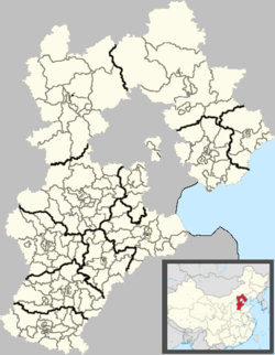 Mancheng Location in Hebei | |
| Coordinates: 38°56′56″N 115°19′19″E / 38.949°N 115.322°ECoordinates: 38°56′56″N 115°19′19″E / 38.949°N 115.322°E | |
| Country | People's Republic of China |
| Province | Hebei |
| Prefecture-level city | Baoding |
| County seat | Huiyang Subdistrict (惠阳街道) |
| Area | |
| • Total | 734 km2 (283 sq mi) |
| Elevation | 44 m (143 ft) |
| Population (2004) | |
| • Total | 390,000 |
| • Density | 530/km2 (1,400/sq mi) |
| Time zone | UTC+8 (China Standard) |
| Postal code | 072150 |
| Website |
www |
Mancheng District (simplified Chinese: 满城区; traditional Chinese: 滿城區; pinyin: Mànchéng Qū) is a district of west-central Hebei province, China, in the eastern foothills of the Taihang Mountains. It is administratively part of Baoding prefecture-level city, of which the Mancheng is a northwestern suburb.
Mancheng is the site of the Han dynasty tombs of king/prince Liu Sheng and his wife Dou Wan.
Administrative divisions
There is 1 subdistrict, 5 towns and 7 townships under the county's administration.[1]
Subdistricts:
- Huiyang Subdistrict (惠阳街道)
Towns:
- Mancheng (满城镇), Daceying (大册营镇), Shenxing (神星镇), Nanhancun (南韩村镇), Fangshunqiao (方顺桥镇)
Townships:
- Yujiazhuang Township (于家庄乡), Xiantai Township (贤台乡), Yaozhuang Township (要庄乡), Bailong Township (白龙乡), Shijing Township (石井乡), Tuonan Township (坨南乡), Liujiatai Township (刘家台乡)
References
- ↑ 2011年统计用区划代码和城乡划分代码:满城县 (in Chinese). National Bureau of Statistics of the People's Republic of China. Retrieved 2012-07-18.
External links
| Wikimedia Commons has media related to Mancheng County. |
This article is issued from
Wikipedia.
The text is licensed under Creative Commons - Attribution - Sharealike.
Additional terms may apply for the media files.