Congtai District

congtai
| Congtai 丛台区 | |
|---|---|
| District | |
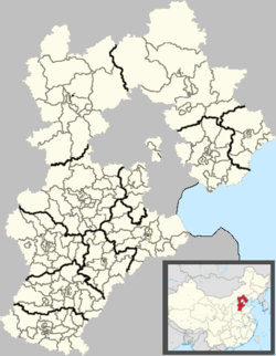 Congtai Location in Hebei | |
| Coordinates: 36°37′07″N 114°29′36″E / 36.61861°N 114.49333°ECoordinates: 36°37′07″N 114°29′36″E / 36.61861°N 114.49333°E | |
| Country | People's Republic of China |
| Province | Hebei |
| Prefecture-level city | Handan |
| Area | |
| • Total | 28 km2 (11 sq mi) |
| Elevation | 61 m (199 ft) |
| Population | |
| • Total | 330,000 |
| • Density | 12,000/km2 (31,000/sq mi) |
| Time zone | UTC+8 (China Standard) |
| Postal code | 056004 |
Congtai District (simplified Chinese: 丛台区; traditional Chinese: 叢台區; pinyin: Cóngtái Qū) is a district of the city of Handan, Hebei, People's Republic of China, with a population of 330,000 residing in an area of just 28 km2 (11 sq mi).
The district seats the Handan's executive, legislature and judiciary, together with its CPC and Public Security bureaus.
Administration
As of 2009, the district comprises 10 street committees and 1 township (乡, xiang). There are a total of 70 block committees under these Subdistricts:
Street Committee
- Renmin Road Subdistrict (人民路街道)
- Zhonghua Subdistrict (中华街道)
- East Congtai Subdistrict (丛台东街道)
- West Congtai Subdistrict (丛台西街道)
- Guangmingqiao Subdistrict (光明桥街道)
- Qinhe Subdistrict (沁河街道)
- Heping Subdistrict (和平街道)
- Liulinqiao Subdistrict (柳林桥街道)
- East Lianfang Subdistrict (联纺东街道)
- West Lianfang Subdistrict (联纺西街道)
Township
- Sucao Township (苏曹乡)
References
This article is issued from
Wikipedia.
The text is licensed under Creative Commons - Attribution - Sharealike.
Additional terms may apply for the media files.