Laishui County
| Laishui County 涞水县 | |
|---|---|
| County | |
 | |
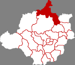 Laishui in Baoding | |
.png) Baoding in Hebei | |
| Coordinates: 39°23′38″N 115°42′50″E / 39.394°N 115.714°ECoordinates: 39°23′38″N 115°42′50″E / 39.394°N 115.714°E | |
| Country | People's Republic of China |
| Province | Hebei |
| Prefecture-level city | Baoding |
| County seat | Laishui Town (涞水镇) |
| Area | |
| • Total | 1,666 km2 (643 sq mi) |
| Elevation | 42 m (138 ft) |
| Population | |
| • Total | 340,000 |
| • Density | 200/km2 (530/sq mi) |
| Time zone | UTC+8 (China Standard) |
| Postal code | 074100 |
Laishui County (simplified Chinese: 涞水县; traditional Chinese: 淶水縣; pinyin: Láishuǐ Xiàn) is a county in central Hebei province, China, bordering the Municipality of Beijing to the north and in the basin of the Juma River. It is under the administration of the prefecture-level city of Baoding and contains its northernmost point; it has a population of 340,000 residing in an area of 1,666 km2 (643 sq mi). It is served by China National Highway 112 and G5 Beijing–Kunming Expressway.
Administrative divisions
There are 7 towns, 7 townships, and 1 ethnic township under the county's administration.[1]
Towns:
- Laishui (涞水镇), Yi'an (义安镇), Shiting (石亭镇), Zhaogezhuang (赵各庄镇), Yongyang (永阳镇), Sanpo (三坡镇), Jiulong (九龙镇)
Townships:
- Longmen Township (龙门乡), Qizhongkou Township (其中口乡), Songgezhuang Township (宋各庄乡), Hujiazhuang Township (胡家庄乡), Mingyi Township (明义乡), Wangcun Township (王村乡), Dongwenshan Township (东文山乡), Loucun Manchu Ethnic Township (娄村满族乡)
References
- ↑ 2011年统计用区划代码和城乡划分代码:涞水县 (in Chinese). National Bureau of Statistics of the People's Republic of China. Retrieved 2012-07-18.
External links
This article is issued from
Wikipedia.
The text is licensed under Creative Commons - Attribution - Sharealike.
Additional terms may apply for the media files.