Jabalpur Airport
| Jabalpur Airport Dumna Airport | |||||||||||
|---|---|---|---|---|---|---|---|---|---|---|---|
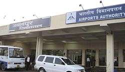 Airport entrance | |||||||||||
| Summary | |||||||||||
| Airport type | Public | ||||||||||
| Operator | Airports Authority of India | ||||||||||
| Serves | Jabalpur, | ||||||||||
| Location | Dumna | ||||||||||
| Elevation AMSL | 1,624 ft / 495 m | ||||||||||
| Coordinates | 23°11′05″N 080°03′31.5″E / 23.18472°N 80.058750°ECoordinates: 23°11′05″N 080°03′31.5″E / 23.18472°N 80.058750°E | ||||||||||
| Website |
www | ||||||||||
| Map | |||||||||||
 JLR Location in India  JLR JLR (India) | |||||||||||
| Runways | |||||||||||
| |||||||||||
| Statistics (April 2017-March 2018) | |||||||||||
| |||||||||||
Jabalpur Airport (IATA: JLR, ICAO: VAJB), also known as Dumna Airport, is an airport situated 25 kilometres (16 miles) east of Jabalpur, Madhya Pradesh. It is the third busiest airport in Madhya Pradesh after Indore Airport and Bhopal Airport. The airport is very important as it serves whole of eastern Madhya Pradesh, especially the Mahakaushal region. It serves the tourists who visit Kanha National Park, Bandhavgarh National Park, Pench National Park , Bhedaghat amongst others. The airport is spread over an area of 759.52 acres. Air India & SpiceJet have been operating scheduled flight services to and from Jabalpur.
History
The airport was constructed during the British era airport was opened in the 1930s and used periodically by the Royal Air Force and Royal Flying Corps before and during World War II. It was commonly known as Jubbulpore Aerodrome, and had a dirt runway until the 1960s. The new paved runway was built atop the original dirt runway, in the same alignment. Before the aerodrome at Dumna was opened, planes had been landing, even in the 1920s, within a racecourse inside the city limits of Jabalpur.
Runway
The runway is capable of serving narrow body aircraft including Airbus 320 family/Boeing 737-800 and is equipped with night landing facilities, DVOR/DME, NDB and precision approach path indicator. It has a parking for one A-320/B-737 or 2 ATR-72 aircraft.
Terminal
The terminal has the capacity of handling 150 passengers at the peak hours. It has 4 check-in desks apart from CCTV's and an X-ray machine for security. The airport is equipped with runway lighting, car-calling, night landing facilities, a food stall and an ATM. The Government of Madhya Pradesh had provided with Tourism Information Center and medical facilities like first-aid, MIR, and doctors and nurse will be provided soon.
Expansion
A new Integrated terminal will be built with an area of 9350 m2 and capable of handling 500 passengers at peak hours.The project also includes extending the runway to 2750 meters from the current 1988 meters, a 14 km long boundary wall, a 5 km long approach road connecting airport to the city, ATC control tower cum technical block, apron, taxiway,isolation bay and a fire station.The foundation stone was laid on August 13, 2018 by Suresh Prabhu, Jayant Sinha, Rakesh Singh amongst other.
Airlines and destinations
| Airlines | Destinations |
|---|---|
| Alliance Air | Delhi |
| SpiceJet | Ahmedabad (Begins 31st October 2018), Delhi, Hyderabad, Mumbai |
Airport connectivity
Pre-paid metro taxi services are available along with pre-paid auto rickshaws. Coach services to key locations in Jabalpur and private car rental services are available.
Accidents and Incidents
- On 4 December 2015, a Spicejet Bombardier Dash 8 Q400 registration VT-SUC, was operating as Spicejet Flight 2458, was landing at Jabalpur when the aircraft collided with a herd of 30-40 wild boars. 3 boars were killed and the aircraft skidded off the runway coming to a stop with the left gear collapsed, left engine damage, and other unknown damage caused by the impact. Despite the damage, no serious passenger injuries were reported[1][2]
References
- ↑ "Accident: Spicejet DH8D at Jabalpur on Dec 4th 2015, boar strike, runway excursion, left main and nose gear collapsed". Avherald.com. Retrieved 2017-03-29.
- ↑ Boyle, Darren. "Indian passenger aircraft badly damaged after hitting a wild boar on landing | Daily Mail Online". Dailymail.co.uk. Retrieved 2017-03-29.
External links
- Airport information for VAJB at World Aero Data. Data current as of October 2006.