City of Devonport
| Devonport City Council Tasmania | |||||||||||||||
|---|---|---|---|---|---|---|---|---|---|---|---|---|---|---|---|
|
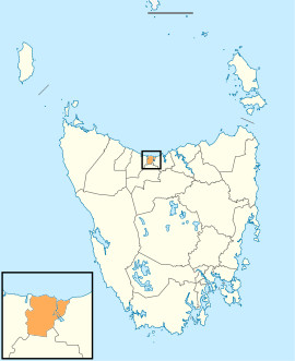
Map showing the Devonport local government area. | |||||||||||||||
| Coordinates | 41°12′28″S 146°18′49″E / 41.2078°S 146.3137°ECoordinates: 41°12′28″S 146°18′49″E / 41.2078°S 146.3137°E | ||||||||||||||
| Population | 24,696 (2016 census)[1] | ||||||||||||||
| • Density | 221.9/km2 (575/sq mi) | ||||||||||||||
| Established | 1 January 1907[2] | ||||||||||||||
| Area | 116 km2 (44.8 sq mi) | ||||||||||||||
| Mayor | Annette Rockliff | ||||||||||||||
| Council seat | Devonport | ||||||||||||||
| Region | Devonport and surrounds | ||||||||||||||
| State electorate(s) | Braddon | ||||||||||||||
| Federal Division(s) | Braddon | ||||||||||||||
|
| |||||||||||||||
| Website | Devonport City Council | ||||||||||||||
| |||||||||||||||
Devonport City Council (or City of Devonport) is a local government body located in the city and surrounds of Devonport in northern Tasmania. The Devonport local government area is classified as urban and has a population of 24,696, which also encompasses Lillico, Tugrah and part of Spreyton.
History and attributes
The Devonport municipality was established on 1 January 1907, becoming a city council on 1 January 1981.[2][3] Devonport was proclaimed a city by Prince Charles of Wales on 21 April 1981, in a ceremony conducted on the Devonport Oval. The city moto is The City with Spirit, this gives reference to being the home base for the passenger ferry ships Spirit of Tasmania I and Spirit of Tasmania II.
Devonport is classified as urban, regional and small (URS) under the Australian Classification of Local Governments.[4]
Government
| Name | Position[5] | Party affiliation | |
|---|---|---|---|
| Annette Rockliff | Mayor/ Alderman | Independent | |
| Charlie Emmerton | Alderman | Independent | |
| Grant Goodwin | Alderman | Independent | |
| Alison Jarman | Alderman | Independent | |
| Tammy Milne | Alderman | Independent | |
| Lynn Laycock | Alderman | Independent | |
| Jeff Matthews | Alderman | Independent | |
| Leon Perry | Alderman | Independent | |
Suburbs[6]
| Suburb | Census population 2016 | Reason |
|---|---|---|
| Aberdeen | 229 | |
| Ambleside | 663 | |
| Devonport | 13,759 | Includes Highfield |
| Don | 643 | |
| East Devonport | 4,053 | Includes Pardoe Downs, Rannoch, Pannorama Heights |
| Eugenana | 203 | |
| Forthside | 81 | |
| Highfield | Incl. in Devonport | |
| Lillico | 25 | |
| Melrose | 102 | |
| Miandetta | 1,852 | |
| Pardoe Downs | Incl. in East Devonport | |
| Pannorama Heights | Incl. in East Devonport | |
| Quoiba | 427 | |
| Rannoch | Incl. in East Devonport | |
| Spreyton | 1,669 | |
| Stony Rise | 643 | |
| Paloona | ||
| Tugrah | 366 | |
| Total | 24,715 | |
| (19) | Variance | |
| Local government total | 24,696 | Gazetted Devonport Local Government Area |
See also
References
- ↑ Australian Bureau of Statistics (27 June 2017). "Devonport (C)". 2016 Census QuickStats. Retrieved 23 November 2017.

- 1 2 "Agency Details: Devonport Municipal Council". search.archives.tas.gov.au. Tasmanian Government. Retrieved 11 June 2018.
- ↑ "Agency Details: Devonport City Council". search.archives.tas.gov.au. Tasmanian Government. Retrieved 11 June 2018.
- ↑ "Local government national report 2014-2015". regional.gov.au. Australian Government. Retrieved 8 June 2018.
- ↑ "Mayor & Alderman – Devonport City". devonport.tas.gov.au. Devonport City Council. Retrieved 16 May 2015.
- ↑ Devonport City Council (28 October 2005). "City of Devonport" (PDF). Retrieved 26 July 2015.
External links
- Devonport City Council official website
- Local Government Association Tasmania
- Tasmanian Electoral Commission - local government