Cuivre River State Park
| Cuivre River State Park | |
| Missouri State Park | |
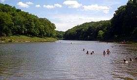 Swimming area in Lincoln Lake | |
| Country | United States |
|---|---|
| State | Missouri |
| County | Lincoln |
| Elevation | 548 ft (167 m) [1] |
| Coordinates | 39°02′01″N 90°55′51″W / 39.03361°N 90.93083°WCoordinates: 39°02′01″N 90°55′51″W / 39.03361°N 90.93083°W [1] |
| Area | 6,426.94 acres (2,601 ha) [2] |
| Established | 1946 [3] |
| Management | Missouri Department of Natural Resources |
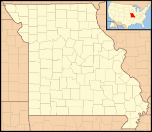 Location in Missouri | |
| Website: Cuivre River State Park | |
|
Camp Sherwood Forest Historic District | |
| Nearest city | Elsberry, Missouri |
| Area | 132 acres (53 ha) |
| Built | 1936 |
| Built by | CCC |
| Architectural style | Rustic |
| MPS | ECW Architecture in Missouri State Parks 1933-1942 TR |
| NRHP reference # | 85000512 |
| Added to NRHP | March 4, 1985 |
|
Cuivre River State Park Administrative Area Historic District | |
| Nearest city | Troy, Missouri |
| Area | 620 acres (250 ha) |
| Built | 1934 |
| Built by | CCC; WPA |
| Architectural style | Rustic |
| MPS | ECW Architecture in Missouri State Parks 1933-1942 TR |
| NRHP reference # | 85000514 |
| Added to NRHP | March 4, 1985 |
Cuivre River State Park is a public recreation area covering more than 6,400 acres (2,600 ha) northeast of the city of Troy in the Lincoln Hills region of northeastern Missouri, United States. The state park's rugged landscapes range from native grasslands and savannas to limestone bluffs over looking forested hills. The park offers an extensive system of hiking trails plus swimming and camping facilities and is managed by the Missouri Department of Natural Resources.[4] It encompasses the Lincoln Hills Natural Area (1872 acres)[5] and two designated wild areas: Big Sugar Creek (1675 acres) and Northwoods (1082 acres).[6][7]
History
The park began as a federal recreation demonstration area in the 1930s when workers from the Civilian Conservation Corps and the Works Project Administration[8] constructed roads, bridges, group camps, and a picnic shelter.[9] The state took possession of the park in 1946.[3] Two national historic districts—Camp Sherwood Forest and the Cuiver River State Park Administrative Area—were added to the National Register of Historic Places in 1985.
- Camp Sherwood Forest: The district encompasses 52 buildings and structures constructed by the Civilian Conservation Corps between 1934 and 1936. They include the Amphitheater (1936-1938), Council Circle (1936-1938), Dining Lodge (1936-1938), Central Restroom / Shower (1936-1938), Cook's Quarters (1936-1938), Administration Building (1936-1938), Recreation Hall (1936-1938), and Director's Lodge (1936-1938). The district also includes cabins and associated kitchen and latrine units at Ancaster Village, Nottingham Village, and Fountaindale Village.[8]:100–108
- Cuiver River State Park Administrative Area: The district encompasses six buildings and structures constructed by the Civilian Conservation Corps and the Works Projects Administration between 1934 and 1941. They are the Cul Bridge (1941), Shelter/Restroom (1940), Wellhouse (1940), Warehouse (1934-1941), Service Building (Garage) (1934-1941), and Park Office (1934-1941).[8]:132–136
Activities and amenities
The park offers two campgrounds, backpack camping, fishing on Sugar Creek, swimming and canoeing on 55-acre Lake Lincoln, and trails for hiking, cycling and horseback riding.[4]
| Trail | Length |
|---|---|
| Big Sugar Creek Trail | 3.75 miles (6.04 km) |
| Blackhawk Point Trail | 5.75 miles (9.25 km) |
| Blazing Star Trail | 2 miles (3.2 km) |
| Cuivre River Trail | 11.25 miles (18.11 km) |
| Frenchman's Bluff Trail | 1.5 miles (2.4 km) |
| Hamilton Hollow Trail | .9 miles (1.4 km) |
| Lakeside Trail | 3.5 miles (5.6 km) |
| Lone Spring Trail | 5.2 miles (8.4 km) |
| Mossy Hill Trail | .8 miles (1.3 km) |
| Old Schoolhouse Trail | 3.85 miles (6.20 km) |
| Prairie Trail | .3 miles (0.48 km) |
| Turkey Hollow Trail | .8 miles (1.3 km) |
References
- 1 2 "Cuivre River State Park". Geographic Names Information System. United States Geological Survey.
- ↑ "Cuivre River State Park: Data Sheet" (PDF). Missouri Department of Natural Resources. November 2017. Retrieved April 23, 2018.
- 1 2 "State Park Land Acquisition Summary". Missouri State Parks. Retrieved August 17, 2015.
- 1 2 "Cuivre River State Park". Missouri Department of Natural Resources. Retrieved October 1, 2014.
- ↑ "Lincoln Hills Natural Area". Missouri Department of Conservation. Retrieved April 23, 2018.
- ↑ "Missouri State Park Designated Wild Areas". Missouri Department of Natural Resources. Retrieved October 7, 2015.
- ↑ Henry, Steve (2006). 60 Hikes Within 60 Miles: St Louis (2nd ed.). Menasha Ridge Press. pp. 100–02. ISBN 0897326121.
- 1 2 3 Wright, Bonnie. "ECW Architecture in Missouri State Parks 1933-1942 Thematic Resources" (PDF). National Register of Historic Places Nomination Form. Missouri Department of Natural Resources. Retrieved October 6, 2015.
- ↑ "Cuiver River State Park: History". Missouri Department of Natural Resources. Retrieved October 7, 2015.
- ↑ "Cuiver River State Park: Trails". Missouri Department of Natural Resources. Retrieved October 6, 2015.
External links
| Wikimedia Commons has media related to Cuivre River State Park. |
- Cuivre River State Park Missouri Department of Natural Resources
- Cuivre River State Park Map Missouri Department of Natural Resources

