Table Rock State Park (Missouri)
| Table Rock State Park | |
| Missouri State Park | |
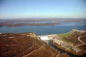 Table Rock Lake and Dam with state park in left foreground | |
| Country | United States |
|---|---|
| State | Missouri |
| Counties | Taney, Stone |
| Elevation | 889 ft (271 m) [1] |
| Coordinates | 36°35′15″N 93°18′37″W / 36.58750°N 93.31028°WCoordinates: 36°35′15″N 93°18′37″W / 36.58750°N 93.31028°W [1] |
| Area | 356.03 acres (144 ha) [2] |
| Established | 1959 |
| Management | Missouri Department of Natural Resources |
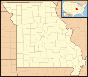 Location in Missouri | |
| Website: Table Rock Mountain State Park | |
Table Rock State Park is a public recreation area in the U.S. state of Missouri consisting of 356 acres (144 ha) located in Taney County and Stone County on Table Rock Lake along the southern side of the city of Branson. The state park's facilities include a marina, campgrounds, and trails for hiking and bicycling.[3]
References
- 1 2 "Table Rock State Park". Geographic Names Information System. United States Geological Survey.
- ↑ "State parks...estimated acres" (PDF). Revised Statewide Comprehensive Outdoor Recreation Plan: 2008-2012. Missouri Department of Natural Resources. pp. 142–143. Retrieved April 13, 2018.
- ↑ "Table Rock State Park". Missouri State Parks. Missouri Department of Natural Resources. Retrieved September 8, 2014.
External links
- Table Rock State Park Missouri Department of Natural Resources
- Table Rock State Park Map Missouri Department of Natural Resources
This article is issued from
Wikipedia.
The text is licensed under Creative Commons - Attribution - Sharealike.
Additional terms may apply for the media files.