Lake Wappapello State Park
| Lake Wappapello State Park | |
| Missouri State Park | |
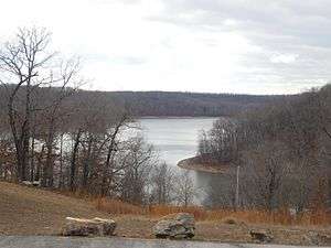 Lake Wappapello as seen from the park. | |
| Country | United States |
|---|---|
| State | Missouri |
| County | Wayne |
| Elevation | 420 ft (128 m) [1] |
| Coordinates | 36°56′38″N 90°19′51″W / 36.94389°N 90.33083°WCoordinates: 36°56′38″N 90°19′51″W / 36.94389°N 90.33083°W [1] |
| Area | 1,854.23 acres (750 ha) [2] |
| Established | 1956 |
| Management | Missouri Department of Natural Resources |
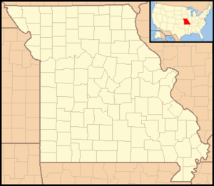 Location in Missouri | |
| Website: Lake Wappapello State Park | |
Lake Wappapello State Park is a public recreation area consisting of 1,854 acres (750 ha) bordering Lake Wappapello in Wayne County, Missouri. The state park features two campgrounds, trails for hikers, bikers, backpackers, and equestrians, and swimming, fishing, and boating on the lake.[3]
History
Lake Wappapello was created when, beginning in 1938, the U.S. Army Corps of Engineers dammed the St. Francis River for flood control purposes. The state began leasing land bordering the lake for use as a state park in 1956.[4]
References
- 1 2 "Lake Wappapello State Park". Geographic Names Information System. United States Geological Survey.
- ↑ "State parks...estimated acres" (PDF). Revised Statewide Comprehensive Outdoor Recreation Plan: 2008-2012. Missouri Department of Natural Resources. pp. 142–143. Retrieved September 9, 2014.
- ↑ "Lake Wappapello State Park". Missouri State Parks. Missouri Department of Natural Resources. Retrieved September 9, 2014.
- ↑ "General Information: Lake Wappapello State Park". Missouri State Parks. Missouri Department of Natural Resources. Retrieved April 13, 2018.
External links
- Lake Wappapello State Park Missouri Department of Natural Resources
- Lake Wappapello State Park Map Missouri Department of Natural Resources
This article is issued from
Wikipedia.
The text is licensed under Creative Commons - Attribution - Sharealike.
Additional terms may apply for the media files.