National Register of Historic Places listings in St. Louis County, Missouri
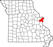
Location of St. Louis County in Missouri
This is a list of the National Register of Historic Places listings in St. Louis County, Missouri.
This is intended to be a complete list of the properties and districts on the National Register of Historic Places in St. Louis County, Missouri, United States. Latitude and longitude coordinates are provided for many National Register properties and districts; these locations may be seen together in a map.[1]
There are 182 properties and districts listed on the National Register in the county. Another 3 properties were once listed but have been removed. Because the city of St. Louis is separate from St. Louis County, properties and districts in the city are listed elsewhere.
- This National Park Service list is complete through NPS recent listings posted October 11, 2018.[2]
Current listings
| [3] | Name on the Register | Image | Date listed[4] | Location | City or town | Description |
|---|---|---|---|---|---|---|
| 1 | Affton High School | 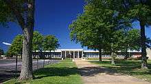 |
August 12, 2010 (#10000551) |
8520 Mackenzie Rd. 38°33′26″N 90°19′18″W / 38.557222°N 90.321667°W |
Affton | |
| 2 | Archambault House | 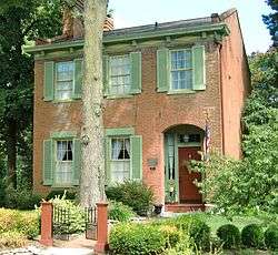 |
May 13, 1976 (#76002178) |
603 rue St. Denis 38°47′43″N 90°19′29″W / 38.795278°N 90.324722°W |
Florissant | |
| 3 | Assumption Greek Orthodox Church | .jpg) |
September 23, 1980 (#80004389) |
6900 Delmar Boulevard 38°39′22″N 90°18′41″W / 38.656111°N 90.311389°W |
University City | |
| 4 | John C. and Georgie Atwood House | 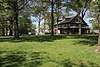 |
May 20, 2018 (#100002428) |
100 S. Clay Ave. 38°44′35″N 90°18′02″W / 38.7430°N 90.3005°W |
Ferguson | |
| 5 | August Aubuchon House |  |
September 12, 1979 (#79003648) |
1002 St. Louis 38°47′30″N 90°19′17″W / 38.791667°N 90.321389°W |
Florissant | |
| 6 | Baptiste G. Aubuchon House |  |
May 6, 1976 (#76002179) |
450 rue St. Jacques 38°47′33″N 90°19′43″W / 38.792500°N 90.328611°W |
Florissant | |
| 7 | B'Nai Amoona Synagogue |  |
April 22, 1984 (#84002698) |
524 Trinity Ave. 38°39′17″N 90°18′38″W / 38.654722°N 90.310556°W |
University City | |
| 8 | Ball-Essen Farmstead Historic District |  |
December 28, 2001 (#01001378) |
749 Babler Park Dr. 38°37′36″N 90°40′25″W / 38.626667°N 90.673611°W |
Wildwood | |
| 9 | Barretts Tunnels | 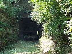 |
December 8, 1978 (#78003138) |
3015 Barrett Station Rd. 38°34′11″N 90°27′53″W / 38.569722°N 90.464722°W |
Kirkwood | |
| 10 | Barteau House | 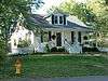 |
September 12, 1979 (#79003649) |
305 N. Costello 38°47′16″N 90°19′20″W / 38.787778°N 90.322222°W |
Florissant | |
| 11 | Barton House | 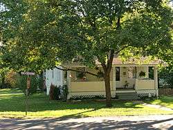 |
September 12, 1979 (#79003650) |
680 St. Catherine 38°47′30″N 90°19′36″W / 38.791667°N 90.326667°W |
Florissant | |
| 12 | Dr. Samuel A. Bassett Office and Residence | 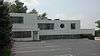 |
February 3, 1993 (#92001866) |
1200 S. Big Bend Boulevard 38°37′52″N 90°19′08″W / 38.631111°N 90.318889°W |
Richmond Heights | |
| 13 | Romanzo N. Bayley House |  |
October 3, 2002 (#02001086) |
419 E. Argonne 38°34′53″N 90°23′55″W / 38.581389°N 90.398611°W |
Kirkwood | |
| 14 | Beaumont-Tyson Quarry District | October 10, 1974 (#74001079) |
Address restricted[5] |
Crescent Hills | 212 acres (86 ha) area which extends also into Jefferson County[6] | |
| 15 | Bellecourt Apartments |  |
September 16, 2002 (#02000983) |
1107-1123 Bellevue Ave. 38°37′51″N 90°18′45″W / 38.630833°N 90.3125°W |
Richmond Heights | |
| 16 | Bennett Avenue Historic District |  |
March 20, 2008 (#08000228) |
7901-8027 Bennett Ave. and 1221-1282 Laclede Station Rd. 38°37′55″N 90°19′45″W / 38.631925°N 90.329142°W |
Richmond Heights | |
| 17 | Louis Auguste Benoist House |  |
June 23, 1969 (#69000317) |
7802 Genesta St. 38°34′09″N 90°18′45″W / 38.569167°N 90.3125°W |
Affton | |
| 18 | Beverly Theater | 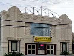 |
August 4, 2005 (#05000811) |
7740 Olive Boulevard 38°40′19″N 90°20′14″W / 38.671944°N 90.337222°W |
University City | |
| 19 | Big Chief Restaurant | 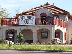 |
April 2, 2003 (#03000181) |
17352 Old Manchester Rd. 38°34′52″N 90°39′35″W / 38.581111°N 90.659722°W |
Wildwood | |
| 20 | Gen. Daniel Bissell House | 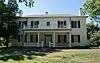 |
November 28, 1978 (#78003135) |
10225 Bellefontaine Rd. 38°45′21″N 90°13′24″W / 38.755833°N 90.223333°W |
Bellefontaine Neighbors | |
| 21 | John P. and Dora Blake House | 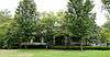 |
October 3, 2002 (#02001087) |
549 N. Taylor 38°35′19″N 90°24′17″W / 38.588611°N 90.404722°W |
Kirkwood | |
| 22 | Bockwrath-Wiese House | 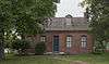 |
February 2, 1979 (#79003676) |
St. Ferdinand Park 38°48′12″N 90°19′28″W / 38.803333°N 90.324444°W |
Florissant | |
| 23 | Bonhomme Creek Archeological District | November 21, 1974 (#74002207) |
Address Restricted |
Chesterfield | ||
| 24 | William Bopp House | 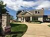 |
April 5, 2006 (#06000218) |
12120 Old Big Bend Rd. 38°34′09″N 90°26′01″W / 38.569167°N 90.433611°W |
Kirkwood | |
| 25 | Bouas House | 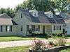 |
September 12, 1979 (#79003651) |
1290 St. Joseph 38°47′34″N 90°19′00″W / 38.792778°N 90.316667°W |
Florissant | |
| 26 | Brentmoor Park, Brentmoor and Forest Ridge District |  |
September 23, 1982 (#82004716) |
Big Bend and Wydown Boulevards 38°38′36″N 90°19′19″W / 38.643333°N 90.321944°W |
Clayton | |
| 27 | Burkhardt Historic District |  |
August 31, 2000 (#00001011) |
16662-16678 Chesterfield Airport Rd.; also the even-numbered properties of 16626-16660 Chesterfield Airport Rd. 38°39′50″N 90°34′45″W / 38.663889°N 90.579167°W |
Chesterfield | Second set of addresses represents a boundary increase of May 5, 2006 |
| 28 | Dr. Leander W. Cape Buildings |  |
November 15, 2005 (#05001283) |
7401-03 Hazel and 2737-47 Sutton 38°36′48″N 90°19′13″W / 38.613333°N 90.320278°W |
Maplewood | |
| 29 | Carney-Keightley House |  |
July 8, 2010 (#10000460) |
930 Hawkins Rd. 38°30′07″N 90°28′56″W / 38.501944°N 90.482222°W |
Fenton | |
| 30 | Carrswold Historic District |  |
September 9, 1982 (#82004889) |
1-26 Carrswold Dr. 38°38′42″N 90°19′46″W / 38.645000°N 90.329444°W |
Clayton | |
| 31 | Casa Alvarez |  |
June 18, 1976 (#76002180) |
289 rue St. Denis 38°47′48″N 90°19′43″W / 38.796667°N 90.328611°W |
Florissant | |
| 32 | Central Webster Historic District |  |
June 11, 1986 (#86001329) |
Roughly bounded by E. and S. Cedar, Plant and W. Maple Aves., E. and W. Jackson Rd., and Gray Ave. 38°35′18″N 90°21′27″W / 38.588333°N 90.357500°W |
Webster Groves | |
| 33 | Charbonier Bluff |  |
September 28, 1995 (#95001100) |
Charbonier Rd. 38°48′52″N 90°23′04″W / 38.814444°N 90.384444°W |
Hazelwood | |
| 34 | Church Street Commercial District |  |
August 23, 1984 (#84002701) |
2-100 Church St. 38°44′42″N 90°18′17″W / 38.745000°N 90.304722°W |
Ferguson | |
| 35 | Judge Enos Clarke House |  |
December 12, 2002 (#02001088) |
503 E. Monroe 38°34′45″N 90°23′50″W / 38.579167°N 90.397222°W |
Kirkwood | |
| 36 | Claverach Park |  |
August 24, 2015 (#15000537) |
Roughly bounded by Broadview, Claverach, Crestwood, Harcourt, Hillvale & Ridgemoor Drs., Clayton Rd., Wydown Blvd. 38°38′23″N 90°19′23″W / 38.6397°N 90.323°W |
Clayton | |
| 37 | Coldwater Cemetery | 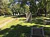 |
May 19, 2004 (#04000462) |
15290 Old Halls Ferry Rd. 38°50′05″N 90°16′59″W / 38.834722°N 90.283056°W |
Florissant | |
| 38 | James H. and Marietta Comfort House | 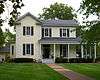 |
October 3, 2002 (#02001089) |
235 E. Jefferson 38°34′57″N 90°24′10″W / 38.582500°N 90.402778°W |
Kirkwood | |
| 39 | Coral Court Motel | 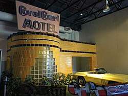 |
April 25, 1989 (#89000311) |
7755 Watson Rd. 38°34′20″N 90°20′05″W / 38.572222°N 90.334722°W |
Marlborough | Demolished.[7] |
| 40 | Cori House | 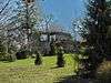 |
October 2, 1986 (#86002799) |
1080 N. Berry Rd. 38°35′55″N 90°22′35″W / 38.598611°N 90.376389°W |
Glendale | |
| 41 | Cragwold |  |
December 30, 2009 (#09001175) |
1455 Cragwold Rd. 38°33′20″N 90°26′16″W / 38.555669°N 90.437656°W |
Kirkwood | Estate house and nature reserve of Edwin A. Lemp, on the Meramec River |
| 42 | Crescent Quarry Archeological Site | February 12, 1971 (#71001030) |
South of the Meramec River in the Crescent Hills[8] 38°31′41″N 90°34′16″W / 38.528056°N 90.571111°W |
Crescent | A square 1,000 feet (300 m) on each side; part of a large district of five square miles[8] | |
| 43 | Curtiss-Wright Aeroplane Factory |  |
September 6, 2016 (#16000586) |
130 Banshee Rd. 38°45′29″N 90°21′56″W / 38.757928°N 90.365523°W |
Hazelwood | |
| 44 | Rudolph and Dorothy C. Czufin House |  |
July 12, 2002 (#02000792) |
24 Dielman Rd. 38°39′14″N 90°22′32″W / 38.653889°N 90.375556°W |
Ladue | |
| 45 | Delmar Loop-Parkview Gardens Historic District |  |
February 16, 1984 (#84002624) |
Roughly bounded by Kingsland Ave., North Dr., Delmar Boulevard, and Eastgate 38°39′21″N 90°18′15″W / 38.655833°N 90.304167°W |
University City | |
| 46 | Des Peres Presbyterian Church | 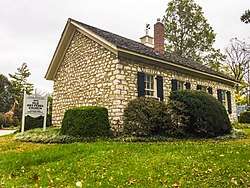 |
April 14, 1978 (#78003137) |
2255 Geyer Rd. 38°37′22″N 90°25′12″W / 38.622778°N 90.42°W |
Frontenac | |
| 47 | Donaldson Court Apartments |  |
October 13, 1983 (#83004032) |
601-615 Westgate Ave. 38°39′23″N 90°18′17″W / 38.656481°N 90.304645°W |
University City | |
| 48 | Douglas House |  |
September 12, 1979 (#79003652) |
801 St. Francois 38°47′32″N 90°19′26″W / 38.792222°N 90.323889°W |
Florissant | |
| 49 | Downtown Kirkwood Historic District | 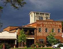 |
October 28, 2009 (#09000859) |
105-133 E. Argonne, 100-159 W. Argonne, 108-212 N. Clay, 105-140 E. Jefferson, and 100-161 W. Jefferson 38°34′55″N 90°24′24″W / 38.582083°N 90.406617°W |
Kirkwood | |
| 50 | Dr. Edmund A. Babler Memorial State Park Historic District |  |
February 27, 1985 (#85000539) |
Northwest of Grover 38°37′12″N 90°41′38″W / 38.620000°N 90.693889°W |
Grover | |
| 51 | East Monroe Historic District |  |
July 14, 2004 (#04000695) |
Roughly bounded by Madison Ave., S. Holmes St., Scott Ave., and Smith St. 38°34′49″N 90°23′59″W / 38.580278°N 90.399722°W |
Kirkwood | |
| 52 | Fairfax House |  |
April 15, 2004 (#04000280) |
9401 Manchester Rd. 38°36′43″N 90°21′45″W / 38.611944°N 90.3625°W |
Rock Hill | |
| 53 | Farmers State Bank of Chesterfield |  |
August 20, 1999 (#99001019) |
16676-78 Chesterfield Airport Rd. 38°39′50″N 90°34′46″W / 38.663889°N 90.579444°W |
Chesterfield | |
| 54 | Ferguson School Central School | 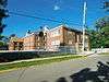 |
September 7, 1984 (#84002706) |
201 Wesley Ave. 38°44′34″N 90°18′28″W / 38.742778°N 90.307778°W |
Ferguson | |
| 55 | Charles W. Ferguson House | 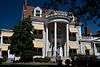 |
September 18, 1984 (#84002704) |
15-17 W. Lockwood Ave. 38°35′35″N 90°21′26″W / 38.593056°N 90.357222°W |
Webster Groves | |
| 56 | George W. and Virginia Fishback House | 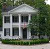 |
October 3, 2002 (#02001090) |
440 E. Argonne 38°34′51″N 90°23′53″W / 38.580833°N 90.398056°W |
Kirkwood | |
| 57 | Fort Bellefontaine | 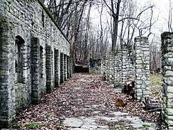 |
February 23, 2016 (#16000031) |
Fort Belle Fontaine County Park[9] 38°49′36″N 90°12′59″W / 38.826667°N 90.216389°W |
Black Jack | |
| 58 | Louisa Garrett House |  |
June 27, 2007 (#07000618) |
280 Washington St. 38°47′35″N 90°19′54″W / 38.793192°N 90.331803°W |
Florissant | |
| 59 | Glen Echo Historic District |  |
October 25, 2007 (#07001105) |
3401 Lucas-Hunt Rd., 7202-48 Henderson Ave., and 7200-71 St. Andrews Pl. 38°42′04″N 90°17′52″W / 38.701161°N 90.297892°W |
Normandy and Glen Echo Park | |
| 60 | Goldbeck House |  |
September 12, 1979 (#79003653) |
1061 St. Louis 38°47′30″N 90°19′14″W / 38.791667°N 90.320556°W |
Florissant | |
| 61 | Gorlock Building |  |
November 8, 1984 (#84000256) |
101-113 W. Lockwood Ave. 38°35′35″N 90°21′33″W / 38.593056°N 90.359167°W |
Webster Groves | |
| 62 | Grace Episcopal Church | 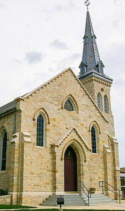 |
April 12, 1982 (#82004720) |
Taylor and Argonne Sts. 38°34′51″N 90°24′12″W / 38.580833°N 90.403333°W |
Kirkwood | |
| 63 | Greenwood Cemetery | 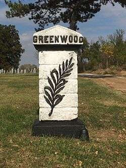 |
February 24, 2004 (#04000090) |
6571 St. Louis Ave. 38°41′19″N 90°17′19″W / 38.688611°N 90.288611°W |
Hillsdale | |
| 64 | Greenwood Historic District |  |
April 12, 2006 (#06000246) |
3500-3540 Greenwood and 7518 St. Elmo 38°36′24″N 90°19′14″W / 38.606667°N 90.320556°W |
Maplewood | |
| 65 | Haarstick-Whittemore Houses |  |
September 20, 1982 (#82004717) |
6420 and 6440 Forsyth Boulevard 38°38′46″N 90°18′32″W / 38.646111°N 90.308889°W |
Clayton | Presently home to the Whittemore House Club |
| 66 | Egbert W. Halsey Cottage |  |
October 3, 2002 (#02001091) |
126 E. Washington 38°35′04″N 90°24′17″W / 38.584444°N 90.404722°W |
Kirkwood | |
| 67 | Harry Hammerman House |  |
March 20, 2008 (#08000227) |
219 Graybridge Ln. 38°39′24″N 90°22′21″W / 38.656667°N 90.3725°W |
Ladue | |
| 68 | Hampton Park |  |
December 21, 2005 (#05001437) |
1108-1176 Center Dr., 1012-1259 Hampton Park Dr., 1140-1173 Hillside Dr., 7914-8045 Park Dr., and 8000-8062 South Dr. 38°38′09″N 90°19′54″W / 38.635833°N 90.331667°W |
Richmond Heights | |
| 69 | Martin Franklin Hanley House |  |
May 27, 1971 (#71001029) |
7600 Westmoreland Ave. 38°39′06″N 90°19′54″W / 38.651667°N 90.331667°W |
Clayton | |
| 70 | Hanson House | 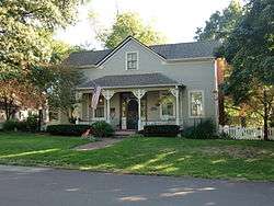 |
September 12, 1979 (#79003654) |
704 Ste. Catherine 38°47′30″N 90°19′34″W / 38.791667°N 90.326111°W |
Florissant | |
| 71 | Hawken House | 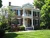 |
February 16, 1970 (#70000858) |
1155 S. Rock Hill Rd. 38°34′24″N 90°22′34″W / 38.573333°N 90.376111°W |
Webster Groves | |
| 72 | Nathaniel Hawthorne Elementary School | 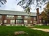 |
October 2, 2017 (#100001688) |
1351 N. Hanley Rd. 38°40′29″N 90°19′50″W / 38.674816°N 90.330549°W |
University City | |
| 73 | Henry Avenue Historic District | 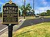 |
January 8, 2003 (#02001692) |
120, 210, 211, 218, 220, 226, 230, 310, 314, and 320 Henry Ave. 38°35′33″N 90°31′06″W / 38.5925°N 90.518333°W |
Manchester | |
| 74 | Hi-Pointe-De Mun Historic District |  |
May 7, 2005 (#05000370) |
Roughly bounded by S. Skinker Boulevard, Clayton Rd., Seminary Place, De Mun Ave., and Northwood Ave.; also roughly bounded by Clayton Rd., De Mun Ave., San Bonita Ave., and Big Bend Boulevard 38°38′14″N 90°18′31″W / 38.637222°N 90.308611°W |
Clayton | Second set of boundaries represents a boundary increase of March 22, 2007 |
| 75 | Hubecky House |  |
September 12, 1979 (#79003674) |
197 Lafayette 38°47′46″N 90°19′23″W / 38.796111°N 90.323056°W |
Florissant | |
| 76 | Wilson Price Hunt House |  |
September 23, 1980 (#80004386) |
7717 Natural Bridge Rd. 38°42′25″N 90°18′15″W / 38.706944°N 90.304167°W |
Normandy | |
| 77 | J. Milton Turner School |  |
August 22, 2002 (#02000905) |
238 Meacham Ave., and 245 Saratoga Ave. 38°33′54″N 90°24′09″W / 38.565°N 90.4025°W |
Kirkwood | |
| 78 | Jarville | _House_NRHP_84002634_046.jpg) |
February 16, 1984 (#84002634) |
1723 Mason Rd. 38°36′30″N 90°29′10″W / 38.608333°N 90.486111°W |
Between Manchester and Town and Country | |
| 79 | Jefferson Barracks Historic District |  |
February 1, 1972 (#72001492) |
10 miles (16 km) south of St. Louis on the Mississippi River 38°29′53″N 90°16′28″W / 38.498056°N 90.274444°W |
Lemay | |
| 80 | Jefferson Barracks National Cemetery | 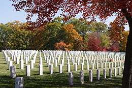 |
July 9, 1998 (#98000840) |
2900 Sheridan Rd. 38°29′50″N 90°17′24″W / 38.497222°N 90.29°W |
Green Park | |
| 81 | Jefferson-Argonne Historic District |  |
July 14, 2004 (#04000696) |
Roughly defined as being both sides of Jefferson Ave. and the northern side of Argonne between Taylor St. and Holmes Ave. 38°34′53″N 90°23′49″W / 38.581389°N 90.396944°W |
Kirkwood | |
| 82 | David Keith House |  |
October 3, 2002 (#02001094) |
116 N. Woodlawn 38°34′54″N 90°23′49″W / 38.581667°N 90.396944°W |
Kirkwood | |
| 83 | Kirkwood Missouri Pacific Depot | July 5, 1985 (#85001476) |
W. Argonne Dr. at Kirkwood Rd. 38°34′54″N 90°24′29″W / 38.581667°N 90.408056°W |
Kirkwood | ||
| 84 | Robert Koch Hospital | 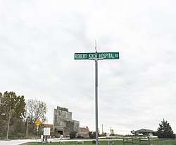 |
October 31, 1984 (#84000206) |
4101 Koch Rd. 38°28′57″N 90°17′05″W / 38.4825°N 90.284722°W |
Oakville | Demolished in 1989.[10] |
| 85 | Kramer House |  |
September 12, 1979 (#79003675) |
520 Ste. Catherine 38°47′33″N 90°19′40″W / 38.7925°N 90.327778°W |
Florissant | |
| 86 | Russell and Ruth Goetz Kraus House |  |
January 31, 1997 (#96001595) |
120 N. Ballas Rd. 38°34′57″N 90°26′31″W / 38.5825°N 90.441944°W |
Kirkwood | |
| 87 | Kreienkamp Store | .jpg) |
May 5, 2000 (#00000439) |
19160 Melrose Rd. 38°34′19″N 90°43′15″W / 38.571944°N 90.720833°W |
Wildwood | |
| 88 | Kuehn House |  |
September 12, 1979 (#79003655) |
410 S. Harrison 38°47′29″N 90°19′50″W / 38.791389°N 90.330556°W |
Florissant | |
| 89 | Ladue Estates |  |
May 26, 2010 (#09000901) |
1-80 Ladue Estates Dr. 38°39′18″N 90°25′44″W / 38.655022°N 90.428872°W |
Creve Coeur | |
| 90 | Lance House |  |
September 12, 1979 (#79003656) |
508 St. Antoine 38°47′45″N 90°19′31″W / 38.795833°N 90.325278°W |
Florissant | |
| 91 | Marcus Laramie House |  |
September 12, 1979 (#79003657) |
929 St. Denis 38°47′35″N 90°19′16″W / 38.793056°N 90.321111°W |
Florissant | |
| 92 | Wilson Larimore House |  |
February 10, 1989 (#88003244) |
11510 Larimore Rd. 38°46′27″N 90°12′05″W / 38.774167°N 90.201389°W |
Bellefontaine Neighbors | |
| 93 | Theodore Link Historic Buildings |  |
September 11, 1980 (#80004390) |
7100, 7104, and 7108 Delmar Boulevard 38°39′24″N 90°19′01″W / 38.656667°N 90.316944°W |
University City | |
| 94 | William Long Log House |  |
December 5, 1978 (#78003136) |
9385 Pardee Rd. 38°32′47″N 90°21′51″W / 38.546389°N 90.364167°W |
Crestwood | |
| 95 | The Lyceum |  |
April 3, 1979 (#79003206) |
14318 Manchester Road 38°35′33″N 90°30′37″W / 38.5925°N 90.510278°W |
Manchester | |
| 96 | Manchester Methodist Episcopal Church |  |
February 10, 1983 (#83001053) |
129 Woods Mill Rd. 38°35′41″N 90°30′34″W / 38.594722°N 90.509444°W |
Manchester | |
| 97 | Maplewood Commercial Historic District at Manchester and Sutton |  |
December 20, 2006 (#06001135) |
Roughly bounded by Manchester, Marietta, Marshall, and Sutton 38°36′53″N 90°19′06″W / 38.614722°N 90.318333°W |
Maplewood | |
| 98 | Marshall Place Historic District |  |
June 17, 1982 (#82004726) |
Marshall Pl. 38°35′45″N 90°21′28″W / 38.595833°N 90.357778°W |
Webster Groves | |
| 99 | Maryland Terrace Historic District | .jpg) |
September 3, 1998 (#98001137) |
7001-7419 Maryland Ave. and 7001-7394 Westmoreland Dr. 38°39′03″N 90°19′22″W / 38.650833°N 90.322778°W |
University City | |
| 100 | McGarry House |  |
April 12, 1982 (#82004724) |
6965 Pershing Ave. 38°39′10″N 90°18′51″W / 38.652778°N 90.314167°W |
University City | |
| 101 | Lizzie McLagan House |  |
October 3, 2002 (#02001092) |
549 E. Argonne 38°34′52″N 90°23′44″W / 38.581111°N 90.395556°W |
Kirkwood | |
| 102 | Patrick and Moire McMullen House |  |
October 3, 2002 (#02001093) |
212 W. Monroe 38°34′44″N 90°24′32″W / 38.578889°N 90.408889°W |
Kirkwood | |
| 103 | McPherson-Holland House |  |
September 16, 1982 (#82004719) |
115 Edwin Ave. 38°35′10″N 90°23′07″W / 38.586111°N 90.385278°W |
Glendale | |
| 104 | Meramec River U.S. 66 Bridge - J421 | September 16, 2009 (#09000888) |
Historic U.S. Route 66 spanning the Meramec River 38°30′20″N 90°35′31″W / 38.505556°N 90.591997°W |
Eureka | Riveted Warren deck truss bridge | |
| 105 | Meyer House |  |
September 12, 1979 (#79003658) |
915 N. Lafayette 38°47′45″N 90°19′24″W / 38.795833°N 90.323333°W |
Florissant | |
| 106 | Frank Moellring House |  |
September 12, 1979 (#79003659) |
1002 Boone 38°47′42″N 90°19′13″W / 38.795°N 90.320278°W |
Florissant | |
| 107 | Moller House |  |
September 12, 1979 (#79003660) |
300 Washington 38°47′34″N 90°19′51″W / 38.792778°N 90.330833°W |
Florissant | |
| 108 | Moorlands Addition Apartment District |  |
September 30, 2009 (#09000787) |
Roughly bounded by Clayton Rd., Glenridge Ave., Wydown Boulevard, and both sides of Westwood Dr. 38°38′23″N 90°19′53″W / 38.639858°N 90.331439°W |
Clayton | |
| 109 | Mount Hope Cemetery | October 3, 2003 (#03000994) |
1215 Lemay Ferry Rd. 38°32′02″N 90°17′29″W / 38.533889°N 90.291389°W |
Lemay | ||
| 110 | Mudd's Grove |  |
April 5, 1984 (#84002710) |
302 W. Argonne Dr. 38°34′52″N 90°24′39″W / 38.581111°N 90.410833°W |
Kirkwood | |
| 111 | Joseph and Ann Murphy Residence |  |
May 10, 2010 (#10000246) |
7901 Stanford Ave. 38°39′46″N 90°20′31″W / 38.662694°N 90.341819°W |
University City | |
| 112 | John B. Myers House |  |
December 13, 1974 (#74002210) |
180 Dunn Rd.; also 108 Dunn Rd. 38°46′35″N 90°20′13″W / 38.776389°N 90.336944°W |
Florissant | 108 Dunn represents a boundary increase of September 19, 1977 |
| 113 | Narrow Gauge Railroad Station |  |
September 12, 1979 (#79003661) |
1060 St. Catherine 38°47′23″N 90°19′21″W / 38.789722°N 90.3225°W |
Florissant | |
| 114 | New Mount Sinai Cemetery |  |
December 22, 2005 (#05001434) |
8430 Gravois Rd. 38°33′25″N 90°18′20″W / 38.556944°N 90.305556°W |
Affton | |
| 115 | Nicolay House |  |
September 12, 1979 (#79003662) |
549 N. St. Jacques 38°47′36″N 90°19′42″W / 38.793333°N 90.328333°W |
Florissant | |
| 116 | Nims Mansion |  |
October 2, 2017 (#100001689) |
2741 Finestown Rd. 38°24′35″N 90°19′27″W / 38.409609°N 90.324191°W |
Oakville | |
| 117 | Prof. Frances E. Nipher House |  |
October 3, 2002 (#02001095) |
435 N. Harrison 38°35′08″N 90°24′41″W / 38.585556°N 90.411389°W |
Kirkwood | |
| 118 | North Taylor Avenue Historic District |  |
August 7, 2012 (#12000474) |
Roughly bounded by Manchester Rd., E. Adams, & N. Taylor Aves. 38°35′32″N 90°24′14″W / 38.592087°N 90.403969°W |
Kirkwood | |
| 119 | Norwood Hills Country Club | 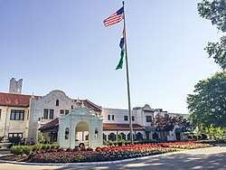 |
February 25, 2005 (#05000084) |
1 Norwood Hills Country Club Dr. 38°43′20″N 90°17′02″W / 38.722222°N 90.283889°W |
Ferguson | |
| 120 | Old Ferguson West Historic District |  |
November 2, 2011 (#11000784) |
Roughly bounded by Carson Rd., Harvey & Tiffin Aves. & Florissant Rd. 38°44′33″N 90°18′32″W / 38.7425°N 90.308889°W |
Ferguson | |
| 121 | Old Stone Church |  |
April 13, 1973 (#73002274) |
Conway Rd. at White Rd. 38°38′57″N 90°31′33″W / 38.64915°N 90.525772°W |
Chesterfield | |
| 122 | Old Webster Historic District |  |
August 4, 2004 (#04000782) |
Roughly bounded by Allen Ave., Elm Ave., W. Lockwood Ave. and the Missouri Pacific RR Tracks 38°35′43″N 90°21′32″W / 38.595278°N 90.358889°W |
Webster Groves | |
| 123 | Olive Chapel African Methodist Episcopal Church |  |
April 20, 2004 (#04000345) |
309 S. Harrison Ave. 38°34′44″N 90°24′39″W / 38.578889°N 90.410833°W |
Kirkwood | |
| 124 | Orrville Historic District |  |
October 18, 2003 (#03001053) |
526 and 538 Eatherton Rd. 38°38′14″N 90°39′34″W / 38.637222°N 90.659444°W |
Wildwood | |
| 125 | Osage Hills School |  |
May 24, 2007 (#07000462) |
1110 Glenwood S 38°33′55″N 90°26′30″W / 38.565278°N 90.441667°W |
Kirkwood | |
| 126 | Theodore A. Pappas House |  |
February 14, 1979 (#79003208) |
865 Masonridge Rd. 38°38′13″N 90°29′03″W / 38.636944°N 90.484167°W |
Creve Coeur | |
| 127 | Parkview Historic District |  |
March 14, 1986 (#86000788) |
Roughly bounded by Delmar Ave., Skinker and Millbrook Boulevards, and Mellville Ave. 38°39′08″N 90°18′11″W / 38.652222°N 90.303056°W |
University City | |
| 128 | Pasadena Hills Historic District |  |
December 4, 2004 (#04001281) |
Bounded by the city limits of Pasadena Hills 38°42′26″N 90°19′55″W / 38.707222°N 90.331944°W |
Pasadena Hills | |
| 129 | Elisha and Lucy Patterson Farmstead Historic District |  |
November 17, 2004 (#04001242) |
15505 New Halls Ferry Rd. 38°49′38″N 90°18′38″W / 38.827222°N 90.310556°W |
Florissant | |
| 130 | Payne-Gentry House |  |
April 17, 1979 (#79003202) |
4211 Fee Fee Rd. 38°44′50″N 90°23′59″W / 38.747222°N 90.399722°W |
Bridgeton | |
| 131 | Peters House |  |
September 12, 1979 (#79003664) |
903 rue St. Francois 38°47′28″N 90°19′21″W / 38.791111°N 90.3225°W |
Florissant | |
| 132 | Pine Lawn Carriage House | February 16, 1984 (#84002666) |
6292-94 Stillwell Dr. 38°41′27″N 90°16′48″W / 38.690833°N 90.28°W |
Pine Lawn | Demolished[11] | |
| 133 | Samuel Plant House |  |
April 19, 1984 (#84002711) |
800 Cella Rd. 38°38′39″N 90°22′20″W / 38.644167°N 90.372222°W |
Ladue | |
| 134 | Pond School |  |
November 6, 2012 (#12000910) |
17123 Manchester Rd. 38°34′40″N 90°38′48″W / 38.577681°N 90.646613°W |
Wildwood | |
| 135 | Price School | February 14, 1985 (#85000285) |
Price School Lane 38°38′20″N 90°22′20″W / 38.638889°N 90.372222°W |
Ladue | Demolished[12] | |
| 136 | Charles S. and Mary Warder Rannells House |  |
September 20, 2006 (#06000861) |
2200 Bredell 38°37′16″N 90°19′34″W / 38.621111°N 90.326111°W |
Maplewood | |
| 137 | Red Cedar Inn |  |
April 2, 2003 (#03000180) |
1047 East Osage 38°28′53″N 90°43′02″W / 38.481389°N 90.717222°W |
Pacific | |
| 138 | Reeb House |  |
September 12, 1979 (#79003665) |
446 St. Charles 38°47′41″N 90°19′58″W / 38.794722°N 90.332778°W |
Florissant | |
| 139 | Theodore and Lena Richter House |  |
December 5, 2002 (#02001096) |
229 S. Van Buren 38°34′46″N 90°25′00″W / 38.579444°N 90.416667°W |
Kirkwood | |
| 140 | Rickelman House |  |
September 12, 1979 (#79003666) |
680 Washington 38°47′28″N 90°19′38″W / 38.791111°N 90.327222°W |
Florissant | |
| 141 | Otto Ripple Agency |  |
September 12, 1979 (#79003663) |
755 rue St. Francois 38°47′33″N 90°19′28″W / 38.7925°N 90.324444°W |
Florissant | |
| 142 | George R. and Elsie Robinson House |  |
October 31, 2002 (#02001268) |
443 E. Argonne 38°34′53″N 90°23′52″W / 38.581389°N 90.397778°W |
Kirkwood | |
| 143 | Rock House, Edgewood Children's Center |  |
September 9, 1982 (#82004727) |
330 N. Gore 38°35′55″N 90°21′53″W / 38.598611°N 90.364722°W |
Webster Groves | |
| 144 | Rockwood Court Apartments |  |
April 5, 2006 (#06000222) |
330 W. Lockwood 38°35′42″N 90°21′51″W / 38.595°N 90.364167°W |
Webster Groves | |
| 145 | Rott School |  |
September 15, 2005 (#05001022) |
9455 Rott Rd. 38°32′10″N 90°25′19″W / 38.536111°N 90.421944°W |
Sunset Hills | |
| 146 | St. Ferdinand Central Historic District |  |
September 12, 1979 (#79003647) |
Roughly bounded by rue St. Francois, rue St. Ferdinand, and rue St. Denis, and Lafayette St. 38°47′41″N 90°19′38″W / 38.794722°N 90.327222°W |
Florissant | |
| 147 | St. Ferdinand's Shrine Historic District |  |
September 12, 1979 (#79003759) |
Between Cold Water and Fountain Creeks 38°47′47″N 90°20′02″W / 38.796389°N 90.333889°W |
Florissant | |
| 148 | St. Stanislaus Seminary |  |
September 22, 1972 (#72001491) |
700 Howdershell Rd. 38°32′15″N 90°17′16″W / 38.5375°N 90.287778°W |
Florissant | |
| 149 | St. Vincent's Hospital |  |
April 12, 1982 (#82004722) |
7301 St. Charles Rock Rd. 38°41′32″N 90°18′23″W / 38.692222°N 90.306389°W |
Normandy | |
| 150 | Joseph Sappington House |  |
October 14, 1982 (#82000589) |
Southwest of Affton at 10734 Clearwater Drive 38°32′15″N 90°21′21″W / 38.5375°N 90.355833°W |
Affton | |
| 151 | Thomas J. Sappington House | 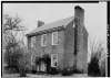 |
June 28, 1974 (#74002209) |
1015 S. Sappington Rd. 38°33′51″N 90°23′05″W / 38.564167°N 90.384722°W |
Crestwood | |
| 152 | Zephaniah Sappington House | September 18, 1980 (#80004384) |
Originally located south of Crestwood at 11145 Gravois Rd. 38°32′29″N 90°22′08″W / 38.541389°N 90.368889°W |
Crestwood | Now known as the Sappington-Dressel House, the original house was dismantled and moved to Defiance, Missouri where it was acquired and completely reconstructed by Lindenwood University.[13] | |
| 153 | Saratoga Lanes Building |  |
January 29, 2008 (#07001492) |
2725 Sutton Boulevard 38°36′48″N 90°19′13″W / 38.613333°N 90.320278°W |
Maplewood | |
| 154 | Schmidt House | 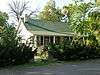 |
September 12, 1979 (#79003667) |
359 St. Jean 38°47′33″N 90°19′50″W / 38.7925°N 90.330556°W |
Florissant | |
| 155 | Schoonover House | 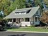 |
September 12, 1979 (#79003668) |
983 St. Antoine 38°47′38″N 90°19′13″W / 38.793889°N 90.320278°W |
Florissant | |
| 156 | Seven Gables Building | 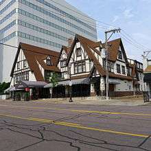 |
July 16, 1985 (#85001564) |
18-26 N. Meramec 38°39′04″N 90°20′21″W / 38.651111°N 90.339167°W |
Clayton | See Meier and Comfort for more information. |
| 157 | Shanley Building |  |
September 20, 1982 (#82004718) |
7800 Maryland Ave. 38°39′05″N 90°20′13″W / 38.651389°N 90.336944°W |
Clayton | |
| 158 | Sioux Passage Park Archeological Site | July 24, 1974 (#74002211) |
Address Restricted |
Florissant | ||
| 159 | Smith House |  |
September 12, 1979 (#79003669) |
310 Florissant Rd. 38°47′17″N 90°19′22″W / 38.788056°N 90.322778°W |
Florissant | |
| 160 | Stroer House |  |
September 12, 1979 (#79003670) |
700 Aubuchon 38°47′26″N 90°19′04″W / 38.790556°N 90.317778°W |
Florissant | |
| 161 | Sutter-Meyer House |  |
April 12, 1982 (#82004725) |
6826 Chamberlain Court 38°39′50″N 90°18′41″W / 38.663889°N 90.311389°W |
University City | |
| 162 | Taille de Noyer |  |
January 10, 1980 (#80004385) |
1 rue Taille de Noyer 38°46′17″N 90°18′36″W / 38.771389°N 90.31°W |
Florissant | |
| 163 | Tebeau House |  |
September 12, 1979 (#79003671) |
250 St. Catherine 38°47′39″N 90°19′53″W / 38.794167°N 90.331389°W |
Florissant | |
| 164 | Marvin Tebeau House |  |
September 12, 1979 (#79003672) |
449 St. Joseph 38°47′52″N 90°19′32″W / 38.797778°N 90.325556°W |
Florissant | |
| 165 | Thornhill |  |
July 18, 1974 (#74002208) |
Olive Street Rd. in Faust County Park 38°40′06″N 90°32′44″W / 38.668333°N 90.545556°W |
Chesterfield | |
| 166 | Rosalie Tilles Park |  |
April 19, 2018 (#100002336) |
9551 Litzsinger Rd. 38°37′10″N 90°21′57″W / 38.619375°N 90.365722°W |
Ladue | |
| 167 | G.W. Tolhurst House |  |
October 3, 2002 (#02001097) |
345 E. Argonne 38°34′53″N 90°24′01″W / 38.581389°N 90.400278°W |
Kirkwood | |
| 168 | Tuxedo Park Christian Church |  |
November 8, 2006 (#06000988) |
700 Tuxedo Boulevard 38°36′12″N 90°20′30″W / 38.603333°N 90.341667°W |
Webster Groves | |
| 169 | Tuxedo Park Station |  |
March 22, 1984 (#84002713) |
643 Glen Rd. 38°36′08″N 90°20′52″W / 38.602222°N 90.347778°W |
Webster Groves | Former Missouri Pacific Railroad depot. |
| 170 | U.S. Army Publications Distribution Center |  |
October 5, 2015 (#15000704) |
1655 Woodson Rd. 38°41′00″N 90°21′53″W / 38.6834°N 90.3648°W |
Overland | |
| 171 | University City Education District |  |
January 31, 1985 (#85000172) |
7400 and 7401 Balson Ave. and 951 N. Hanley Rd. 38°39′53″N 90°19′51″W / 38.664722°N 90.330833°W |
University City | |
| 172 | University City Plaza |  |
March 7, 1975 (#75002092) |
Roughly bounded by Delmar Boulevard and Trinity, Harvard, and Kingsland Aves. 38°39′27″N 90°18′34″W / 38.6575°N 90.309444°W |
University City | City Hall (University City, Missouri) is a contributing property |
| 173 | University Heights Subdivision Number One |  |
September 23, 1980 (#80004391) |
Roughly bounded by Delmar Boulevard and Yale, Dartmouth, and Harvard Aves. 38°39′34″N 90°18′38″W / 38.659444°N 90.310556°W |
University City | |
| 174 | Elijah J. Unsell House |  |
December 12, 2002 (#02001098) |
615 E. Monroe 38°34′44″N 90°23′39″W / 38.578889°N 90.394167°W |
Kirkwood | |
| 175 | James W. and Mary Way House |  |
December 12, 2002 (#02001099) |
305 N. Harrison 38°35′00″N 90°24′42″W / 38.583333°N 90.411667°W |
Kirkwood | |
| 176 | Webster College-Eden Theological Seminary Collegiate District |  |
December 28, 1982 (#82000590) |
470 and 475 E. Lockwood Ave. 38°36′02″N 90°20′39″W / 38.600556°N 90.344167°W |
Webster Groves | |
| 177 | Webster Park Residential Historic District |  |
December 30, 2008 (#08001260) |
Roughly bounded by Newport, Bompart, E. Lockwood, N. Maple, and Glen Rd. 38°35′43″N 90°20′55″W / 38.595372°N 90.3487°W |
Webster Groves | |
| 178 | White Haven; Ulysses S. Grant National Historic Site |  |
April 4, 1979 (#79003205) |
9060 Whitehaven Dr. or 7400 Grant Street 38°33′06″N 90°21′06″W / 38.551792°N 90.351683°W |
Grantwood Village | |
| 179 | Wildwood House |  |
April 5, 2006 (#06000234) |
40 Dames Court 38°44′42″N 90°17′30″W / 38.745°N 90.291667°W |
Ferguson | |
| 180 | Williams Creek Archeological District | November 23, 1977 (#77001527) |
Address Restricted |
St. Louis | ||
| 181 | Withington House |  |
September 12, 1979 (#79003673) |
502 St. Marie 38°47′24″N 90°19′49″W / 38.79°N 90.330278°W |
Florissant | |
| 182 | Wydown-Forsyth District |  |
May 23, 1988 (#88000628) |
Roughly bounded by Forsyth, Skinker Boulevard, Fauquier, Wydown Terrace Dr., and University Ln. 38°38′38″N 90°18′25″W / 38.643889°N 90.306944°W |
Clayton |
Former listings
| [3] | Name on the Register | Image | Date listed | Date removed | Location | City or town | Summary |
|---|---|---|---|---|---|---|---|
| 1 | Busch's Grove | September 9, 1982 (#82004721) | January 7, 2005 | 9160 Clayton Rd. 38°38′28″N 90°22′01″W / 38.6411°N 90.3669°W |
Ladue | ||
| 2 | Miles A. Seed Carriage House | March 25, 1987 (#87000455) | December 19, 1994 | 2456 Hord Ave., rear 38°38′28″N 90°22′01″W / 38.6411°N 90.3669°W |
Jennings | ||
| 3 | Utz-Tesson House | January 22, 1973 (#73002178) | August 21, 2015 | 615 Utz Lane 38°46′46″N 90°22′20″W / 38.779444°N 90.372222°W |
Hazelwood |
See also
References
| Wikimedia Commons has media related to National Register of Historic Places in St. Louis County, Missouri. |
- ↑ The latitude and longitude information provided in this table was derived originally from the National Register Information System, which has been found to be fairly accurate for about 99% of listings. For about 1% of NRIS original coordinates, experience has shown that one or both coordinates are typos or otherwise extremely far off; some corrections may have been made. A more subtle problem causes many locations to be off by up to 150 yards, depending on location in the country: most NRIS coordinates were derived from tracing out latitude and longitudes from USGS topographical quadrant maps created under the North American Datum of 1927, which differs from the current, highly accurate WGS84 GPS system used by most on-line maps. Chicago is about right, but NRIS longitudes in Washington are higher by about 4.5 seconds, and are lower by about 2.0 seconds in Maine. Latitudes differ by about 1.0 second in Florida. Some locations in this table may have been corrected to current GPS standards.
- ↑ "National Register of Historic Places: Weekly List Actions". National Park Service, United States Department of the Interior. Retrieved on October 11, 2018.
- 1 2 Numbers represent an ordering by significant words. Various colorings, defined here, differentiate National Historic Landmarks and historic districts from other NRHP buildings, structures, sites or objects.
- ↑ The eight-digit number below each date is the number assigned to each location in the National Register Information System database, which can be viewed by clicking the number.
- ↑ Federal and state laws and practices restrict general public access to information regarding the specific location of this resource. In some cases, this is to protect archeological sites from vandalism, while in other cases it is restricted at the request of the owner. See: Knoerl, John; Miller, Diane; Shrimpton, Rebecca H. (1990), Guidelines for Restricting Information about Historic and Prehistoric Resources, National Register Bulletin (29), National Park Service, U.S. Department of the Interior, OCLC 20706997 .
- ↑ National Park Service (2013-11-02). "National Register Information System". National Register of Historic Places. National Park Service.
- ↑ National Register - St Louis County - State Historic Preservation Office - DNR Archived 2012-04-05 at the Wayback Machine.. Dnr.mo.gov. Retrieved on 2013-09-07.
- 1 2 Pool, Kelly J. "A History of Amateur Archaeology in the St. Louis Area". Missouri Archaeologist 50 Whole Volume (1989): 110.
- ↑ Fort Belle Fontaine Trailes, St. Louis County Parks and Recreation, 2016. Accessed 2016-05-07.
- ↑
- ↑ . Retrieved on 2017-07-09.
- ↑ . Retrieved on 2017-07-15.
- ↑ Retrieved on 2017-07-05
| Topics | |
|---|---|
| Lists by states |
|
| Lists by insular areas | |
| Lists by associated states | |
| Other areas | |
| |
This article is issued from
Wikipedia.
The text is licensed under Creative Commons - Attribution - Sharealike.
Additional terms may apply for the media files.