St. Joe State Park
| St. Joe State Park | |
| Missouri State Park | |
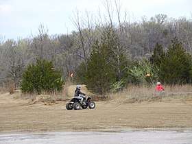 ORV riders in St. Joe State Park | |
| Country | United States |
|---|---|
| State | Missouri |
| County | St. Francois |
| Elevation | 928 ft (283 m) [1] |
| Coordinates | 37°48′15″N 90°31′01″W / 37.80417°N 90.51694°WCoordinates: 37°48′15″N 90°31′01″W / 37.80417°N 90.51694°W [1] |
| Area | 8,242.98 acres (3,336 ha) [2] |
| Established | 1976 [3] |
| Management | Missouri Department of Natural Resources |
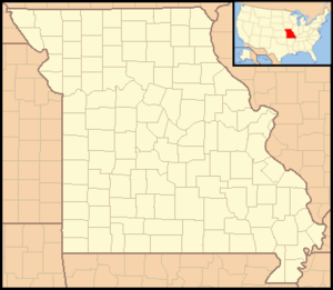 Location in Missouri | |
| Website: St. Joe State Park | |
St. Joe State Park is a public recreation area consisting of 8,243 acres (3,336 ha) on the south side of Park Hills, Missouri, along the flanks of the Saint Francois Mountains.[4] The state park includes the Missouri Mines State Historic Site with its former St. Joe Minerals mill buildings and museum of geology and mining.[5] The park features a 2,000-acre (810 ha) off-road vehicle (ORV) riding area located on the old mine tailings dumps, camping facilities, and trails for hiking, bicycling, and horseback riding.[4]
References
- 1 2 "Saint Joe State Park". Geographic Names Information System. United States Geological Survey.
- ↑ "St. Joe State Park: Data Sheet" (PDF). Missouri Department of Natural Resources. November 2017. Retrieved April 18, 2018.
- ↑ "State Park Land Acquisition Summary". Missouri State Parks. Retrieved April 18, 2018.
- 1 2 "St. Joe State Park". Missouri Department of Natural Resources. Retrieved September 9, 2014.
- ↑ "Missouri Mines State Historic Site". Missouri Department of Natural Resources. Retrieved April 18, 2018.
External links
- St. Joe State Park Missouri Department of Natural Resources
- St. Joe State Park Map Missouri Department of Natural Resources
| Wikimedia Commons has media related to St. Joe State Park. |
This article is issued from
Wikipedia.
The text is licensed under Creative Commons - Attribution - Sharealike.
Additional terms may apply for the media files.