| [3] |
Name on the Register |
Image |
Date listed[4] |
Location |
City or town |
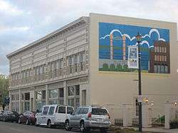
Description |
|---|
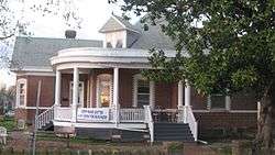
| 1 |
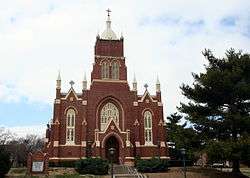
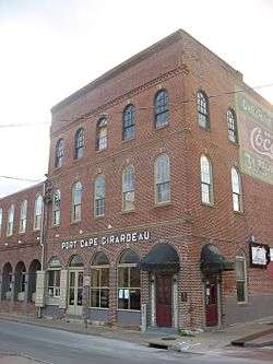
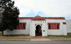
B'Nai Israel Synagogue |
|
May 5, 2004
(#04000385) |
121 S. Main St.
37°18′04″N 89°31′09″W / 37.301111°N 89.519167°W / 37.301111; -89.519167 (B'Nai Israel Synagogue) |
Cape Girardeau |
|
| 2 |
Bainbridge Ferry |
|
June 21, 2007
(#07000573) |
County Road 630
37°24′43″N 89°26′16″W / 37.411944°N 89.437778°W / 37.411944; -89.437778 (Bainbridge Ferry) |
Cape Girardeau |
|
| 3 |
Bainbridge Ferry Rd. |
|
June 21, 2007
(#07000577) |
County Road 623
37°26′11″N 89°28′07″W / 37.436517°N 89.468747°W / 37.436517; -89.468747 (Bainbridge Ferry Rd.) |
Cape Girardeau |
|
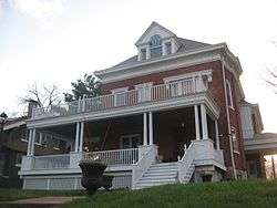
| 4 |
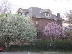
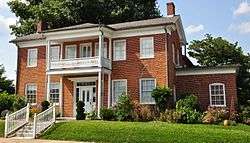
Bennett-Tobler-Pace-Oliver House |
|
April 18, 1985
(#85000853) |
224 E. Adams
37°22′54″N 89°39′56″W / 37.381667°N 89.665556°W / 37.381667; -89.665556 (Bennett-Tobler-Pace-Oliver House) |
Jackson |
|
| 5 |
Big Hill Farmstead Historic District |
|
December 22, 1999
(#99001598) |
2246 Route PP
37°21′49″N 89°41′26″W / 37.363611°N 89.690556°W / 37.363611; -89.690556 (Big Hill Farmstead Historic District) |
Jackson |
|
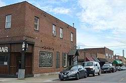
| 6 |
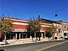
Broadway Commercial Historic District |
|
September 6, 2016
(#15001017) |
600, 700 & 800 blks. of Broadway & 210 N. Ellis St.
37°18′24″N 89°31′39″W / 37.306789°N 89.527404°W / 37.306789; -89.527404 (Broadway Commercial Historic District) |
Cape Girardeau |
|
| 7 |
Broadway Theatre |
|
June 15, 2015
(#15000354) |
805 Broadway St.
37°18′24″N 89°31′42″W / 37.306667°N 89.528472°W / 37.306667; -89.528472 (Broadway Theatre) |
Cape Girardeau |
|
| 8 |
Broadway and North Fountain Street Historic District |
|
July 15, 2003
(#03000654) |
320-400 Broadway St. and 221 N. Fountain St.
37°18′23″N 89°31′20″W / 37.306389°N 89.522222°W / 37.306389; -89.522222 (Broadway and North Fountain Street Historic District) |
Cape Girardeau |
|
| 9 |
Broadway-Middle Commercial Historic District |
|
July 24, 2007
(#07000753) |
500 block of Broadway St. and 100 block of N. Middle St.; also south side 400 block of Broadway
37°18′24″N 89°31′27″W / 37.306667°N 89.524167°W / 37.306667; -89.524167 (Broadway-Middle Commercial Historic District) |
Cape Girardeau |
Second set of boundaries represents a boundary increase of September 4, 2013 |
| 10 |
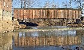
Burfordville Covered Bridge |
|
May 19, 1970
(#70000325) |
Eastern edge of Burfordville on County Road HH
37°22′02″N 89°48′09″W / 37.367222°N 89.8025°W / 37.367222; -89.8025 (Burfordville Covered Bridge) |
Burfordville |
|
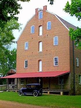
| 11 |
Burfordville Mill |
|
May 27, 1971
(#71000463) |
Off Route 34
37°22′05″N 89°48′06″W / 37.368056°N 89.801667°W / 37.368056; -89.801667 (Burfordville Mill) |
Burfordville |
|
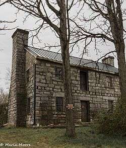
| 12 |
Abraham Byrd House |
|
June 21, 2007
(#07000572) |
2832 County Road 442
37°27′05″N 89°41′58″W / 37.451389°N 89.699444°W / 37.451389; -89.699444 (Abraham Byrd House) |
Jackson |
|
| 13 |
Cape Girardeau Commercial Historic District |
|
July 20, 2000
(#00000820) |
100 block of N. Main and the 100 block of Broadway Sts.; also 101 N. Main St.; also 127 N. Water St.
37°18′20″N 89°31′06″W / 37.305556°N 89.518333°W / 37.305556; -89.518333 (Cape Girardeau Commercial Historic District) |
Cape Girardeau |
101 N. Main and 127 N. Water represent boundary increases of July 11, 2007 and August 29, 2008 respectively |
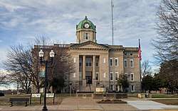
| 14 |
Cape Girardeau Court of Common Pleas |
|
October 25, 2010
(#10000856) |
44 N. Lorimier St.
37°18′18″N 89°31′12″W / 37.305°N 89.52°W / 37.305; -89.52 (Cape Girardeau Court of Common Pleas) |
Cape Girardeau |
|
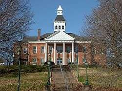
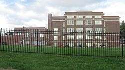
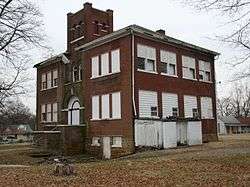
| 15 |
Central High School |
|
July 18, 2008
(#08000663) |
101 S. Pacific St.
37°18′12″N 89°31′50″W / 37.303333°N 89.530556°W / 37.303333; -89.530556 (Central High School) |
Cape Girardeau |
|
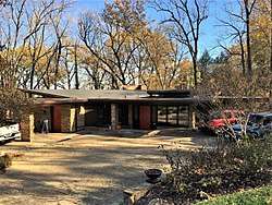
| 16 |
Dr. Jean Chapman House |
|
March 15, 2016
(#16000084) |
1150 N. Henderson Ave.
37°19′12″N 89°31′57″W / 37.320063°N 89.532561°W / 37.320063; -89.532561 (Dr. Jean Chapman House) |
Cape Girardeau |
|
| 17 |
George Boardman Clark House |
|
July 22, 1994
(#94000738) |
6 S. Fountain St.
37°18′12″N 89°31′20″W / 37.303333°N 89.522222°W / 37.303333; -89.522222 (George Boardman Clark House) |
Cape Girardeau |
|
| 18 |
Courthouse-Seminary Neighborhood Historic District |
|
September 9, 2010
(#10000723) |
Roughly bounded by Middle St., Themis St., Main St., Aquamsi St., and Morgan Oaks St.
37°18′05″N 89°31′17″W / 37.301389°N 89.521389°W / 37.301389; -89.521389 (Courthouse-Seminary Neighborhood Historic District) |
Cape Girardeau |
|
| 19 |
Erlbacher Buildings |
|
July 8, 2009
(#09000502) |
1105 and 1107 Broadway St.
37°18′30″N 89°31′56″W / 37.308333°N 89.532222°W / 37.308333; -89.532222 (Erlbacher Buildings) |
Cape Girardeau |
|
| 20 |
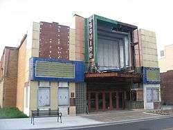
Esquire Theater |
|
September 15, 2005
(#05001025) |
824 Broadway St.
37°18′26″N 89°31′45″W / 37.307222°N 89.529028°W / 37.307222; -89.529028 (Esquire Theater) |
Cape Girardeau |
|
| 21 |
Frizel-Welling House |
|
June 25, 1999
(#99000742) |
209 W. Main St.
37°22′57″N 89°40′10″W / 37.3825°N 89.669444°W / 37.3825; -89.669444 (Frizel-Welling House) |
Jackson |
|
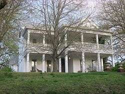
| 22 |
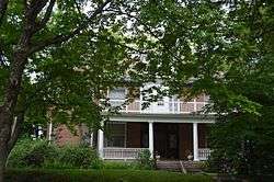
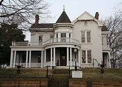
Glenn House |
|
October 11, 1979
(#79001354) |
325 S. Spanish St.
37°17′53″N 89°31′14″W / 37.298056°N 89.520556°W / 37.298056; -89.520556 (Glenn House) |
Cape Girardeau |
|
| 23 |
Green's Ferry |
|
June 21, 2007
(#07000571) |
On the Mississippi River at the end of Green's Ferry Rd.[5]
37°27′04″N 89°27′27″W / 37.451111°N 89.457500°W / 37.451111; -89.457500 (Green's Ferry) |
Cape Girardeau |
|
| 24 |
Haarig Commercial Historic District |
|
July 20, 2000
(#00000819) |
Along sections of the 600 block of Good Hope St. and 300 block of S. Sprigg St.
37°17′58″N 89°31′38″W / 37.299444°N 89.527222°W / 37.299444; -89.527222 (Haarig Commercial Historic District) |
Cape Girardeau |
|
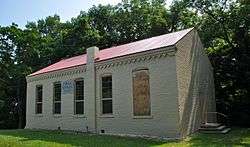
| 25 |
Hanover Lutheran Church |
|
September 14, 1987
(#87001575) |
2949 Perryville Rd.
37°21′10″N 89°33′37″W / 37.352778°N 89.560278°W / 37.352778; -89.560278 (Hanover Lutheran Church) |
Cape Girardeau |
|
| 26 |
William Henry and Lilla Luce Harrison House |
|
December 6, 2005
(#05001375) |
313 Themis St.
37°18′17″N 89°31′17″W / 37.304722°N 89.521500°W / 37.304722; -89.521500 (William Henry and Lilla Luce Harrison House) |
Cape Girardeau |
|
| 27 |
Himmelberger and Harrison Building |
|
July 17, 2003
(#03000653) |
400 Broadway St.
37°18′24″N 89°31′21″W / 37.306667°N 89.522500°W / 37.306667; -89.522500 (Himmelberger and Harrison Building) |
Cape Girardeau |
|
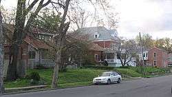
| 28 |
House at 323 Themis Street |
|
June 27, 1997
(#97000629) |
323 Themis St.
37°18′18″N 89°31′19″W / 37.305000°N 89.521806°W / 37.305000; -89.521806 (House at 323 Themis Street) |
Cape Girardeau |
|
| 29 |
Huhn-Harrison House |
|
June 27, 2002
(#02000699) |
340 S. Lorimier St.
37°17′52″N 89°31′18″W / 37.297778°N 89.521667°W / 37.297778; -89.521667 (Huhn-Harrison House) |
Cape Girardeau |
|
| 30 |
Jackson Uptown Commercial Historic District |
|
February 1, 2006
(#05001562) |
Roughly bounded by Court, Main, Missouri, and High Sts.
37°22′57″N 89°40′06″W / 37.3825°N 89.668436°W / 37.3825; -89.668436 (Jackson Uptown Commercial Historic District) |
Jackson |
|
| 31 |
Jefferson School |
|
May 12, 2009
(#09000300) |
731 Jefferson Ave.
37°17′49″N 89°31′45″W / 37.296944°N 89.529167°W / 37.296944; -89.529167 (Jefferson School) |
Cape Girardeau |
|
| 32 |
Kage School |
|
September 29, 2005
(#05001090) |
3110 Kage Rd.
37°19′57″N 89°34′45″W / 37.3325°N 89.579167°W / 37.3325; -89.579167 (Kage School) |
Cape Girardeau |
|
| 33 |
Klostermann Block |
|
July 22, 1994
(#94000739) |
7, 9, 11, 13, and 15 S. Spanish St.
37°18′11″N 89°31′11″W / 37.303056°N 89.519722°W / 37.303056; -89.519722 (Klostermann Block) |
Cape Girardeau |
|
| 34 |
Edward S. and Mary Annatoile Albert Lilly House |
|
June 20, 2008
(#08000535) |
129 S. Lorimier St.
37°18′05″N 89°31′18″W / 37.301389°N 89.521667°W / 37.301389; -89.521667 (Edward S. and Mary Annatoile Albert Lilly House) |
Cape Girardeau |
|
| 35 |
Main-Spanish Commercial Historic District |
|
December 30, 2008
(#08001259) |
Roughly the 100 blocks of Main and Spanish Sts. and adjacent portions of Themis and Independence Sts.
37°18′16″N 89°31′08″W / 37.304444°N 89.518889°W / 37.304444; -89.518889 (Main-Spanish Commercial Historic District) |
Cape Girardeau |
|
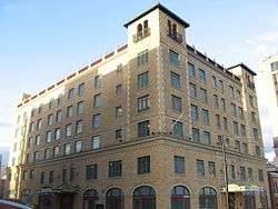
| 36 |
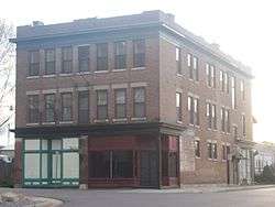
Marquette Hotel |
|
April 11, 2002
(#02000356) |
338 Broadway St.
37°18′24″N 89°31′19″W / 37.306667°N 89.521944°W / 37.306667; -89.521944 (Marquette Hotel) |
Cape Girardeau |
|
| 37 |
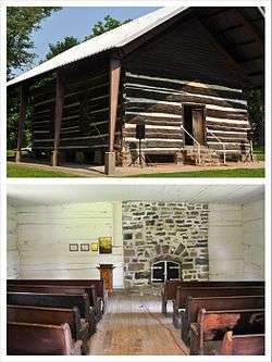
McKendree Chapel |
|
April 13, 1987
(#06000042) |
Off Interstate 55; also the southern side of Bainbridge Rd., 0.5 miles west of Interstate 55
37°22′41″N 89°37′07″W / 37.378056°N 89.618611°W / 37.378056; -89.618611 (McKendree Chapel) |
Jackson |
Specific address represents a boundary increase of February 14, 2006 |
| 38 |
Miller-Seabaugh House and Dr. Seabaugh Office Building |
|
January 4, 1996
(#95001494) |
341 Market St.
37°25′58″N 89°47′52″W / 37.432778°N 89.797778°W / 37.432778; -89.797778 (Miller-Seabaugh House and Dr. Seabaugh Office Building) |
Millersville |
|
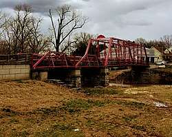
| 39 |
Old Appleton Bridge |
|
August 25, 2009
(#09000648) |
Main St. over Apple Creek
37°35′52″N 89°42′50″W / 37.597639°N 89.71375°W / 37.597639; -89.71375 (Old Appleton Bridge) |
Old Appleton |
|
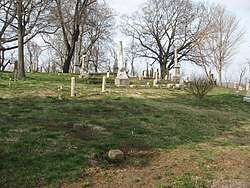
| 40 |
Old Lorimier Cemetery |
|
September 28, 2005
(#05001091) |
500 N. Fountain St.
37°18′40″N 89°31′12″W / 37.311111°N 89.520000°W / 37.311111; -89.520000 (Old Lorimier Cemetery) |
Cape Girardeau |
|
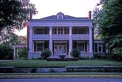
| 41 |
Oliver-Leming House |
|
September 12, 1980
(#80002323) |
740 North St.
37°18′35″N 89°31′40″W / 37.309722°N 89.527778°W / 37.309722; -89.527778 (Oliver-Leming House) |
Cape Girardeau |
|
| 42 |
Abraham Russell Ponder House |
|
March 27, 2008
(#08000226) |
141 S. Louisiana Ave.
37°18′09″N 89°32′19″W / 37.302500°N 89.538611°W / 37.302500; -89.538611 (Abraham Russell Ponder House) |
Cape Girardeau |
|
| 43 |
Frederick W. and Mary Karau Pott House |
|
June 25, 1999
(#99000745) |
826 Themis St.
37°18′22″N 89°31′46″W / 37.306111°N 89.529444°W / 37.306111; -89.529444 (Frederick W. and Mary Karau Pott House) |
Cape Girardeau |
|
| 44 |
James Reynolds House |
|
October 13, 1983
(#83003942) |
623 N. Main St.
37°18′41″N 89°31′05″W / 37.311389°N 89.518056°W / 37.311389; -89.518056 (James Reynolds House) |
Cape Girardeau |
|
| 45 |
August and Amalia Shivelbine House |
|
June 25, 1999
(#99000743) |
303 S. Spanish St.
37°17′55″N 89°31′14″W / 37.298750°N 89.520556°W / 37.298750; -89.520556 (August and Amalia Shivelbine House) |
Cape Girardeau |
|
| 46 |
South Middle Street Historic District |
|
October 14, 2009
(#09000829) |
513 William St. and 202-230 and 203-229 S. Middle St.
37°18′00″N 89°31′29″W / 37.300000°N 89.524720°W / 37.300000; -89.524720 (South Middle Street Historic District) |
Cape Girardeau |
|
| 47 |
Southeast Missourian Building |
|
June 1, 2005
(#05000509) |
301 Broadway St.
37°18′22″N 89°31′16″W / 37.306111°N 89.521111°W / 37.306111; -89.521111 (Southeast Missourian Building) |
Cape Girardeau |
|
| 48 |
St. James A.M.E. Church |
|
January 15, 2014
(#13001085) |
516 North St.
37°18′34″N 89°31′26″W / 37.309543°N 89.523856°W / 37.309543; -89.523856 (St. James A.M.E. Church) |
Cape Girardeau |
|
| 49 |
St. Vincent De Paul Catholic Church |
|
April 12, 1982
(#82003131) |
131 S. Main St.
37°18′03″N 89°31′10″W / 37.300833°N 89.519444°W / 37.300833; -89.519444 (St. Vincent De Paul Catholic Church) |
Cape Girardeau |
|
| 50 |
St. Vincent's College Building |
|
September 30, 2005
(#05001092) |
201 Morgan Oak St.
37°17′47″N 89°31′16″W / 37.296389°N 89.521111°W / 37.296389; -89.521111 (St. Vincent's College Building) |
Cape Girardeau |
|
| 51 |
Col George C. Thilenius House |
|
April 14, 1983
(#83000974) |
100 Longview Pl.
37°18′24″N 89°32′30″W / 37.306667°N 89.541667°W / 37.306667; -89.541667 (Col George C. Thilenius House) |
Cape Girardeau |
|
| 52 |
Trail of Tears State Park Archeological Site |
|
December 2, 1970
(#70000326) |
Address Restricted
|
Oriole |
An archeological site in Trail of Tears State Park |
| 53 |
Julius Vasterling Building |
|
June 17, 2009
(#09000439) |
633-637 Broadway St.
37°18′23″N 89°31′35″W / 37.306527°N 89.526527°W / 37.306527; -89.526527 (Julius Vasterling Building) |
Cape Girardeau |
|
| 54 |
Warehouse Row Historic District |
|
December 4, 2004
(#04001285) |
19 N. Water St.
37°18′20″N 89°31′04″W / 37.305556°N 89.517778°W / 37.305556; -89.517778 (Warehouse Row Historic District) |
Cape Girardeau |
|
| 55 |
Robert Felix and Elma Taylor Wichterich House |
|
August 12, 1999
(#99000987) |
300 Good Hope St.
37°17′57″N 89°31′19″W / 37.299305°N 89.522083°W / 37.299305; -89.522083 (Robert Felix and Elma Taylor Wichterich House) |
Cape Girardeau |
|
| 56 |
J. Maple and Grace Senne Wilson House |
|
July 7, 2015
(#15000365) |
344 N. Ellis St.
37°18′34″N 89°31′39″W / 37.309444°N 89.527500°W / 37.309444; -89.527500 (J. Maple and Grace Senne Wilson House) |
Cape Girardeau |
|
| 57 |
Wood Building |
|
December 10, 2003
(#03001269) |
1-3 S. Frederick and 605-607 Independence Sts.
37°18′14″N 89°31′33″W / 37.303889°N 89.525833°W / 37.303889; -89.525833 (Wood Building) |
Cape Girardeau |
|

.jpg)