City of Port Adelaide Enfield
| City of Port Adelaide Enfield South Australia | |||||||||||||||
|---|---|---|---|---|---|---|---|---|---|---|---|---|---|---|---|
 | |||||||||||||||
| Population | 121,230 (2016 census)[1] | ||||||||||||||
| • Density | 1,290/km2 (3,340/sq mi) | ||||||||||||||
| Established | 26 March 1996 | ||||||||||||||
| Area | 94 km2 (36.3 sq mi) | ||||||||||||||
| Mayor | Gary Johanson | ||||||||||||||
| Council seat | Port Adelaide | ||||||||||||||
| Region |
Western Adelaide[2] Northern Adelaide[3] | ||||||||||||||
| State electorate(s) | Port Adelaide, Lee, Cheltenham, Croydon, Playford, Enfield, Torrens, Florey, Dunstan | ||||||||||||||
| Federal Division(s) | Port Adelaide, Adelaide, Makin, Sturt | ||||||||||||||
|
| |||||||||||||||
| Website | City of Port Adelaide Enfield | ||||||||||||||
| |||||||||||||||
The City of Port Adelaide Enfield, located across inner north and north-western suburbs of Adelaide, is one of the largest metropolitan councils within South Australia. It was established on 26 March 1996 by the amalgamation of the City of Port Adelaide and the City of Enfield.
Extending from the River Torrens to Outer Harbor, and covering an area of approximately 97 km², the Port Adelaide Enfield contains some of the South Australia's finest historical buildings and landmarks. The Port Adelaide area is known as the History Precinct, as it is home to the Maritime Museum, the National Railway Museum and the Aviation Museum.
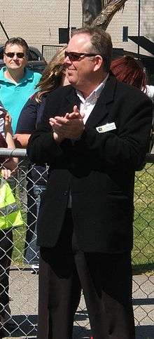
As of 2016 the current Mayor is Gary Johanson, who was elected in 2006. There are 17 ward councillors who represent the residents and businesses of their wards at council meetings.
Council
The current council as of November 2017 is:[4]
| Ward | Party[5] | Councillor | Notes | |
|---|---|---|---|---|
| Mayor | SA-BEST | Gary Johanson | ||
| Enfield | SA-BEST | Carol Martin | ||
| Labor | Michael Iammarrone | |||
| Independent | Peter McKay | |||
| Klemzig | Independent | Tony Barca | ||
| Independent | Paul Russell | |||
| Northfield | Independent | Mark Basham | ||
| Independent | Anne-Marie Hubycz | |||
| Labor | Matt Osborn | Deputy Mayor | ||
| Outer Harbor | Independent | Peter Jamieson | ||
| Independent | Vanessa McCluskey | |||
| Parks | Independent | John Croci | ||
| Labor | Kim Dinh | |||
| Independent | Guy Wilcock | |||
| Port Adelaide | Independent | Claire Boan | ||
| Independent | Ray Guscott | |||
| Semaphore | Independent | Helen Wright | ||
| Independent | Michelle Hogan | |||
History
The City of Port Adelaide Enfield was established on 26 March 1996 by the amalgamation of the City of Port Adelaide and the City of Enfield.
The council of Port Adelaide was established on 27 December 1855 when Port Adelaide was declared a Corporate Town centred at the port of Adelaide which had been opened some years prior in 1837.[6] From 1884 to 1900 five adjacent district councils were amalgamated with the Corporate Town of Port Adelaide, dramatically increasing its size.[6] In 1901 Port Adelaide was proclaimed a city by Governor Tennyson.[6]
Centred around the township of Enfield, the District Council of Yatala south was formed in 1868 when the District Council of Yatala was divided in two. Dry Creek and the Dry Creek-Port Adelaide railway line formed the new council's northern boundary.[7] In 1933, Yatala South was renamed to be Enfield council. In 1944 Enfield district council became a municipality and in 1953, thanks to the post-war boom in population, it was upgraded to city status.[6]
Mayors
Suburbs
- Alberton – 5014
- Angle Park – 5010
- Birkenhead – 5015
- Blair Athol – 5084
- Broadview – 5083 (part)
- Clearview – 5085
- Croydon Park – 5008
- Dernancourt – 5075 (part)
- Devon Park – 5008 (part)
- Dry Creek – 5094 (part)
- Dudley Park – 5008
- Enfield – 5085
- Ethelton – 5015
- Exeter – 5019
- Ferryden Park – 5010
- Gepps Cross – 5094
- Gilles Plains – 5086 (part)
- Gillman – 5013
- Glanville – 5015
- Greenacres – 5086
- Hampstead Gardens – 5086
- Hillcrest – 5086
- Holden Hill – 5088 (part)
- Kilburn – 5084
- Klemzig – 5087
- Largs Bay – 5016
- Largs North – 5016
- Manningham – 5086
- Mansfield Park – 5012
- New Port – 5015
- North Haven – 5018
- Northfield – 5085
- Northgate – 5085
- Oakden – 5086
- Osborne – 5017
- Ottoway – 5013
- Outer Harbor – 5018
- Peterhead – 5016
- Port Adelaide – 5015
- Prospect - 5082 (part)
- Queenstown – 5014
- Regency Park – 5010
- Rosewater – 5013
- Sefton Park – 5083 (part)
- Semaphore – 5019
- Semaphore South – 5019
- Taperoo – 5017
- Valley View – 5093 (part)
- Walkley Heights – 5098 (part)
- Windsor Gardens – 5087
- Wingfield – 5013
- Woodville Gardens – 5012
See also
- Local Government Areas of South Australia
- City of Port Adelaide
- James Millner (doctor), early alderman of Port Adelaide Council
- City of Enfield
- List of Adelaide parks and gardens
References
Couper-Smartt, J (February 2003). Port Adelaide: Tales from a "Commodious Harbour". Friends of the South Australian Maritime Museum Inc. ISBN 0-646-42058-5.
Footnotes
- ↑ Australian Bureau of Statistics (27 June 2017). "Port Adelaide Enfield (C)". 2016 Census QuickStats. Retrieved 16 November 2017.

- ↑ "Western Adelaide SA Government region" (PDF). The Government of South Australia. Retrieved 17 April 2017.
- ↑ "Northern Adelaide SA Government region" (PDF). The Government of South Australia. Retrieved 17 April 2017.
- ↑ "Elected Members". City of Port Adelaide Enfield. Retrieved 21 November 2017.
- ↑ Elected Member Register of Interests Information 2017/2018 City of Port Adelaide Enfield. Retrieved 2 December 2017.
- 1 2 3 4 "Our History: Enfield History". City of Port Adelaide Enfield. Archived from the original on 3 April 2015. Retrieved 23 February 2016.
- ↑ Marsden, Susan (2012). "A History of South Australian Councils to 1936" (PDF). Local Government Association of South Australia. Retrieved 23 February 2016.
Formed on 18 June 1868 when the original Yatala Council (see Yatala) was divided into DCs of Yatala North and Yatala South. On 22 June 1933 Yatala South was renamed DC of Enfield.
- 1 2 3 "Those Who Served:1853 – 2014" (PDF). City of Port Adelaide Enfield. pp. 27–28. Retrieved 23 January 2018.