Riverland
| Riverland South Australia | |
|---|---|
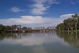 Paringa Bridge over the Murray River | |
| Population | 41, 802 (2008)[1] |
| LGA(s) | |
| State electorate(s) | Chaffey, Stuart |
| Federal Division(s) | Barker |
The Riverland is a region of South Australia. It covers an area of 9,386 square kilometres (3,624 sq mi) along the Murray River from where it flows into South Australia from New South Wales and Victoria downstream to Blanchetown. The major town centres are Renmark, Berri, Loxton, Waikerie, Barmera and Monash, along with many minor townships, the population is approximately 35,000 people.
The Riverland is located 1.75 to 3 hours (or 150 to 280 km (93 to 174 mi)) north east of Adelaide, and 90 minutes west (or 120 to 250 kilometres (75 to 155 mi)) from Mildura, Victoria via the Sturt Highway.
The Riverland has a Mediterranean climate with warm, dry summers and relatively mild winters, with temperatures a few degrees above those of Adelaide. The average summer temperature is 32.5 °C (90.5 °F), with a winter average of 16.2 °C (61.2 °F) and an average rainfall of 260.6 millimetres (10.26 in).[2]
History
The Riverland’s history is strongly linked to irrigation and the area's suitability for growing crops. The region enjoys a warm Mediterranean climate, and has vast acres of fertile soil and a readily available water source in the Murray River.
The first district to be established in the region was Renmark in 1887 by the Chaffey Brothers, who also established the Mildura Irrigation District in the neighbouring upstream Region of Sunraysia. Other settlements followed in the 1890s at: Holder, Kingston, Lyrup, Moorook, Murtoa, New Era, New Renmark, Pyap, Ramco and Waikerie.[3]
Some of these irrigation schemes were developed as a government response to the economic depression of the 1890s, where the aim was to keep energy, talent and capital from leaving South Australia using Village Settlement Schemes.[3]
In 1901 a Royal Commission recommended that the settlements be subdivided and leased to individual settlers instead of village associations, and over time most of these areas became government irrigation areas.[3]
Soldier settlement schemes were later allotted for returned servicemen at: Berri, Chaffey, Cadell and Cobdogla from 1917. Loxton and Cooltong were allotted from 1946 on. During World War II, the region hosted an internment camp for people of Japanese,[4] German and Italian origin or descent. This camp was based at Loveday but little remains today to indicate its existence.
In 1956 and 1961 the privately developed Sunlands/Golden Heights schemes were established. As pumping technology became more affordable and efficient, more recent development occurred through private irrigation, where irrigators operated their own pumping infrastructure pumping water from the River. Water trade enabled further growth in these properties from the early 1990s with the Riverland purchasing water from pasture users in upstream states, or from the downstream lower Murray region, to expand the winegrape and almond industries. Some of this development was funded through managed investment schemes. Now the majority of irrigation is from private infrastructure.
The Central Irrigation Trust manages most of the community supplied districts with a total of 13,000 ha.[5] There is also the Renmark Irrigation Trust, which supplies water to 4,700 ha.[6] All the water is supplied from the River Murray. Many of the towns were established for the re-settlement of soldiers after their return from World War I or World War II. Most towns were established as separate irrigation districts.[3]
Economy
The Riverland’s economy is driven by primary production.[7] The region has sustainable comparative advantages for high value irrigated horticulture including soils, climate, reliability of water supply, best practice water supply systems, ability to grow a diversity of crops, fruit fly free status and proximity to markets.[3]
The area is Australia’s largest wine producing region, growing over half (63 per cent in 2014)[8] of South Australia’s wine grapes. Most major Australian wine companies source a significant amount of bulk wine from the Riverland.
In 2013 the region produced 22 per cent of Australia’s wine grape crush with approximately 21,000 hectares under wine grapes, which was produced by over 1,000 growers.[8]
The Riverland is also a significant almond and stone fruit growing region, producing 18 per cent of Australia’s almonds and 7 per cent of Australia’s fresh stone fruit.[8]
Riverland juices and milk drinks are stocked on supermarket shelves across Australia and internationally.[8]
The agriculture industry is the largest employer in the area[7] with approximately 3000 farm based businesses in the Riverland Region.
Transportation
The Riverland is located on the main eastern state transit link, which connects Adelaide to the eastern states.
Road: The Sturt Highway, a part of the National Highway Network, is the major highway connecting the Riverland Region with interstate and overseas freight connections at Adelaide’s Outer Harbor and Adelaide Airport. Main roads provide regional access between towns, as well as alternative routes to major regional areas such as Murray Bridge.[9]
Air: Renmark has a regional airport that provides services for light planes, and potential for future expansion of commuter services. Waikerie airport has a sealed runway and is an operating airfield.[9]
Recreation
The region is known for its natural wonders, with the opportunity to go for guided and self-guided walks, horse-riding or bike riding (both mountain biking or cycling), canoeing or kayaking on the river and creeks. Lake Bonney provides opportunities for sailing, zorbing or windsurfing. Lake Bonney was also the site where on 23 November 1964, Donald Campbell achieved the Australian Water Speed Record of 216 miles per hour (348 km/h) in his boat, the BlueBird.
The region also has a vibrant Motorsports culture with options for 4-wheel driving, trail bike or motocross riding, go-kart and speedway.
Festivals
Renmark Rose Festival
Renmark is well known for its annual Rose Festival, a 10-day long event held in October each year, which is a major tourist attraction.[10] The very first Rose Week was run in 1994, and was the brainchild of Eithne Sidhu who collaborated with David Ruston, who owns Australia's largest rose garden (27 acres) and houses the National Rose Collection.[10]
Loxton Christmas Light's Festival
Starting with a single Christmas light display out on a property in Loxton North, the Loxton Christmas Lights Festival today incorporates many homes throughout the township, and attracts thousands of visitors to the region over the period from November through December each year. It began when Peter Mangelsdorf was inspired to start a small Christmas display known as Christmas Wonderland. The 250 metres (270 yd) frontage of Peter's property is filled with a magnificent display of Christmas lights and images, ranging from Bethlehem scenes to popular characters dressed for the festive season.[11]
Riverland Food and Wine Festival
Held in mid-October each year, the Riverland Food and Wine is the region's main food and wine event showcasing local wines, ales, ciders, spirits in addition to local cuisine. Held on the banks of the Murray River, the day includes entertainment, and has become a popular event with locals and visitors alike.[12]
Tourism
Destination Riverland is the Riverland’s tourism body,[13] with this industry worth around $148 million annually.[14]
Governance
The region is represented at a State level in the House of Assembly by local Liberal Member for Chaffey, Tim Whetstone MP. Federally, Liberal Member for Barker, Tony Pasin MP is the region’s representative in the House of Representatives. Local, Anne Ruston is a Federal Senator for South Australia.
Education
Pre-school
- Waikerie Children’s Centre
- Barmera Kindergarten
- Monash Kindergarten
- Berri Community Preschool
- Renmark West Pre-School
- Renmark Children’s Centre
- Riverland Early Learning Centre
- Woodleigh – Loxton District Children’s Centre
- Loxton Pre-School Centre
- Loxton North Kindergarten
Primary Level
|
Public
|
Private and religious
|
Senior Schooling
There are four public high schools across the Riverland region:
- Waikerie High School
- Glossop High School
- Renmark High School
- Loxton High School
Special Education
- Riverland Special School
Further education
TAFE SA has a centrally located campus in Berri.[15]
Conservation
| Designations | |
|---|---|
| Official name | Riverland |
| Designated | 23 September 1987 |
| Reference no. | 377[16] |
The predominant natural environment consists of River Red Gum and Black Box forests that line the river banks and flood plains, as well as steep cliffs. The Riverland is abundant in wildlife, the more common species encountered being Pelicans, Kookaburras, Brush Tail Possums and Perons Tree Frogs. Less common species include Koalas (introduced to Renmark), Bush Stone Curlews and Carpet Pythons (rated 'vulnerable' to extinction in the region).[17]
Riverlanders share an interest in the health of the River Murray.[18] The Riverland region lies in the southern part of the Murray Darling Basin where the broad River Murray floodplain and its river meanders for approximately 400 kilometres (250 mi) through red sandy Mallee dune landscapes. Several conservation reserves protect biodiversity and provide for conservation and wise use activities.[9]
Protected area associated with the River Murray include Murray River National Park, Loch Luna Game Reserve and Moorook Game Reserve. Mallee landscape reserves include Chowilla Regional Reserve, Billiatt Conservation Park, Pooginook Conservation Park, Calperum Station and several privately owned reserves including Birds Australia’s Gluepot Reserve. In the river valley, there are several hundred wetlands[17] including two Ramsar wetlands of international importance — Banrock Station Wetland Complex and the Riverland Wetland which encompasses Chowilla floodplain, and other wetlands including Pike River basin, Gurra Gurra wetlands and Katarapko Creek.[9][19]
Media
- The Murray Pioneer
- The River News
- The Loxton News
Radio
- Magic FM - 93.1 FM
- 5RM – 801 AM
- ABC News radio – 93.9 FM
- ABC Riverland SA - 1062 AM
- ABC Classic FM – 105.1 FM
Television
- ABRS, the relay of ABC Television
- RTS, part of the WIN Network
See also
References
- ↑ "National Regional Profile: Riverland (Statistical Subdivision), Population/People". Australian Bureau of Statistics. 19 November 2010. Retrieved 7 April 2016.
- ↑ "Riverland Weather". Destination Riverland. Destination Riverland. 2016-09-30. Retrieved 2016-09-30.
- 1 2 3 4 5 "SA Riverland Community Profile" (PDF). www.mdba.gov.au/sites/default/files/archived/guide_pbp/AppendixC_SA_Riverland_community_profile.pdf. Murray Darling Basin Authority. 8 October 2010. Retrieved 2016-09-29.
- ↑ "Loveday Project: Japanese civilians interned in Australia". Wordpress.com. Retrieved 23 November 2012.
- ↑ "Central Irrigation Trust". cit.org.au. Retrieved 17 May 2017.
- ↑ "Renmark Irrigation Trust". rit.org.au. Retrieved 17 May 2017.
- 1 2 "Live, Work, Play, Invest Riverland" (PDF). www.rdamr.org.au/fileadmin/user_upload/Riverland/Publications/RDA_LWP_PDF_Version_NOv_2014.pdf. Regional Development Australia Murraylands and Riverland Inc. 8 December 2014. Retrieved 30 September 2016.
- 1 2 3 4 "Mapping Capability and Connections Report" (PDF). www.rdamr.org.au/fileadmin/user_upload/Riverland/documents/Mapping_Capability_and_Connections_Report.pdf. Australian Government, Department of Industry. 30 March 2015. Retrieved 30 September 2016.
- 1 2 3 4 "Riverland Regional prospectus" (PDF). www.rdamr.org.au/fileadmin/user_upload/Murraylands/Docs/Riverland_Prospectus_v6.pdf. Riverland Futures taskforce. 11 April 2012. Retrieved 2016-09-30.
- 1 2 "Ruston's Roses". Renmark Rose Festival. Renmark Rose Festival. 2016-09-30. Retrieved 2016-09-30.
- ↑ Peta, Martin (17 December 2011). "Christmas Light's at Loxton". ABC Riverland. ABC Riverland. Retrieved 2016-09-30.
- ↑ Kuerschner, Jane (October 16, 2015). "Wine and food showcase promises…. more, more, more". murraypioneer.com. Murray Pioneer. Retrieved 30 September 2016.
- ↑ "Destination Riverland". Retrieved 30 September 2016.
- ↑ "The Value of Tourism in the Riverland" (PDF). South Australian Tourism Commission. South Australian Tourism Commission. 31 December 2015. Retrieved 30 September 2016.
- ↑ "Aboriginal Access Centre delivering new courses at Berri Campus". TAFE SA. TAFE SA. 30 September 2016. Retrieved 30 September 2016.
- ↑ "Riverland". Ramsar Sites Information Service. Retrieved 25 April 2018.
- 1 2 "Parks of the Riverland: Healthy Parks, Healthy Regions". www.parks.sa.gov.au. Dept. or Environment and Natural resources. Retrieved 7 December 2016.
- ↑ Sydney Morning Herald (2008-07-02). "Xenophon want help for Murray River". Fairfax. Retrieved 2008-07-02.
- ↑ "Katfish Reach". katfish.org.au. Retrieved 17 May 2017.
External links
| Wikimedia Commons has media related to Riverland. |
- Riverland Tourism Region
- Destination Riverland
- Regional Development Australia Murraylands and Riverland Inc.
- Tourism SA
- Wine Diva
- Guide to The Riverland
| Topics | ||
|---|---|---|
| Regions | ||
| Cities and towns | ||
South Australia portal | ||