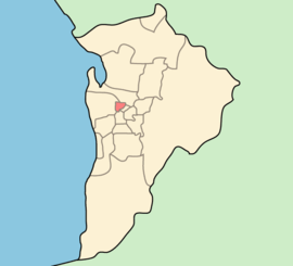
City of Prospect
| City of Prospect South Australia | |||||||||||||||
|---|---|---|---|---|---|---|---|---|---|---|---|---|---|---|---|
 | |||||||||||||||
| Population | 20,527 (2016 census)[1] | ||||||||||||||
| • Density | 2,628.3/km2 (6,807/sq mi) | ||||||||||||||
| Established | 1872 | ||||||||||||||
| Area | 7.81 km2 (3.0 sq mi) | ||||||||||||||
| Mayor | David O'Loughlin | ||||||||||||||
| Council seat | Prospect | ||||||||||||||
| Region | Eastern Adelaide[2] | ||||||||||||||
| State electorate(s) | Adelaide, Enfield | ||||||||||||||
| Federal Division(s) | Adelaide | ||||||||||||||
|
| |||||||||||||||
| Website | City of Prospect | ||||||||||||||
| |||||||||||||||
The City of Prospect is an inner urban local government area (LGA) in Adelaide, South Australia. The council seat is the unusually-large suburb of Prospect, which makes up almost two thirds of the council area. Established in 1872, it is one of the oldest local government bodies in South Australia.
Prospect's population is growing and reflective of a broader demographic. Prospect has a relatively young resident population (average age 36yo), many of whom are ‘knowledge workers’, with high education, skills, intellectual capacity and disposable incomes.
The community has embraced the significant change effected in recent years. The City of Prospect has had a clear intent over recent years to encourage new, mixed use, larger scale, high quality sustainable development along the arterial roads. This intent has been reflected in council's integrated strategic planning, master plans, public realm and infrastructure upgrades and changes to council's Development Plan. This has created many commercial and business opportunities along the main roads, more housing options to accommodate a growing and diverse residential population and greater capacity for jobs and positive impact on the local economy.
Council
The current council as of June 2016 is:[3]
| Ward | Party[4] | Councillor | Notes | |
|---|---|---|---|---|
| Mayor | Labor | David O'Loughlin | ||
| North | Labor | Monica Lee | ||
| Liberal | Talis Evans | |||
| West | Independent | Kristina Barnett | ||
| Independent | Matt Larwood | |||
| Central | Independent | Mark Groote | ||
| Independent | Alison Bowman | |||
| East | Independent | Allen Harris | ||
| Independent | Mark Standen | |||
History
Prior to European settlement in 1838, the Prospect area was a tiny part of the traditional lands of the Kaurna people, who lived in small bands across the Adelaide Plains.[5]
To the new settlers, the locality presented a "beautiful prospect", being described as "well timbered, with waving gum and shady trees".[6] Thus Prospect Village was named by Colonel William Light shortly after the colonisation of South Australia in 1838. George Fife Angas was given the right to make first choice of "country section", to which he and other early investors in South Australia were entitled by their purchase of land orders prior to settlement (see Lands administrative divisions of South Australia § Land division history). Under Light's plan for the city and adjoining rural areas, the present-day inner metropolitan area was laid out as hundreds which were further divided into sections, of about 80 acres (32 ha) in size.[7] Prospect was to fall within the Hundred of Yatala when it was proclaimed in 1846, but prior to this the section were simply referred to as "country section" and the number.
At a meeting in March 1838, Angas made his choice, selecting the triangular section 474, now the Collinswood but earlier split between Collinswood and the historic suburb of Rosebery. Later in 1838 further selections were made and six sections (four in the southernmost parts of present-day City of Prospect) were purchased by the Mechanics Land Company, including section 349 in which the village of Prospect arose. The company divided the 80-acre sections into 8-acre (3.2 ha) blocks, and sold them for £10 a block.[7]
Section 348 immediately south of Prospect Village was known as Little Adelaide.[8]
As early as November 1838, plots of land "fronting the new road to the harbour" had been created from subdivisions in the new village of Prospect and were being publicly advertised for sale.[9] These subdivided sections came to be known as Prospect Village. Early attempts to garden in the vicinity of Prospect failed as the soil is naturally dry, the nearest source of water then being the River Torrens. For many years blocks of land in the area remained unfenced and, in springtime, livestock from nearby areas were not prevented from feeding on the thick grass growing on the hills of Prospect.[7]
Establishment of local government
In 1853 the District Council of Yatala was established and included, at its extreme south centre, the future area of the City of Prospect. In 1868 Yatala DC was divided at Dry Creek into the District Councils of Yatala South and Yatala North.[10][11][12] In August 1872 the new District Council of Prospect split from the Yatala South DC following lobbying by residents of Prospect village.[12]
Land boom and collapse
In the 1880s there was a land boom in Prospect. Many new subdivisions were made and new houses built. The 1890s saw a collapse of land values and vacant houses were available to rent for just a few shillings per week.[13]
Municipality
In December 1933, the district council was given municipal status as the Corporation of the Town of Prospect. As such it retained the five pre-existing wards of Nailsworth, Kingston, Fitzroy, St. John's Wood and Highbury, each represented by two councillors. The councillors named in the June 1933 proclamation were: Elder George Whittle as mayor, Leonard Andrew Day for Nailsworth, William Henry Verco for Kingston, Richard Angwin for St. John's Wood, and William Thomas Smith for Highbury, with an instruction that the remaining six vacancies be filled by elections later in that year.[14]
Symbols
In 1934 a competition to design a coat of arms for the Town of Prospect was held and a design by Mr. Allan F. Sierp was chosen.[15] It contained the following emblems:
- The first and fourth quarters had shocks of wheat signifying "the early days of the district".
- The second quarter contained a pair of wings to "show the progress to the present prosperity".
- The third depicted a cornucopia, or horn of plenty, overflowing with fruit.
Suburbs
|
|
See also
References
- ↑ Australian Bureau of Statistics (27 June 2017). "Prospect (C)". 2016 Census QuickStats. Retrieved 16 November 2017.

- ↑ "Eastern Adelaide SA Government region" (PDF). The Government of South Australia. Retrieved 17 April 2017.
- ↑ "Elected Members". The City of Prospect. Retrieved 6 June 2016.
- ↑ "Elected Members Register of Interests" (PDF). The City of Prospect. Retrieved 6 June 2016.
- ↑ "Historical Timeline". City of Prospect. Retrieved 3 June 2016.
The Kaurna people lived in small bands across the Adelaide Plains, including the Prospect area, prior to the European settlement.
- ↑ "Location". City of Prospect. Retrieved 3 June 2016.
- 1 2 3 "Past eventful, present is progressive". Prospect supplement—eight pages in News. 63, (9, 689). Adelaide, South Australia. 31 August 1954. p. 18. Retrieved 2 June 2016 – via National Library of Australia.
- ↑ "YATALA" (Map). Hundred of Yatala. 1896.
- ↑ "FOR SALE". South Australian Gazette and Colonial Register. Adelaide. 3 November 1838. p. 3.
Three acres of Lot 1 in Prospect Village, fronting the new road to the harbour.
- ↑ "Our History: Enfield History". City of Port Adelaide Enfield. Archived from the original on 3 April 2015. Retrieved 23 February 2016.
- ↑ "Historical Timeline". City of Prospect. Retrieved 13 July 2011.
- 1 2 Marsden, Susan (2012). "LOCAL GOVERNMENT ASSOCIATION OF SOUTH AUSTRALIA: A HISTORY OF SOUTH AUSTRALIAN COUNCILS to 1936" (PDF).
[In 1868,] Prospect ratepayers [...] believed they were not getting their fair share of roadworks, and that the council office was too far away at Gepps Cross. Led by council member James Harrington, Prospect Village residents petitioned for separation, and 1 August 1872 part was severed to form the new DC of Prospect.
- ↑ "Past eventful, present is progressive". Prospect supplement—eight pages in News. 63, (9, 689). Adelaide, South Australia. 31 August 1954. p. 18. Retrieved 2 June 2016 – via National Library of Australia.
In the 1880s there was a land boom in Prospect, and many new subdivisions were made. New houses were built and the settlement seemed headed for prosperity. The nineties saw a collapse of land values and vacant houses, were available for letting at a few shillings a week.
- ↑ "Local Government Areas (Re-arrangement) Acts, 1929 and 1931.—Area of District Council District of Prospect To Be a Municipality" (PDF). South Australian Government Gazette (27 ed.). 1933: 1050. 22 June 1933. Retrieved 28 July 2017.
- ↑ "THE CITY OF PROSPECT". News. 63, (9, 689). Adelaide, South Australia. 31 August 1954. p. 23. Retrieved 5 June 2016 – via National Library of Australia.