Blair Athol, South Australia
| Blair Athol Adelaide, South Australia | |
|---|---|
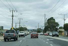 Grand Junction Road | |
| Population |
|
| Postcode(s) | 5084 |
| LGA(s) | City of Port Adelaide Enfield |
| State electorate(s) | Enfield |
| Federal Division(s) | Adelaide |
Blair Athol is located about 15 km (9 mi) north of the Adelaide CBD, South Australia. Blair Athol borders the suburbs of Gepps Cross, Enfield, Prospect and Kilburn. Blair Athol's main and longest street is Florence Avenue.
History
Blair Athol Post Office opened on 15 June 1955 and was renamed Blair Athol West in 1966. At that time the existing Enfield office (open since 1852) was renamed Blair Athol and it was replaced by the Enfield Plaza office in 1997.[3]
Reserves
Blair Athol has two reserves, Blair Athol Recreational Reserve and Barton Street Reserve. The Blair Athol Recreational Reserve is a large reserve covering a total area of approx. 46,800 sq. metres (180 x 260 metres). It features a football oval, cricket ground with batting cages, two netball/basketball courts and tennis courts which are exclusively used by members of the Kilburn tennis club. This reserve also features a large parking lot, 2 playgrounds with one to the north and the other to the south, a gazebo and the Kilburn Footy Club. Barton Street Reserve features a large grass field and a playground with several benches. This reserve covers a total area of approx. 18,400 Sq metres (230 x 80 metres).
Government
Blair Athol is run by the City of Port Adelaide Enfield. The council was set up in 1996 and one of its main offices is located in Enfield. The South Australian Education Department helped set up the school system in Blair Athol and Kilburn. Blair Athol has 3 main schools. Gepps Cross Primary School and St. Paul Lutheran Primary School cater for levels 1-7. Gepps Cross Senior School is the only secondary school in Blair Athol and is partners with Enfield High School.
Shopping
Blair Athol has one of the few family owned hardware stores left Randall's Hardware next to another family owned business Pets Everywhere. Blair Athol had a Coles supermarket located on the corner of Florence Avenue and Prospect Road. This supermarket has ceased operation in July 2016, with the site to be redeveloped. It was reopened in 2017 as an IGA featuring products from Afghanistan, Iran and Pakistan. Kilburn Post Office is located across the road from the IGA (old Coles).
Transport
Blair Athol is serviced by the G10 bus line between Adelaide and Grand Junction Road, travelling via Prospect Road and also bus routes 221, 222, 224, 225, 226, 228 and 229, which travel between Adelaide and various destinations in the Northern suburbs via Main North Road. Residents of Blair Athol can also catch the train line to and from the city. The station is located in Kilburn, several hundred metres from Prospect Road.
See also
References
- ↑ Australian Bureau of Statistics (31 October 2012). "Blair Athol (State Suburb)". 2011 Census QuickStats. Retrieved 16 February 2015.

- ↑ Australian Bureau of Statistics (25 October 2007). "Blair Athol (State Suburb)". 2006 Census QuickStats. Retrieved 16 February 2015.
- ↑ Premier Postal History. "Post Office List". Premier Postal Auctions. Retrieved 26 May 2011.