North Haven, South Australia
| North Haven South Australia | |||||||||||||||
|---|---|---|---|---|---|---|---|---|---|---|---|---|---|---|---|
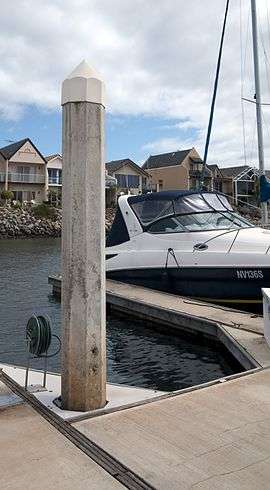 Floating dock at North Haven | |||||||||||||||
 North Haven | |||||||||||||||
| Coordinates | 34°47′15″S 138°29′32″E / 34.787510°S 138.492160°ECoordinates: 34°47′15″S 138°29′32″E / 34.787510°S 138.492160°E | ||||||||||||||
| Population | 5,798 (2011 census)[1] | ||||||||||||||
| Established | 1975[2] | ||||||||||||||
| Postcode(s) | 5018[3] | ||||||||||||||
| Time zone | ACST (UTC+9:30) | ||||||||||||||
| • Summer (DST) | ACST (UTC+10:30) | ||||||||||||||
| Location | 18 km (11 mi) northwest of Adelaide city centre | ||||||||||||||
| LGA(s) | City of Port Adelaide Enfield[2] | ||||||||||||||
| State electorate(s) | [4] | ||||||||||||||
| Federal Division(s) | Port Adelaide[5] | ||||||||||||||
| |||||||||||||||
| |||||||||||||||
| Footnotes |
Location[3] Coordinates[2] Climate[6] Adjoining suburbs[2] | ||||||||||||||
North Haven is a north-western suburb of Adelaide 20 km from the CBD, in the state of South Australia, Australia and falls under the City of Port Adelaide Enfield. It is adjacent to Osborne and Outer Harbor. The postcode for North Haven is 5018. It is bounded to the north and east by Oliver Rogers and Victoria Road, to the south by Marmora Terrace and the west by Gulf St Vincent.
A small residential area that lies north of the Gulf Point Marina is often referred to as being a part of Outer Harbor (though it still lies within the boundaries of North Haven).
History
North Haven originally started as a private sub-division in Section 769 in the cadastral unit of Hundred of Port Adelaide. Its creation in 1976 was originally opposed by the Postmaster General of Australia due to “size & duplication of name else in Australia.” Its boundaries have been altered as follows since 1976 - boundary with the suburb of Outer Harbor, addition of land from the suburb of Osborne and other ‘unnamed land’, and the addition of a ‘portion of the Harbor’ in February 2007.[2]
Facilities
The suburb is served by a retirement village on Military Road, a small shopping centre on Osborne Road. That has many retail stores and is home to a supermarket, a chemist and a Bakery as well as other restaurants and businesses. The western coastal side of the suburb contains a newly constructed Surf Lifesaving Club (completed in 2007), and the Gulf Point Marina which is home to a large sailing community. The marina, lined with exclusive houses, is protected by two artificial breakwaters. Attached to the marina is the Cruising Yacht Club of South Australia, one of Adelaide's largest yacht clubs, whilst around the entrance to the Port River lies the Royal South Australian Yacht Squadron.
The local cricket club is the North Haven Cricket Club which fields numerous teams in Adelaide and Suburban Cricket Association.
Education
North Haven is also home to a local Primary School (North Haven School R-7) and a Kindergarten (North Haven Kindergarten) North Haven does not have a high school, but there is one in the nearby suburb of Taperoo (Ocean View College B-12).
Transport
The 330 bus services both Lady Gowrie and Osborne Roads and Osborne and Victoria Roads. The Outer Harbor railway line terminates at Outer Harbor railway station, which is actually in North Haven. The suburb is serviced by two more train stations, North Haven railway station and Osborne railway station.
Governance
North Haven is located within the federal division of Port Adelaide, the state electoral district of Port Adelaide and the local government area of the City of Port Adelaide Enfield.[5][4][2]

References
- ↑ Australian Bureau of Statistics (31 October 2012). "North Haven (SA)". 2011 Census QuickStats. Retrieved 10 May 2016.

- 1 2 3 4 5 6 "Search result for " North Haven (SUB)" (Record no SA0050639) with the following layers being selected - "Suburbs and Localities"". Property Location Browser. Government of South Australia. Retrieved 11 May 2016.
- 1 2 "Postcode for North Haven, South Australia". postcodes-australia.com. Retrieved 11 May 2016.
- 1 2 "Port Adelaide electorate boundaries as of 2014". Electoral Commission SA. Retrieved 11 May 2016.
- 1 2 "Federal electoral division of Port Adelaide" (PDF). Australian Electoral Commission. Retrieved 11 May 2016.
- ↑ "Monthly climate statistics: Summary statistics PARAFIELD AIRPORT (nearest station)". Commonwealth of Australia , Bureau of Meteorology. Retrieved 11 May 2016.
External links
| Wikimedia Commons has media related to North Haven, South Australia. |