Ottoway, South Australia
| Ottoway Adelaide, South Australia | |||||||||||||||
|---|---|---|---|---|---|---|---|---|---|---|---|---|---|---|---|
 Ottoway | |||||||||||||||
| Coordinates | 34°50′48″S 138°32′08″E / 34.84667°S 138.53556°ECoordinates: 34°50′48″S 138°32′08″E / 34.84667°S 138.53556°E | ||||||||||||||
| Postcode(s) | 5013 | ||||||||||||||
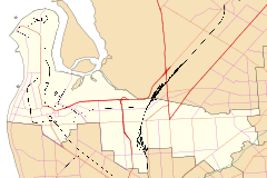
| Location |
| ||||||||||||||
| LGA(s) | City of Port Adelaide Enfield | ||||||||||||||
| State electorate(s) | Port Adelaide | ||||||||||||||
| Federal Division(s) | Port Adelaide | ||||||||||||||
| |||||||||||||||
Ottoway is an industrial suburb of Adelaide, South Australia, in the City of Port Adelaide Enfield local government area. It is around 12 km (7 mi) west-northwest of the city centre.
The suburb was laid out on section 1160, Hundred of Port Adelaide, the grant of which was in 1851 secured by one George Dale. When the land was subdivided in 1883 the surveyors and vendors Ferry, Moore & Wallmann named the suburb "Ottoway".[1] Geoff Manning, in his Place Names of South Australia, idiosyncratically gives the spelling "Ottaway", and gives as its derivation the publican Thomas Finch Ottaway (c. 1816 – 21 July 1867), who in 1853 purchased the land from George Dale.[2]
References
- ↑ "Advertising". South Australian Register. XLVIII, (11, 390). South Australia. 17 May 1883. p. 8. Retrieved 2 June 2017 – via National Library of Australia.
- ↑ Geoff Manning. "Place Names of South Australia". State Library of South Australia. Retrieved 2 June 2017.
This article is issued from
Wikipedia.
The text is licensed under Creative Commons - Attribution - Sharealike.
Additional terms may apply for the media files.