Clare and Gilbert Valleys Council
| Clare and Gilbert Valleys Council South Australia | |||||||||||||||
|---|---|---|---|---|---|---|---|---|---|---|---|---|---|---|---|
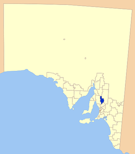 Location of Clare and Gilbert Valleys Council | |||||||||||||||
| Population | 9,023 (2016 census)[1] | ||||||||||||||
| • Density | 4.904/km2 (12.70/sq mi) | ||||||||||||||
| Established | 1997 | ||||||||||||||
| Area | 1,840 km2 (710.4 sq mi) | ||||||||||||||
| Mayor | Allan Aughey[2] | ||||||||||||||
| Council seat | Clare | ||||||||||||||
| Region | Yorke and Mid North[3] | ||||||||||||||
| State electorate(s) | Frome, Goyder | ||||||||||||||
| Federal Division(s) | Wakefield, Grey | ||||||||||||||
| Website | Clare and Gilbert Valleys Council | ||||||||||||||
| |||||||||||||||
The Clare and Gilbert Valleys Council is a local government area located in the Yorke and Mid North region of South Australia.[3] The council was founded on 1 July 1997 with the amalgamation of the District Council of Clare, the District Council of Riverton and the District Council of Saddleworth and Auburn.[4] The council seat is located at Clare; it also maintains branch offices at Riverton and Saddleworth.[5]
Geography
It includes the towns and localities of Anama, Armagh, Auburn, Barinia, Benbournie, Black Springs, Bungaree, Boconnoc Park, Clare, Emu Flat, Giles Corner, Gillentown, Hill River, Hilltown, Leasingham, Manoora, Marrabel, Mintaro, Penwortham, Polish Hill River, Rhynie, Riverton, Saddleworth, Sevenhill, Spring Farm, Spring Gully, Stanley, Stanley Flat, Steelton, Stockport, Tarlee, Tarnma, Tothill Belt, Tothill Creek, Undalya, Waterloo, Watervale and Woolshed Flat, and parts of Alma, Farrell Flat, Halbury, Hoyleton and Salter Springs.[6]
Councillors
The Clare and Gilbert Valleys Council has a directly elected mayor.[7]
| Ward | Councillor | Notes | |
|---|---|---|---|
| Mayor[2] | Allan Aughey | ||
| Deputy Mayor | Nedd Golding | ||
| Unsubdivided[2] | Leon Bruhn | [8] | |
| Ian Burfitt | |||
| Elizabeth Calvert | |||
| Lucy Drummond | |||
| Jeremy Kells | |||
| Helen Perry | |||
| Dianne Schwarz | |||
| Tim Siv | |||
See also
References
- ↑ Australian Bureau of Statistics (27 June 2017). "Clare and Gilbert Valleys (DC)". 2016 Census QuickStats. Retrieved 10 April 2018.

- 1 2 3 "Elected Members". Clare & Gilbert Valleys Council. Retrieved 1 April 2016.
- 1 2 "Yorke and Mid North SA Government region" (PDF). The Government of South Australia. Retrieved 10 October 2014.
- ↑ "Clare & Gilbert Valleys Council Profile". District Council of Clare & Gilbert Valleys. Retrieved 31 March 2016.
- ↑ "Contact Us". Clare & Gilbert Valleys Council. Retrieved 1 April 2016.
- ↑ "Location SA Map Viewer". Government of South Australia. Retrieved 1 April 2016.
- ↑ "Election Results 2014" (PDF). Local Government Association of South Australia. Retrieved 1 April 2016.
- ↑ "Clare and Gilbert Valleys Council farewells one of its own". Northern Argus. 29 March 2016. Retrieved 1 April 2016.