Gangni Upazila
| Gangni গাংনী | |
|---|---|
| Upazila | |
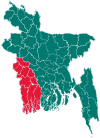
 Gangni Location in Bangladesh | |
| Coordinates: 23°49′N 88°45.3′E / 23.817°N 88.7550°ECoordinates: 23°49′N 88°45.3′E / 23.817°N 88.7550°E | |
| Country |
|
| Division | Khulna Division |
| District | Meherpur District |
| Area | |
| • Total | 341.98 km2 (132.04 sq mi) |
| Population (1991) | |
| • Total | 229,138 |
| • Density | 670/km2 (1,700/sq mi) |
| Time zone | UTC+6 (BST) |
| Website | Official Map of Gangni |
Gangni (Bengali: গাংনী) is an Upazila of Meherpur District[1] in the Division of Khulna, Bangladesh. Gangni Upazila (meherpur district) with an area 341.58 km2, is bounded by daulatpur (Kushtia) upazila on the north, alamdanga and meherpur sadar upazilas on the south, mirpur (Kushtia) upazila on the east, Meherpur Sadar upazila and West Bengal of India on the west. Main rivers are Bhairab, Kazla. Dharla and Ilangi Beels are notable.Gangni (Town) consists of 5 mouzas. It has an area of 22.86 km2. It has a population of 19126; male 51.48% and female 48.95%. Literacy rate among the town people is 28.8%.Administration Gangni thana, now an upazila, was established in 1923. It consists of 9 union parishads, 100 mouzas, 136 village, 5 border outpost.
Geography
It has 43922 households and total area 341.98 km². it also has 9 union parishad in gangni upazilla. its name billow......... মোঃ রাজু আহমেদ রিকাত। রাইপুর ইউনিয়ন ডিজিটাল সেন্টার , গাংনী, মেহেরপুর।
Demographics
At the 1991 Bangladesh census, Gangni had a population of 229,138, of whom 117,027 were aged 18 or older. Males constituted 51.05% of the population, and females 48.95%. Gangni had an average literacy rate of 21% (7+ years), against the national average of 32.4%.[2]
Arts and culture
Public library 4, rural club 10, playground 20. Main occupations Agriculture 38.19%, agricultural labourer 33.75%, wage labourer 4.43%, commerce 12.48%, construction 1%, service 2.7%, others 7.45%.Land use Cultivable land 26.545 hectare; fallow land 38 hectare; single crop 13.4%, double crop 67.5%, triple crop 19.2%; land under irrigation 54%.Land control Among the peasants, 14.29% are rich, 50.79% intermediate and 34.92% small; cultivable land per head 0.15 hectare.,
Points of interest
Shaharbati Neelkuthi (1859) and Gosaidubi Mosque at Karamdi.Marks of War of Liberation Mass grave 2 (Kazipur and Tepukhali playground)
Administration
Gangni has 9 Unions, 1 Pourasava, 103 Mauzas/Mahallas, and 136 villages.
==
Gangni Unions ===== 1. Kathuli Union Parishad 2. Tetul Baria Union Parishad 3. Kazipur Union Parishad 4. Bamundi Union Parishad 5. Motmura Union Parishad 6. Solotaka Union Parishad 7. Saharbati Union Parishad 8. Dhankhola Union Parishad 9. Raipur Union Parishad
Information by Md Razu Ahmad Rikat (Uddokta) Raipur Union Parishad UDC, Gangni, Meherpur.
মোঃ রাজু আহমেদ রিকাত (উদ্যোক্তা) ৯নং রাইপুর ইউনিয়ন ডিজিটাল সেন্টার গাংনী, মেহেরপুর।
==
Education
Old educational institutions are Hoglabaria High School and Gangni High School.
See also
References
- ↑ Rajib Ahmed (2012), "Gangni Upazila", in Sirajul Islam and Ahmed A. Jamal, Banglapedia: National Encyclopedia of Bangladesh (Second ed.), Asiatic Society of Bangladesh
- ↑ "Population Census Wing, BBS". Archived from the original on 2005-03-27. Retrieved November 10, 2006.
| Upazila/Thana: | ||
|---|---|---|