Rincon Band of Luiseño Indians
The Rincon Band of Luiseño Indians are a federally recognized tribe of Luiseño who live on the Rincon Indian Reservation in the Valley Center CDP, San Diego County, California. It is one of six such tribes in Southern California that are composed of Luiseño people.[1] The Luiseño are considered one of the groups of the California Mission Indians.
The band developed the Harrah's Resort Southern California (previously known as Harrah's Rincon Resort and Casino) that is located on the reservation, specifically in the city of Funner, California. The tribe is a member of the Indian Health Council, which runs a health clinic adjacent to the reservation.[2]
Reservation
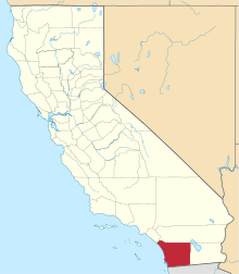
Rincon Indian Reservation lies in northeastern San Diego County, along the San Luis Rey River.[3] California State Route 76 was constructed north of the reservation. The total area of the reservation is 4,275 acres (1,730 ha).[3]
The population on the reservation is around 1,500.[3] In the 2010 census, 188 people in the Valley Center CDP (census-designated place) self-identified as Native Americans. Tribal enrollment is about 651.[3]
See also
Notes
- ↑ Indian entities recognized and eligible to receive services from the United States Bureau of Indian Affairs Archived 2012-03-06 at the Wayback Machine.: Federal Register, Volume 75, Number 190 dated October 1, 2010 (75 FR 60810)
- ↑ "Indian Health Council: Empowering Native Wellness".
- 1 2 3 4 White, Phillip. "California Indians and their reservations: an online dictionary". San Diego State University Library.
References
- Bean, Lowell J. and Shipek, Florence C. (1978) "Luiseño," in 'California,' vol. 8, ed. Robert Heizer, Handbook of North American Indians (Washington, D. C.: Smithsonian Institution): 550–563.
External links
- Rincon Band of Luiseño Indians tribal government homepage
- "Articles of Association: Covering Procedures for Administering the Affairs of the Rincon, San Luiseno Band of Mission Indians, California, February 21, 1959, as amended through 1994" (PDF). Archived (PDF) from the original on November 26, 2013.
Coordinates: 33°16′3″N 116°57′20″W / 33.26750°N 116.95556°W