Del Mar, California
| Del Mar, California | ||
|---|---|---|
| City | ||
| City of Del Mar | ||
 | ||
| ||
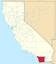
 Location of Del Mar in San Diego County, California. | ||
 Del Mar, California Location in the contiguous United States | ||
| Coordinates: 32°57′18″N 117°15′50″W / 32.95500°N 117.26389°WCoordinates: 32°57′18″N 117°15′50″W / 32.95500°N 117.26389°W | ||
| Country |
| |
| State |
| |
| County |
| |
| Incorporated | July 15, 1959[1] | |
| Government | ||
| • Mayor | Dwight Worden[2] | |
| Area[3] | ||
| • City | 1.78 sq mi (4.60 km2) | |
| • Land | 1.71 sq mi (4.42 km2) | |
| • Water | 0.07 sq mi (0.18 km2) 3.94% | |
| Elevation[4] | 112 ft (34 m) | |
| Population (2010) | ||
| • City | 4,161 | |
| • Estimate (2016)[5] | 4,365 | |
| • Density | 2,557.12/sq mi (987.43/km2) | |
| • Metro | SD-TJ: 5,105,768 | |
| Time zone | UTC-8 (PST) | |
| • Summer (DST) | UTC-7 (PDT) | |
| ZIP code | 92014 | |
| Area code(s) | 858 | |
| FIPS code | 06-18506 | |
| GNIS feature ID | 1656480 | |
| Website |
www | |

Del Mar is a beach city in San Diego County, California. Del Mar is Spanish for "of the sea" or "by the sea," which reflects its location on the coast of the Pacific Ocean. The Del Mar Horse Races are hosted on the Del Mar racetrack every summer. In 1885, Colonel Jacob Taylor purchased 338 acres (1.37 km2) from Enoch Talbert, with visions of building a seaside resort for the rich and famous.[6] The United States Navy operated a Naval Auxiliary Air Facility for blimps at Del Mar during World War II.[7] The population was estimated at 4,311 in 2014, up from 4,161 at the 2010 census.[8]
Geography and climate
According to the United States Census Bureau, the city has a total area of 1.8 square miles (4.7 km2). 1.7 square miles (4.4 km2) of it is land and 0.1 square miles (0.26 km2) of it (3.94%) is water. At the southern edge of Del Mar is the Los Peñasquitos Lagoon.
Del Mar's climate is considered mediterranean-subtropical with warm, dry summers and mild, humid winters. Temperatures exceed 85 °F (29 °C) only on a few occasions throughout the year and rarely drop below 41 °F (5 °C). The average yearly temperature in Del Mar is approximately 65 °F (18 °C).
Del Mar is also one of few locations in which the Torrey Pine tree grows. The Torrey Pine is the rarest pine in the United States and only two populations of this endangered species exist.[9] The Soledad Valley at the south of Del Mar severs two colony segments of the Pinus torreyana.
Demographics
| Historical population | |||
|---|---|---|---|
| Census | Pop. | %± | |
| 1960 | 3,124 | — | |
| 1970 | 3,956 | 26.6% | |
| 1980 | 5,017 | 26.8% | |
| 1990 | 4,860 | −3.1% | |
| 2000 | 4,389 | −9.7% | |
| 2010 | 4,161 | −5.2% | |
| Est. 2016 | 4,365 | [5] | 4.9% |
| U.S. Decennial Census[10] | |||
2010
The 2010 United States Census[11] reported that Del Mar had a population of 4,161. The population density was 2,341.9 people per square mile (904.2/km²). The racial makeup of Del Mar was 3,912 (94.0%) White, 10 (0.2%) African American, eight (0.2%) Native American, 118 (2.8%) Asian, three (0.1%) Pacific Islander, 25 (0.6%) from other races, and 85 (2.0%) from two or more races. Hispanic or Latino of any race were 175 people (4.2%).
The Census reported that 4,161 people (100% of the population) lived in households, zero (0%) lived in non-institutionalized group quarters, and zero (0%) were institutionalized.
There were 2,064 households, out of which 340 (16.5%) had children under the age of 18 living in them, 927 (44.9%) were opposite-sex married couples living together, 114 (5.5%) had a female householder with no husband present, 57 (2.8%) had a male householder with no wife present. There were 124 (6.0%) unmarried opposite-sex partnerships, and 19 (0.9%) same-sex married couples or partnerships. Seven hundred seven households (34.3%) were made up of individuals and 209 (10.1%) had someone living alone who was 65 years of age or older. The average household size was 2.02. There were 1,098 families (53.2% of all households); the average family size was 2.57.
The population was spread out with 564 people (13.6%) under the age of 18, 205 people (4.9%) aged 18 to 24, 1,071 people (25.7%) aged 25 to 44, 1,455 people (35.0%) aged 45 to 64, and 866 people (20.8%) who were 65 years of age or older. The median age was 48.6 years. For every 100 females, there were 102.1 males. For every 100 females age 18 and over, there were 101.1 males.
There were 2,596 housing units at an average density of 1,461.1 per square mile (564.1/km²), of which 1,113 (53.9%) were owner-occupied, and 951 (46.1%) were occupied by renters. The homeowner vacancy rate was 2.6%; the rental vacancy rate was 7.9%. Of the population, 2,398 people (57.6% of the population) lived in owner-occupied housing units and 1,763 people (42.4%) lived in rental housing units.
2000
As of the 2000 census,[12] there were 4,389 people, 2,178 households, and 1,083 families residing in the city. The population density was 2,559.7 inhabitants per square mile (991.0/km²). There were 2,557 housing units at an average density of 1,491.3 per square mile (577.3/km²). The racial makeup of the city was 94.1% White, 0.3% African American, 0.3% Native American, 2.9% Asian, 0.1% Pacific Islander, 0.6% from other races, and 1.71% from two or more races. Hispanic or Latino of any race were 3.9% of the population.
.jpg)

There were 2,178 households out of which 15.4% had children under the age of 18 living with them, 42.8% were married couples living together, 4.8% had a female householder with no husband present, and 50.3% were non-families. 36.6% of all households were made up of individuals and 7.4% had someone living alone who was 65 years of age or older. The average household size was 2.01 and the average family size was 2.61.
In the city, the population was spread out with 13.6% under the age of 18, 5.4% from 18 to 24, 33.1% from 25 to 44, 33.8% from 45 to 64, and 14.1% who were 65 years of age or older. The median age was 44 years. For every 100 females, there were 105.0 males. For every 100 females age 18 and over, there were 105.0 males.
The median income for a household in the city was $120,001, and the median income for a family was $130,270. Males had a median income of $81,250 versus $70,069 for females. The per capita income for the city was $92,425. About 7.8% of families and 8.7% of the population were below the poverty line, including 18.6% of those under age 18 and 8.5% of those age 65 or over.
Current estimates
According to estimates by the San Diego Association of Governments, the median household income of Del Mar in 2005 was $169,348 (not adjusted for inflation). When adjusted for inflation (1999 dollars; comparable to Census data above), the median household income was $100,982.
Government
The City of Del Mar is governed by a city council of five elected representatives. Each year a new mayor is chosen from among the councilmembers.[13]
In the California State Legislature, Del Mar is in the 39th Senate District, represented by Democrat Toni Atkins, and in the 78th Assembly District, represented by Democrat Todd Gloria.[14]
In the United States House of Representatives, Del Mar is in California's 49th congressional district, represented by Republican Darrell Issa.[15]
Del Mar has the highest property crime rate amongst cities in San Diego County[16]
Education
Del Mar is served by the Del Mar Union School District, which includes eight K-8 schools. High school education is provided by the San Dieguito Union High School District.
Transportation
In terms of public transit, North County Transit District provides their BREEZE bus service across the city limits to many destinations but there is no commuter rail stations in the city anymore. The historic Del Mar station once served passengers on the Atchison, Topeka and Santa Fe Railway Surf Line and the Amtrak San Diegan intercity service between the early 1900s until its inevitable closure in 1995, due to the opening of the new Solana Beach station two miles north. The aforementioned station provides Coaster commuter rail and Amtrak's Pacific Surfliner service, but heavy congestion at the station during races and the San Diego County Fair have persuaded the City of Del Mar and LOSSAN to build a "special events" platform near the fairgrounds. If this new platform were to be built, the City of Del Mar would (albeit for a short time) still be provided commuter rail service as before back when the historic Del Mar station was built.
Attractions

- Del Mar racetrack, held live during the summer and now the fall at the Del Mar Fairgrounds. The Fairgrounds also hosts the satellite wagering facility Surfside Race Place throughout the year when races aren't live.[17]
- The San Diego County Fair
- Torrey Pines State Beach
- Powerhouse Community Center
- Del Mar Antique Show, held three times a year for over 50 years on the Del Mar Fairgrounds
- North Beach Area (29th Street to Solana Beach border), also known as "Dog Beach".
Notable people
- Desi Arnaz maintained a residence in North Del Mar on the beach west of Highway 101 near the Del Mar Racetrack after his divorce from Lucille Ball. He was arrested once for brandishing a firearm and ordering people off of his beach area. He resided there until his death.
- Burt Bacharach, songwriter, and Angie Dickinson, actress, had a beach residence in north Del Mar near 26th street.* Gary Beck radio DJ lived on top of Del Mar Heights in the early 70's on Mission Carmel Cove.
- Drew Brees, quarterback of the New Orleans Saints.
- Rachel Buehler, defender for the United States women's national soccer team.
- Martin Cooper, conceived the first handheld mobile phone.
- Tom DeLonge, guitarist and founding member of the pop-punk band Blink-182, rock band Angels & Airwaves, and punk rock band Box Car Racer.
- Jimmy Durante, lived on the beach for many years and has a street named after him.
- Steve Fisher, former head basketball coach at San Diego State University, resident since 1999.
- Rachael Flatt, former figure skater, 2010 Olympian, 2010 US Champion, three-time US silver medalist and 2008 World Junior Champion, was born in Del Mar.
- Craig Taro Gold, author, entrepreneur and entertainer, was raised in Del Mar and attended Torrey Pines High School.
- Tony Hawk, skateboarder and business entrepreneur, was raised in Del Mar.
- Nate Kaeding, former San Diego Chargers placekicker.
- George R. Lunn, former US Congressman and Lt. Governor of New York.
- Carson Palmer, former NFL quarterback.
- Steve Perry, former lead singer of the rock band Journey, lives in Del Mar.
- Madeleine Pickens, along with her deceased husband Allen Paulson owned a home in Del Mar overlooking the Del Mar Racetrack. She currently owns a home on the beach in Del Mar.[18]
- Tristan Prettyman, singer-songwriter.
- Zandra Rhodes, celebrity fashion designer, splits her time between homes in Del Mar and London.[19]
- Anthony Robbins, self-help writer and motivational speaker, lived in "The Castle" in Del Mar.
- Aaron Rodgers, quarterback for the Green Bay Packers.
- Willie Shoemaker, jockey, lived in North Del Mar on beach west of US 101 near Del Mar Racetrack.
- Garrett Stubbs, baseball player.[20]
- Norv Turner, former head coach of the San Diego Chargers.
Cultural references
- In 1966, winners of a KHJ radio station contest rode with members of The Monkees band on a train from Del Mar, which had been renamed 'Clarksville' for the day by the town's mayor.[21]
- Del Mar's beach at 15th Street was used as a backdrop for the opening credits for ABC's Cougar Town.
- The comedy Strange Wilderness features Del Mar's Torrey Pines State Beach in the background during the group's journey south into Mexico.
- Del Mar is the first surfing location mentioned in the 1963 Beach Boys' song Surfin' U.S.A.
- Radio DJ Gary Beck lived for a couple of years in the early 70's on top of Del Mar Heights.
References
- ↑ "California Cities by Incorporation Date". California Association of Local Agency Formation Commissions. Archived from the original (Word) on November 3, 2014. Retrieved August 25, 2014.
- ↑ http://www.delmar.ca.us/. Retrieved September 15, 2018. Missing or empty
|title=(help) - ↑ "2016 U.S. Gazetteer Files". United States Census Bureau. Retrieved Jul 19, 2017.
- ↑ "Del Mar". Geographic Names Information System. United States Geological Survey. Retrieved April 9, 2015.
- 1 2 "Population and Housing Unit Estimates". Retrieved June 9, 2017.
- ↑ "Del Mar city history". Delmarhistoricalsociety.org. Archived from the original on October 27, 2008. Retrieved February 8, 2012.
- ↑ "U.S. Naval Activities World War II by State". Patrick Clancey. Retrieved March 19, 2012.
- ↑ "Annual Estimates of the Resident Population for Incorporated Places: April 1, 2010 to July 1, 2014". Retrieved June 4, 2015.
- ↑ C. Michael Hogan (2008). Torrey Pine: Pinus torreyana, Globaltwitcher, ed. Nicklas Stromberg
- ↑ "Census of Population and Housing". Census.gov. Archived from the original on May 12, 2015. Retrieved June 4, 2015.
- ↑ "2010 Census Interactive Population Search: CA - Del Mar city". U.S. Census Bureau. Retrieved July 12, 2014.
- ↑ "American FactFinder: Del Mar city, California". United States Census Bureau. Retrieved June 9, 2014.
- ↑ "City of Del Mar website". Delmar.ca.us. Retrieved February 8, 2012.
- ↑ "Statewide Database". Regents of the University of California. Retrieved April 9, 2015.
- ↑ "California's 49th Congressional District - Representatives & District Map". Civic Impulse, LLC.
- ↑ https://www.fbi.gov/about-us/cjis/ucr/crime-in-the-u.s/2012/crime-in-the-u.s.-2012/tables/8tabledatadecpdf/table-8-state-cuts/table_8_offenses_known_to_law_enforcement_by_california_by_city_2012.xls. Missing or empty
|title=(help) - ↑ http://www.equestrianmag.com/news/del-mar-fairgrounds-bradvica-equine-12-06.html
- ↑ http://rismedia.com/2007/06/01/regional-spotlight-35-million-home-sale-crushes-del-mar-record/#close
- ↑ "Fashion designer crashes car into Calif. store". Associated Press. Retrieved July 1, 2008.
- ↑
- ↑ |The Monkees rename city! (The Monkees Live Almanac, 1966 Promotional Tour). Retrieved September 29, 2016.
External links
| Wikivoyage has a travel guide for Del Mar. |
| Wikimedia Commons has media related to Del Mar, California. |
| Counties | ||
|---|---|---|
| Major city | ||
| Cities 100k - 250k | ||
| Cities and towns 20k - 99k | ||
| CDPs 20k+ | ||
| Bodies of water | ||
| Regions | ||
| Parks and Monuments | ||