Bucloc, Abra
| Bucloc | ||
|---|---|---|
| Municipality | ||
| Municipality of Bucloc | ||
| ||
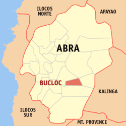 Map of Abra with Bucloc highlighted | ||
.svg.png) Bucloc Location within the Philippines | ||
| Coordinates: 17°26′N 120°52′E / 17.44°N 120.86°ECoordinates: 17°26′N 120°52′E / 17.44°N 120.86°E | ||
| Country |
| |
| Region | Cordillera Administrative Region (CAR) | |
| Province | Abra | |
| District | Lone District | |
| Barangays | 4 (see Barangays) | |
| Government [1] | ||
| • Type | Sangguniang Bayan | |
| • Mayor | Gybel B. Cardenas | |
| • Electorate | 1,895 voters (2016) | |
| Area [2] | ||
| • Total | 63.77 km2 (24.62 sq mi) | |
| Population (2015 census)[3] | ||
| • Total | 2,501 | |
| • Density | 39/km2 (100/sq mi) | |
| Time zone | UTC+8 (PST) | |
| ZIP code | 2817 | |
| PSGC | 140104000 | |
| IDD : area code | +63 (0)74 | |
| Climate type | Tropical rainforest climate | |
| Income class | 6th municipal income class | |
| Revenue (₱) | 43,918,689.76 (2016) | |
| Native languages |
Itneg language Ilocano Tagalog | |

Bucloc, officially the Municipality of Bucloc, (Ilokano: Ili ti Bucloc; Tagalog: Bayan ng Bucloc), is a 6th class municipality in the province of Abra, Philippines. According to the 2015 census, it has a population of 2,501 people.[3]
Geography
Bucloc is located at 17°26′N 120°52′E / 17.44°N 120.86°E.
According to the Philippine Statistics Authority, the municipality has a land area of 63.77 square kilometres (24.62 sq mi) [2] constituting 1.53% of the 4,165.25-square-kilometre- (1,608.21 sq mi) total area of Abra.
Barangays
Bucloc is politically subdivided into 4 barangays.[4]
| PSGC | Barangay | Population | ±% p.a. | |||
|---|---|---|---|---|---|---|
| 2015[3] | 2010[5] | |||||
| 140104001 | Ducligan | 23.3% | 582 | 437 | 5.61% | |
| 140104002 | Labaan | 27.2% | 681 | 587 | 2.87% | |
| 140104004 | Lamao (Poblacion) | 22.6% | 566 | 546 | 0.69% | |
| 140104003 | Lingay | 26.9% | 672 | 606 | 1.99% | |
| Total | 2,501 | 2,176 | 2.69% | |||
Demographics
| Population census of Bucloc | ||
|---|---|---|
| Year | Pop. | ±% p.a. |
| 1939 | 719 | — |
| 1948 | 827 | +1.57% |
| 1960 | 1,152 | +2.80% |
| 1970 | 1,401 | +1.97% |
| 1975 | 1,447 | +0.65% |
| 1980 | 1,605 | +2.09% |
| 1990 | 1,932 | +1.87% |
| 1995 | 1,919 | −0.13% |
| 2000 | 2,109 | +2.04% |
| 2007 | 2,227 | +0.75% |
| 2010 | 2,176 | −0.84% |
| 2015 | 2,501 | +2.69% |
| Source: Philippine Statistics Authority[3] [5] [6] [7] | ||
In the 2015 census, Bucloc had a population of 2,501.[3] The population density was 39 inhabitants per square kilometre (100/sq mi).
References
- ↑ "Municipality". Quezon City, Philippines: Department of the Interior and Local Government. Retrieved 31 May 2013.
- 1 2 "Province: Abra". PSGC Interactive. Quezon City, Philippines: Philippine Statistics Authority. Retrieved 12 November 2016.
- 1 2 3 4 5 Census of Population (2015). "Cordillera Administrative Region (CAR)". Total Population by Province, City, Municipality and Barangay. PSA. Retrieved 20 June 2016.
- ↑ "Municipal: Bucloc, Abra". PSGC Interactive. Quezon City, Philippines: Philippine Statistics Authority. Retrieved 8 January 2016.
- 1 2 Census of Population and Housing (2010). "Cordillera Administrative Region (CAR)". Total Population by Province, City, Municipality and Barangay. NSO. Retrieved 29 June 2016.
- ↑ Censuses of Population (1903–2007). "Cordillera Administrative Region (CAR)". Table 1. Population Enumerated in Various Censuses by Province/Highly Urbanized City: 1903 to 2007. NSO.
- ↑ "Province of Abra". Municipality Population Data. Local Water Utilities Administration Research Division. Retrieved 17 December 2016.
External links
| Wikimedia Commons has media related to Bucloc, Abra. |
Places adjacent to Bucloc, Abra | ||||||||||
|---|---|---|---|---|---|---|---|---|---|---|
| ||||||||||
Bangued (capital) | |
| Municipalities | |
| Barangays | |
This article is issued from
Wikipedia.
The text is licensed under Creative Commons - Attribution - Sharealike.
Additional terms may apply for the media files.