Haveli District
| Haveli حویلی | |
|---|---|
| District | |
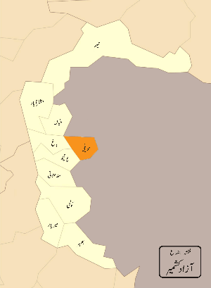 Pakistani district map shows Azad Kashmir (in white) with Haveli highlighted (in maroon). | |
| Country | Pakistan |
| Province | Azad Jammu and Kashmir |
| Headquarters | Forward Kahuta |
| Area | |
| • Total | 598 km2 (231 sq mi) |
| Population (2017) | |
| • Total | 152,124 |
| • Density | 268/km2 (690/sq mi) |
| Time zone | UTC+5 (PST) |
Haveli District is the 9th districts of Azad Jammu and Kashmir. It was separated from the Bagh District on 1 July 2009.[1] It has a population of 152,124 according to the 2017 Census.[2]
Administration
It is divided into three tehsils – Forward Kahuta, Khursheedabad and Mumtazabad. It has one municipal corporation, Forward Kahuta. There are 12UCs in Haveli district consisting of 95 villages.
Geography
Haveli is situated at a high altitude of approximately 8000 feet above sea level. Heavy snowfall occurs regularly through the year. Darra Haji Peer, Lasdana, Neel Kunth and Kalamula are the highest peaks.
Ethnic groups
People of the Haveli district are the most educated of all districts of Azad Kashmir. Gujjar, Rathor and ethnic kashmiri Khawajas are major tribes of the District Haveli. Others include Sayyed Sherazi, syed Kazmi, Bukhari, Gillani, Khan (Pathan), Niazi, Dar, Kiani, Sheikh, Mughal, Thakar, and Farooqi.
Languages
Pahari is the main language, spoken by 55% of the population, where as 25% people spoke Kashmiri language and 20% of the population speaks Gojri language .
Education
According to the Alif Ailaan Pakistan District Education Rankings 2017, Haveli is ranked 33 out of 148 districts in education. For facilities and infrastructure, the district is ranked 146 out of 148.[3] 0
References
- ↑ "District Haveli (Kahutta)". Government of Azad Jammu & Kashmir. Retrieved 6 July 2013.
- ↑ "Census 2017: AJK population rises to over 4m". The Nation. Retrieved 2017-09-01.
- ↑ "Individual district profile link, 2015". Alif Ailaan. Retrieved 2015-05-06.
Coordinates: 33°53′07″N 74°06′12″E / 33.8854°N 74.1033°E
Provincial capital: Muzaffarabad | ||
| Muzaffarabad | 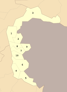 | |
| Poonch | ||
| Mirpur | ||