Sehnsa
| Sehnsa | |
|---|---|
 Sehnsa | |
| Coordinates: 33°30′49″N 73°45′20″E / 33.513650°N 73.7556233°E | |
| Country |
|
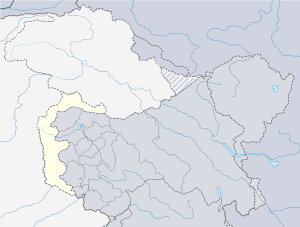
| State | Azad Kashmir |
| District | Kotli District |
| Time zone | UTC+5 (PST) |
Sehnsa is a large town in Pakistan Administered Azad Kashmir which lies on the west of Gulpur on the Kotli-Rawaplindi road. Sehnsa is a sub-divisional (Tehsil) headquarters of Kotli district in the center of Sehnsa valley.
Education
The literacy rate of this area is more than 98%.
Importance
Sehnsa has a number of shops and as a trading base, connecting the town to many other parts of Azad Kashmir as well as Pakistan. www.azadkashmir.com
2005 earthquake
On October 8, 2005 this city also felt strong shocks but no damage occurred. On the same day the NGO (Khidmat Khalq Trust) went to the affected areas of AJK. it was the first NGO to reach the Bagh district to help the affected people. This NGO remained for almost six months and helped build homes. People of Sehnsa also participated in helping.
Religion
The majority of the population are Muslim.[1]
Location
Sehnsa is on the Kotli-Rawalpindi main road Azad Kashmir. between Pounch and Jehlem rivers there is a 40 kilometers long vall
Geography and climate
Sehnsa is a small city and sub-divisional headquarters in the District Kotli in Azad Kashmir. Sehnsa is connected to many other parts of Azad Kashmir as well as Pakistan. It is located at a lower level in the valley.
Sehnsa lies on the Kotli-Rawalpindi road, just before Holar (the boundary point between Azad Kashmir and Pakistan). Sehnsa is a sub-divisional (Tehsil) headquarters of Kotli district in the center of Sehnsa valley. It is 35 km from Kotli. Nearby is the scenic Bruhian surrounded by Chir forests and natural beauty. Sehnsa is positioned at a lower level to that of the surrounding area at a range of 35 km from Kotli. There are nearby forests, and a mild climate, aided by the range of the area. There is a village, named Piahi, next to the main bazaar of Sehensa. There are many plane areas in this region of which one is Bharand. For away from the Potha bazar with the side of jungle there is an old fort of British times. Now the constructive condition of this first is quite affected by weather but still it is a part of Sehnsa History.
The Sehnsa Valley is surrounded by the mountains and seems like a Cup from areal view. In winters the whole Sehnsa Valley is covered with fog and the surroundings hills present an imaginary view because of glittering water flowing down from their tops. Nearby is the scenic area of Bruhian surrounded by Chir (pine) forests. Around bruhian there are langoors [monkeys] peacocks and natives of this area who stick to their traditions as practiced centuries ago. Atkora is one of the largest village of Tehsil Sehnsa. The main feature of this village is; it is surrounded by mountains . Nawan Sharif is a valley of Tehsil Sehnsa. In the middle of the valley there is a Shrine of Hazrat Baba Sheikh Choor Badshah. Thousands of people visit this shrine on every Thursday and during weekdays in every month from Sehnsa, Kotli, Dadyal and in different areas of Distt Suddunhoti and Rawalpindi. The village dharyar(Terhiar)is situated on east bank of river Jehlum on border of neighbouring of Pakistan this is big village. This is on a top hill where some can view Gulpur and Sehnsa town where Lt. Sardar Baro Khan shaheed started freedom fight against Dogra regime in pre-independence South Asia.
Language
The common language is Pahari Hindko an Indo-Asian(ہند کو پہاڑی) language which differs to an extent from Urdu, the national language of Pakistan.
Tribes
There are many tribes in Sehnsa named, Gujjar, Syed, Sudduzai, Janjua, Rajput, Choudary, Jaat, Awan, Mughals, Malik Awan, etc
References
- ↑ "AJ&K Portal". www.ajk.gov.pk. Retrieved 2017-05-08.
External links
| Mirpur |
| ||||||||
|---|---|---|---|---|---|---|---|---|---|
| Muzaffarabad |
| ||||||||
| Poonch |
| ||||||||