Belgaum district
| Belgaum district | |
|---|---|
| district | |
| Belagavi district | |
 Gokak Falls in Belgaum district | |
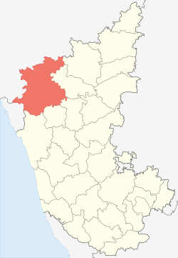 Location in Karnataka, India | |
| Coordinates: 15°51′N 74°33′E / 15.85°N 74.55°ECoordinates: 15°51′N 74°33′E / 15.85°N 74.55°E | |
| Country |
|
| Region | North Karnataka |
| Division | Belgaum division |
| Headquarters | Belgaum |
| Area[1] | |
| • Total | 13,415 km2 (5,180 sq mi) |
| Population (2011)[1] | |
| • Total | 4,778,439 |
| • Density | 360/km2 (920/sq mi) |
| Languages | |
| • Official | Kannada |
| • Other | Marathi |
| Time zone | UTC+5:30 (IST) |
| ISO 3166 code | IN-KA |
| Vehicle registration |
|
| Sex ratio | 1.04 ♂/♀ |
| Literacy | 64.2% |
| Precipitation | 823 millimetres (32.4 in) |
| Website |
belgaum |
Belgaum is a district in the state of Karnataka, India. The city of Belgaum is the district headquarters in North Karnataka. it houses the second legislative building, where the Karnataka Legislature will meet once a year. According to the 2011 Census of India, it has a population of 4,778,439 of which 24.03% live in urban areas,[2] making it the second most populous district in Karnataka (out of 30), after Bangalore.[3] The district has an area of 13,415 square kilometers, and is bounded on the west and north by Maharashtra state, on the northeast by Bijapur District, on the east by Bagalkote District, on the southeast by Gadaga District, on the south by Dharawad District and Uttara Kannada districts, and on the southwest by the state of Goa.
History
Belgaum is the Divisional Headquarters of North Karnataka The ancient name of the town of Belgaum was Venugrama, meaning Bamboo Village. It is also called as Malnad Pradesh. The most ancient place in the district is Halsi; and this, according to inscriptions on copper plates discovered in its neighborhood, was once the capital of a dynasty of nine Kadamba kings. It appears that from the middle of the 6th century to about 760 the area was held by the Chalukyas, who were succeeded by the Rashtrakutas. After the break-up of the Rashtrakuta power a portion of it survived in the Rattas (875–1250), who from 1210 onward made Venugrama their capital. Inscriptions give evidence of a long struggle between the Rattas and the Kadambas of Goa, who succeeded in the latter years of the 12th century in acquiring and holding part of the district. By 1208, however, the Kadambas had been overthrown by the Rattas, who in their turn succumbed to the Yadavas of Devagiri in 1250. After the overthrow of the Yadavas by the Delhi Sultanate (1320), Belgaum was for a short time under the rule of the latter; but only a few years later the part south of the Ghataprabha River was subject to the Hindu rajas of Vijayanagara. In 1347 the northern part was conquered by the Bahmani Sultanate, which in 1473 took the town of Belgaum and conquered the southern part also. When Aurangzeb overthrew the Bijapura sultans in 1686, Belgaum passed to the Mughals. In 1776 the country was overrun by Hyder Ali of Mysore, but was taken by the Madhavrao Peshwa with British assistance. In 1818 it was handed over to the British East India Company, and was made part of the district of Dharwar. In 1836 this was divided into two parts, the northern district becoming Belgaum.[4]
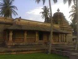
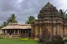
Yadur is situated beside Krishna river, there is famous veerbhadra temple. Many devotees visit this place from Karnataka and Maharashtra. Hooli is one of the oldest villages in Belgaum district. There are many Chalukya temples in the village and the 'Panchaligeswara temple is very famous.
Kittur in Belgaum district is a place of historical importance. Rani Chennamma of Kittur (1778–1829) is known for her resistance to British rule.
The British had a sizable infantry post here, having realised the military importance of its geographic location. It is one of the reasons for Belgaum's sobriquet The Cradle of Infantry. Development of a rail network for the movement of resources and later troops was one of the means employed by both the British East India Company and the British to exert control over India. Belgaum's railway station, the Mahatma Gandhi Railway Station was established by the British. A signboard declaring the sobriquet can be seen hung on Platform 1 at the station.
Border dispute
Belgaum district was incorporated into the newly formed Mysore state (now Karnataka) with the passage of the States Reorganisation Act (1956), which reorganized India's states along linguistic lines since the majority of the people in the district spoke Kannada. Because of that linguistic disparity, the case is now in the Supreme Court of India.
Administrative divisions
Administration of Belgaum District has been divided into 14 taluks. Athani taluk is the largest with an area of 1,997.70 km2 and Raybag taluk is the smallest with an area of 958.8 km2. The district comprises three revenue sub-divisions and six police sub-divisions. Apart from the Belgaum City Corporation, there are 17 municipalities, 20 towns, 485 gram panchayats, 1,138 inhabited villages and 26 non-inhabited villages. Belgaum is also the headquarters of the Belgaum Revenue Division.
Demographics
According to the 2011 census Belgaum district has a population of 4,778,439,[3] roughly equal to the nation of Singapore[5] or the US state of Alabama.[6] This gives it a ranking of 25th in India (out of a total of 640).[3] The district has a population density of 356 inhabitants per square kilometre (920/sq mi) .[3] Its population growth rate over the decade 2001–2011 was 13.38%.[3] Belgaum has a sex ratio of 969 females for every 1000 males,[3] and a literacy rate of 73.94%.[3]
Notable People
- S. Ballesh - Shehnai artist
- Hemant Birje - Actor
- Phadeppa Dareppa Chaugule - India's first Olympic marathon runner
- Kittur Chennamma - Indian freedom fighter
- Shirasangi Lingaraj Desai - Provincial ruler
- Kumar Gandharva - Indian classical singer
- Balappa Hukkeri- Singer
- Kaka Kalelkar (1885–1981) - Indian independence activist
- Chandrashekhara Kambara - Poet
- Atul Kulkarni - Actor
- Belawadi Mallamma - Warrior queen
- Ronit More - Cricketer plays for Chennai Super Kings
- Renukamma Murugodu - Actress
- Bandu Patil- Indian hockey player
- Sangolli Rayanna - Indian Freedom fighter
- Acharya Vidyasagar - Jain Digambara monk
References
- 1 2 "2001 Census". Official Website of Belgaum District. Archived from the original on 21 July 2011. Retrieved 4 January 2011.
- ↑ "Archived copy". Archived from the original on 11 January 2010. Retrieved 2009-08-27.
- 1 2 3 4 5 6 7 "District Census 2011". Census2011.co.in. 2011. Retrieved 2011-09-30.
- ↑

- ↑ US Directorate of Intelligence. "Country Comparison:Population". Retrieved 2011-10-01.
Singapore 4,740,737 July 2011 est.
- ↑ "2010 Resident Population Data". U. S. Census Bureau. Archived from the original on 19 October 2013. Retrieved 2011-09-30.
Alabama 4,779,736
External links
| Wikimedia Commons has media related to Belgaum district. |