Ramdurg
| Ramdurg Ramadurga | |
|---|---|
| town | |
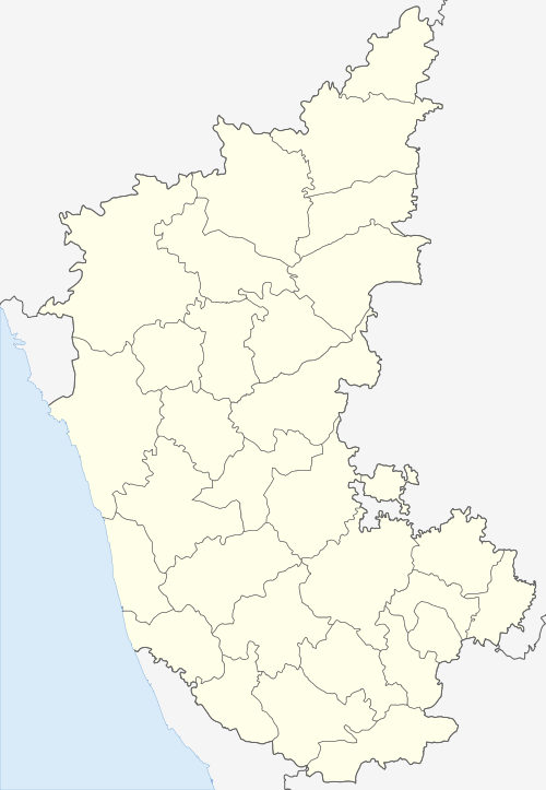
 Ramdurg Location in Karnataka, India | |
| Coordinates: 15°57′N 75°18′E / 15.95°N 75.3°ECoordinates: 15°57′N 75°18′E / 15.95°N 75.3°E | |
| Country | India |
| State | Karnataka |
| District | Belgaum district |
| Founded | 1799 (219-220 years ago ) |
| Founded by | Princely State of British India |
| Named for | Ram |
| Area | |
| • Total | 3.57 km2 (1.38 sq mi) |
| Elevation | 570 m (1,870 ft) |
| Population (2011) | |
| • Total | 39,841 |
| • Density | 8,915.97/km2 (23,092.3/sq mi) |
| Languages | |
| • Official | Kannada |
| Time zone | UTC+5:30 (IST) |
| PIN | 591 123 |
| Telephone code | 083352 |
| Website | www.ramdurgatown.mrc.gov.in |
Ramdurg (Ramadurga) is a town in Belgaum district in the Indian state of Karnataka. The name of the town derives from Rama, as it is believed that Rama, a Hindu god, lived in this location during his exile.
History
The royal state of Ramdurg, founded in 1799, was one of the non-salute princely states of British India under the Bombay Presidency and later the Deccan States Agency. The Konkanasth dynasty area measures 438 square kilometres (169 sq mi). According to the 1901 census, the population was 37,848.[1] Ramdurg acceded to the Dominion of India on 8 March 1948, and is currently part of Karnataka state.
Location
Ramdurg is known for its hills, sugar factories, river and trekking. There are many important places near Ramdurg, such as Shabari Kolla, Godachi, Navilu Teerth, Hoovina Kolla, Sunnal Hanumappa, Megundappan Kolla, Ramdurg Forts and Toragal Forts. Almost all villages that come under Ramdurg talluk are historic places.
Demographics
According to the national census, the town had a population of 29,651 in 1991, rising to 36,649 in 2001 and declining to 34,800 in 2011. The population is virtually equal between males and females.[2] The town is considered 100% urban.[3]
The unemployment rate is 60%, well above the national average of 3.46%.[4] There is 37.5% "usually employed", 4.6% "casually employed" and 57.9% not employed.[5] These terms describing levels of employment are from the Indian census process.
The 2011 census indicated a relatively high literacy rate. Although there are different numbers with a declining trend, the official census in 2011 reported that 81.8% of the local residents were literate.[6]
Culture
Godachi Fair at Godachi, 16 km (9.9 mi) from Ramdurg, is a major fair of the district held in December, attracting people from Siddu Khanpeth, Torgal, Halolli, Sunnal, Budnur, Batakurki, Halgatti, Sureban, Katkol, Chandaragi, Salahalli, Obalapura and Mudkavi.
Moharm festival is held at Yarikittur village.
3 kilometres (1.9 mi) away is Sureban and Manihal, a rich holy place which is a popular tourist destination. There are several temples including:
- Shree Shabhari Deevi – located in a dense forest with dramatic changes during the seasons. There is a belief that Shabari was waiting for Rama in this place.
- Shree Atmananda Aasharma
- Shree Shivananda Hill (Betta)
- Shree Manageramma Hill
- Shree Falahaareswara Temple
- Ramatirtha
Sureban is also amongst the few places in India were "ChithaBasma of Father of Nation Mahathma Gandhiji" has been kept.
Sunnal is a small village near Ramdurg, which is 5 km (3.1 mi) from Ramdurg on Belgavi road. This village is the location of a Maruthi Temple, popularly known as "Sunnal Hanumappa", which has an idol of Lord Hanuman from ancient times. It is believed by thousands of devotees that by praying to Lord Hanuman at Sunnal, one will be blessed twice by the lord Hanuman as his idol is seen by the devotees by both eyes. The stretch of forest along Sunnal and Halloli has bears known as "Sunnal Karadi" or "Sunnal Kaddi" in Kannada.
Hospitals
Hospitals within Ramdurg include: Apte Hospital, Bilagi Hospital, Government Hospital, Kulgod Multispeciality Hospital, Kulkarni Hospital, Dhoot Hospital, Agadi Hospital, Kanbur Hospital, Kambi Hospital, Patavardan Hospital, Guru Hospital, Pavate Hospital, and Gunda Pediatric Hospital.
Transport
The closest airports are Hubli Airport and Belgaum Airport at distances of 77 and 98 km (48 and 61 mi).
The closest railway stations are Bagalkot railway station and Hubli-Dharwad railway station at distances of 40 and 90 km (25 and 56 mi).
The closest cities in the district are Dharwad, Hubli, Belgaum, and Bagalkot, at distances of 70–100 km (43–62 mi).
The KSRTC bus facility connects to major cities of Karnataka and also Pune, Aurungabad, Tuljapur and south Maharashtra.
VRL Logistics provides private bus services from Ramdurg to Bangalore via Hubli.
Education
Schools within Ramdurg include: C.D. Hallyal High School, Taluka Anjuman High School, Government Urdu High School, Pragati Vidyalaya, Samarpana vdyapeetha, Government Boys and Girls School, Vidya Prasark Samiti school, Basaveshawar High School, Cambridge English Medium School, C.S. Bembalagi Science College, Smt. I.S. Yadawad Govt. First Grade College, Govt. P.U. College, Smt. Nagamma Kulgod Para Medical Sciences. Many more schools exist within Ramdurg.
Banks
Many banks are present in Ramdurg, such as State Bank of India, Krantiveera Sangolli Rayanna Co-operative Bank, Union Bank of India, ICICI Bank, IDFC Bank, Syndicate Bank, KVG Bank, Raddi Co-operative Bank, etc.
References
- ↑ "Imperial Gazetteer of India, v. 21, p. 172. "Rāmdurg State"".
- ↑ citypopulation.de/php/india-karnataka.php?adm2id=2901
- ↑ citypopulation.de/php/india-karnataka.php?adm2id=2901
- ↑ tradingeconomics.com/india/unemployment-rate
- ↑ citypopulation.de/php/india-karnataka.php?adm2id=2901
- ↑ citypopulation.de/php/india-karnataka.php?adm2id=2901