Beillé
| Beillé | |
|---|---|
| Commune | |
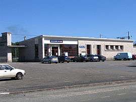 The railway station | |
 Beillé Location within Pays de la Loire region  Beillé | |
| Coordinates: 48°04′58″N 0°30′49″E / 48.0828°N 0.5136°ECoordinates: 48°04′58″N 0°30′49″E / 48.0828°N 0.5136°E | |
| Country | France |
| Region | Pays de la Loire |
| Department | Sarthe |
| Arrondissement | Mamers |
| Canton | La Ferté-Bernard |
| Intercommunality | Communauté de communes du Pays de l'Huisne Sarthoise |
| Government | |
| • Mayor (2008–2014) | René Ganier |
| Area1 | 8 km2 (3 sq mi) |
| Population (2006 [1])2 | 490 |
| • Density | 61/km2 (160/sq mi) |
| Demonym(s) | Beilléen, Beilléenne |
| Time zone | UTC+1 (CET) |
| • Summer (DST) | UTC+2 (CEST) |
| INSEE/Postal code | 72031 /72160 |
|
1 French Land Register data, which excludes lakes, ponds, glaciers > 1 km2 (0.386 sq mi or 247 acres) and river estuaries. 2 Population without double counting: residents of multiple communes (e.g., students and military personnel) only counted once. | |
Beillé is a commune in the Sarthe department in the region of Pays-de-la-Loire in north-western France.
See also
References
- ↑ http://www.insee.fr/fr/ppp/bases-de-donnees/recensement/populations-legales/departement.asp?dep=72#dep_B Populations légales 2006 publiées par l’INSEE le 1er janvier 2009
| Wikimedia Commons has media related to Beillé. |
This article is issued from
Wikipedia.
The text is licensed under Creative Commons - Attribution - Sharealike.
Additional terms may apply for the media files.