Banten
| Banten | |||
|---|---|---|---|
| Province | |||
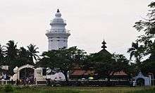
 From left to right, top to bottom: Soekarno-Hatta International Airport, Great Mosque of Banten, Carita Beach, Tanjung Lesung, Ujung Kulon National Park, Sawarna Tourism Village, Port of Merak, Baduy People Villages | |||
| |||
|
Motto(s): Iman Taqwa (Faith and Piety) | |||
 Location of Banten in Indonesia | |||
| Coordinates: 6°30′S 106°15′E / 6.500°S 106.250°ECoordinates: 6°30′S 106°15′E / 6.500°S 106.250°E | |||
| Country |
| ||
| Capital |
| ||
| Largest city |
| ||
| Established | October 4, 2000 | ||
| Government | |||
| • Body | Banten Regional Government | ||
| • Governor | Wahidin Halim [1] (Demokrat) | ||
| • Vice Governor | Andika Hazrumy | ||
| Area | |||
| • Total | 9,662.92 km2 (3,730.87 sq mi) | ||
| Population (2017)[2] | |||
| • Total | 12,448,200 | ||
| • Rank | 5th | ||
| • Density | 1,300/km2 (3,300/sq mi) | ||
| Demographics | |||
| • Ethnic groups | Bantenese (47%), Sundanese (23%), Javanese (12%), Betawi (10%), Chinese (5%)[3] | ||
| • Religion | Islam (91.64%), Christian (4.4%), Buddhism (1.2%), Confucianism (0.03%), Hindu (0.05%) | ||
| • Languages |
Indonesian (official) Sundanese (lingua franca) Javanese (regional) Hakka Betawi Bantenese (native) Baduy | ||
| Time zone | UTC+7 (Indonesia Western Time) | ||
| Postcodes | 15xxx (Tangerang), 42xxx (non-Tangerang) | ||
| Area codes | (62)25x (non-Tangerang), (62)21 (Tangerang) | ||
| ISO 3166 code | ID-BT | ||
| Vehicle registration | A (non-Tangerang), B (Tangerang) | ||
| GRP per capita | US$ 3,114 | ||
| GRP rank | 14th | ||
| HDI |
| ||
| HDI rank | 8th | ||
| Police |
Polda Banten (non-Tangerang) Polda Metro Jaya (Tangerang) | ||
| Largest city by area | Serang - 266.71 square kilometres (102.98 sq mi) | ||
| Largest city by population | Tangerang - (1,798,601 - 2010) | ||
| Largest regency by area | Lebak Regency - 3,426.56 square kilometres (1,323.00 sq mi) | ||
| Largest regency by population | Tangerang Regency - (2,781,428 - 2010) | ||
| Website | Government official site | ||


Banten is the westernmost province on the island of Java, in Indonesia. Its provincial capital city is Serang.
The population of Banten was officially estimated at 11,834,087 at the start of 2014, up from over 10.6 million during the 2010 census.[4] Formerly part of the province of West Java, Banten became a separate province in 2000. The province is a transit corridor to the neighbouring Indonesian island of Sumatra.
Historically, it has had a culture distinct from the rest of Java and that of the broader Indonesian archipelago. In recent years, the northern half, particularly those areas near Jakarta and the Java Sea coast, have experienced rapid rises in population and urbanization, while the southern half, particularly that facing the Indian Ocean, maintains more of its traditional character.
History

In the 5th century, Banten was part of the Kingdom of Tarumanagara. The Lebak relic inscriptions, found in lowland villages on the edge of Ci Danghiyang, Munjul, Pandeglang, Banten, were discovered in 1947 and contains 2 lines of poetry with Pallawa script and Sanskrit language. The inscriptions speak of the courage of king Purnawarman. After the collapse of the Tarumanagara kingdom, due to an attack by Srivijaya, power in the western Java fell to the Kingdom of Sunda. The Chinese source, Chu-fan-chi, written circa 1225, Chou Ju-kua mentioned that in the early 13th Century, Srivijaya still ruled Sumatra, the Malay peninsula, and western Java (Sunda). The source identifies the port of Sunda as strategic and thriving, pepper from Sunda being among the best in quality. The people worked in agriculture and their houses were built on wooden poles (rumah panggung). However, robbers and thieves plagued the country.[5] It was highly possible that the port of Sunda mentioned by Chou Ju-kua was probably refer to the port of Banten.
According to the Portuguese explorer, Tome Pires, in the early 16th century the port of Bantam (Banten) was an important port within the Kingdom of Sunda along with the ports of Pontang, Cheguide (Cigede), Tangaram (Tangerang), Calapa (Sunda Kelapa) and Chimanuk (estuarine of Cimanuk river).[6]
Sultanate of Banten
In 1527, just as the Portuguese fleet was arriving off the coast, newly converted Javanese Muslims under Sunan Gunungjati captured the port of Banten and the surrounding area from the Sundanese leaders and established the Sultanate of Banten. The center of this sultanate, according to J. de Barros, was Banten which was a major port in Southeast Asia rivaling Malacca and Makassar. The city of Banten was located in middle of the bay which is around three miles across. The city was 850 fathoms in length while the seaside town was 400 fathoms in length. Through the middle of town there was a clear river which ships and gale junks could sail into. There is a small tributary of the river extending to the edges of the town. Today, the river is not so large and only small boats can enter. There was a fortress very near to the town whose walls were made of brick and was seven palms wide. There were wooden defense buildings consisting of two levels and armed with good weapons. The middle of the town square was used for military activities and folk art, and as a market in the morning. The king's palace was located on the southern side of the square. Beside the building was an elevated and flat-roofed, called Srimanganti, which was used by the king when meeting the people. To the west of the square was a great mosque.
In the early 17th century, Banten was an important commercial center on international trade routes in Asia. At the time, the administration and governance of port were very supportive of economic growth. Its territory included the area which is now the province of Lampung in southern Sumatra.
When the Dutch arrived in Indonesia the Portuguese had long been in Banten. The English established a representative site in Banten, a "factory", and were followed by the Dutch. In addition, the French and Danes also came to trade in Banten. In the ensuring competition between the European traders, the Dutch emerged as the winners. The Portuguese fled Banten in (1601) after their fleet was destroyed by the Dutch fleet off the coast of Banten. While the coastal areas of Banten came under Dutch influence, the sultanate kept control over the inland region until 1813. In that year, the sultanate was abolished and transformed into a residency of the Dutch East Indies.[7]
Province of Banten
After Indonesia became independent, Banten was absorbed into the province of West Java. However, separatist sentiment ultimately led to the creation of the province of Banten in 2000.[7]
Geography
Banten lies between 5°7'50" and 7°1'11" south latitude and 105°1'11" and 106°7'12" east longitude.[8] The province has an area of 9,662.92 km².[9]
Banten is located near the Sunda Strait's strategic sea lanes that link Australia and New Zealand with Southeast Asia, for example Thailand, Malaysia, and Singapore. In addition, Banten is the link between Java and Sumatra. When linked to the geographical position, and then the government of Banten, especially highways Tangerang (Tangerang City, Tangerang and South Tangerang City) is a buffer area for Jakarta. Economically Banten region has many industries. Banten Province also had some sea port developed in anticipation to capture the excess capacity of the seaport in Jakarta, and is intended to be an alternative to the port of Singapore.
Located on the western tip of Java makes Banten as the gateway to Java and Sumatra and the adjacent areas of Jakarta which is the capital of the State. Geostrategic position is certainly cause Banten as the main liaison trade lanes Sumatra - Java even as part of a circulation of Asian and international trade as well as the location of agglomeration economies and potential settlements. Limit northern region bordering the Java Sea, west of the Sunda Strait, as well as in the southern part of the Indian Ocean, so the area has a potential marine resources.
Topography
The topography of Banten province at an altitude ranging from 0–1000 m asl. In general topography Banten Province is low land which ranges between 0–200 m above sea level, located in the city of Cilegon, Tangerang City, Pandeglang, and most of the Serang District. The Central Lebak and Pandeglang fraction has a height ranging from 201–2000 m asl and East Lebak area has an altitude 501–2000 m asl located at the summit of Mount Sanggabuana and Mount Halimun.
The topography of a region associated with the surface expression shape or morphology region. Morphology Banten region is generally divided into three groups: the morphology of the plains, hills sloping to moderate (low-medium wavy) and steep hills.
Lowland Morphology are generally found in the northern and southern portion. Plains region is a region which has a height of less than 50 meters asl (above sea level) to the coastal areas which have a height of 0–1 m above sea level. Low Hills Morphology - Medium largely occupied the central part of the study area. Hilly region located in areas that have a minimum height of 50 m above sea level. In the north of the city of Cilegon contained the peak of Mount Gede area that has the level of a maximum of 553 m above sea level, while there are hills in Serang District and the southern region of the District Mancak Waringin Kurung and Pandeglang Regency hilly areas are in the south. In Lebak there are hills in the east bordering Bogor and Sukabumi to the characteristics of lithology lithologic unit occupied by the old sediments intruded by igneous rocks in igneous rocks such as granite, granodiorite, diorite and andesite. Usually the area around the igneous rocks occur terobosaan remineralization process containing a very economical value such as tin and copper ore deposits.
Climate
Climate in the Banten region is strongly influenced by Monsoon wind and La Nina or El Nino Wave . When the rainy season (November - March) the weather is dominated by the West wind (of Sumatra, the Indian Ocean south of India) are joined by winds from Asia passing through the South China Sea. August), the weather is dominated by the East wind which causes Banten harsh drought, especially in the northern part of the coast, especially when ongoing El Nino. Temperatures in coastal areas and hills ranging between 22 °C and 32 °C, while the temperature in the mountains with an altitude of between 400 –1350 m above sea level at between 18 °C -29 °C.
The highest rainfall of 2712–3670 mm in the rainy season months of September to May cover 50% area of Pandeglang west and rainfall 335–453 mm in the month from September to May cover 50% area of Serang Regency North, the entire area of the city of Cilegon, 50% area of Tangerang regency north and the entire area of the city of Tangerang. In the dry season, the highest rainfall of 615–833 mm in April–December cover 50% area of Serang Regency north, the whole area of the city of Cilegon, 50% area of Tangerang District north and the entire area of the city of Tangerang, while the bulk the lowest rainfall in the dry season as much as 360–486 mm in the month of June to September 50% coverage area of Tangerang Regency south and 15% area of southeastern Serang District.
Hydrology
Potential water resources in the province of Banten are found in Lebak Regency, because most of the area is a protected forest area and limited production forest.
Based on the division of Watershed (DAS), Banten Province is divided into six watersheds, namely:
- Ujung Kulon watershed, covering the western part of Pandeglang regency (Taman Uional of Ujung Kulon and surrounding areas);
- Cibaliung-Cibareno watershed, covering the southern part of Pandeglang District and the southern part of Lebak District;
- Ciujung-Cidurian watershed, covering the western part of Pandeglang District;
- Rawadano watershed, covering most of Serang District and Pandeglang District;
- Teluklada watershed, covering the western part of Serang Regency and Cilegon City;
- Cisadane-Ciliwung watershed, covering the Eastern part of Tangerang Regency and Tangerang City.
Surface waterworks for the province of Banten are highly dependent on water resources, especially underground water resources. There are 5 identifiable basins of underground water basin (CABT) that are cross-district and city, including Labuan watershed, Rawadano watershed and Malingping watershed and cross province, covering Serang - Tangerang watershed and Jakarta watershed.
Geology
The geological structure of the Banten area consists of rock formations with a thickness level of each formation ranging from 200 to 800 meters and the overall thickness is estimated to exceed 3,500 meters. The Bojongmanic Formation is the oldest unit of the late Miocene, its rock consisting of an intermediate between sandstone and clay of lime, limestone, tuffstone, conglomerate and andesite breccia, its age presumably the early Pliocene. Next is the Cipacar Formation which consists of tumble floating tuffs with tuff clay, conglomerate and glauconite napal, its age is estimated to be the final Pliocene. Above this formation is the Bojong Formation consisting of the sandstone, clay, cocina and tuff.
The southern part of Banten consists of sedimentary rocks, volcanic rocks, breakthrough rocks and alluviums from the early Miocene to Resen, the oldest of which is the Eocene Bayah Formation.
Bayah Formation consists of three members namely Conglomerate Members, Lempung Batu and Batu Gamping. Next are Cicaruruep Formation, Cijengkol Formation, Citarate Formation, Cimapang Formation, Sareweh Formation, Bedouin Formation, Cimancuri Formation and Cikotok Formation.
Volcanic rocks can be grouped in volcanic rocks old and young aged Plistosen Old to Holocene. The breakthrough rocks found are arranged andesiot to the basalt. Tuf Cikasungka is Plistocene, Lava Halimun and Quaternary volcano rocks. On the map sheet Leuwidamar presented also metamorphic rock outcrops that allegedly aged Ologo Miocene consists of Sekis, Genes and Amphibolite exposed in the northern part of the body Granodiorit Cihara. Doriter Quartz middle Miocene to the end, Dasit and Andesite end of Miocene and Basal quarter.
The youngest sedimentary rocks are aluium and coastal sediments in the form of gravel, sand, clay, rombakan limestone, coral mixed with molluscs or shellfish shells, beach and coastal slash reefs.
Administrative divisions
Banten Province is subdivided into four regencies (kabupaten) and four autonomous cities (kota), listed below with their populations at the 2000 and 2010 Censuses, together with the latest (2014) official estimates. The cities and regencies are additionally subdivided into 140 districts, 262 urban villages and 1,242 villages.
| Name | Capital | Area (km2) | Population Census 2000 | Population Census 2010 | Population 2014 Estimate[10] | HDI[11] 2014 Estimates |
|---|---|---|---|---|---|---|
| Cilegon (city) | 175.51 | 294,936 | 374,559 | 416,901 | 0.715 (High) | |
| Serang (city) | 266.71 | (a) | 577,785 | 643,101 | 0.702 (High) | |
| Lebak Regency | Rangkasbitung | 3,426.56 | 1,030,040 | 1,204,095 | 1,340,213 | 0.616 (Medium) |
| Pandeglang Regency | Pandeglang | 2,746.89 | 1,011,788 | 1,149,610 | 1,279,569 | 0.620 (Medium) |
| Serang Regency | Ciruas | 1,734.28 | 1,652,763 | 1,402,818 | 1,561,401 | 0.639 (Medium) |
| Western Banten totals (outside Jabodetabek) | 8,349.95 | 3,989,527 | 4,708,867 | 5,241,185 | ||
| South Tangerang (city) | 147.19 | (b) | 1,290,322 | 1,436,187 | 0.791 (High) | |
| Tangerang (city) | 153.93 | 1,325,854 | 1,798,601 | 2,001,925 | 0.758 (High) | |
| Tangerang Regency | Tigaraksa | 1,011.86 | 2,781,428 | 2,834,376 | 3,154,790 | 0.695 (Medium) |
| Eastern Banten totals (within Jabodetabek) | 1,312.98 | 4,107,282 | 5,923,299 | 6,592,902 | ||
| Banten totals | 9,662.93 | 8,096,809 | 10,632,166 | 11,834,087 | 0.698 (Medium) | |
- (a) The 2000 Census population for Serang city is included in the figure for Serang Regency.
- (b) The 2000 Census population for South Tangerang city is included in the figure for Tangerang Regency.
Notes:
- Tangerang City was incorporated as an autonomous city on 27 February 1993 out of the Tangerang Regency, in which it previously served as administrative capital. It was subsequently replaced by Cipasera (see below).
- Cilegon City was incorporated as an autonomous city on 10 April 1999 out of the Serang Regency, in which it previously served as administrative capital. It was subsequently replaced by Serang (see below).
- Serang City was incorporated as an autonomous city in November 2007 out of the Serang Regency, in which it previously served as administrative capital. It was subsequently replaced by Ciruas.
- South Tangerang City (formerly Cipasera) was incorporated as an autonomous city on 29 October 2008 out of the Tangerang Regency. in which it previously served as administrative capital. It was subsequently replaced by Tigaraksa.
Culture and values
Religion
Most people in Banten embrace Islam with religious fervor is high, but other religions can coexist peacefully.
Potential community and cultural distinctiveness of Banten, among other martial art Pencak Silat, Debus, Rudad, Umbruk, Saman Dance, Mask Dance, Dance Cokek, Dog-dog, Palingtung, and Lojor. In addition, there is also a relic of the heritage include Great Mosque of Banten Lama, Makam Keramat Lama, and many other relics.
In Banten lives the Baduy people. The Baduy are the original Sundanese people who still maintain the tradition of anti-modernization, both how to dress or other living patterns. The Baduy-Rawayan living in the Kendeng Mountains Heritage area of 5101.85 hectares in Kanekes, Leuwidamar subdistrict, Lebak. Baduy villages are generally located in the Ciujung River basin on Kendeng Mountains. This area is known as the area of land inherited from ancestors, which must be maintained, and should not be tampered with.
Languages
The natives who live in Banten Province speak a dialect which is derived from the Old Sundanese language. Dialect is classified as coarse language in modern Sundanese language, which has several levels of the level of fine to coarse level (informal), which was first created in the Sultanate of Mataram occupied Priangan (the eastern part of West Java province). However, in the southern part of Banten such as Lebak and Pandeglang, the local people use of Archaic Sundanese, Modern Sundanese, and Indonesian.; While in the northern part of Banten such as Serang and Cilegon, the local people tend to use the Javanese language as there are many Javanese migrants there. In the northern part of the city of Tangerang, Betawi is also used by Betawi immigrants. In addition to the Sundanese, Javanese and Betawi, Indonesian also used primarily by migrants from other parts of Indonesia.
Traditional weapon
Golok is the traditional weapon in Banten which is the same as the traditional weapon of the Special Capital Region of Jakarta.
Traditional house
The traditional house in Banten called Rumah Panggung with roof thatching, and the floor is made of pounded bamboos split. While the walls were made from the booth (gedek). To buffer stage house is a stone that has been created in such a way that ends shaped beam decreasing as the stone used for pounding rice pedestal. The traditional house is still widely found in areas inhabited by the Kanekes People or the Baduy.
List of governors
At the time of the formation of Banten Province, Djamal Hakamudin was appointed as the first governor by the Indonesian central government. In 2002, the Banten provincial parliament (Dewan Perwakilan Rakyat Daerah or DPRD) chose Djoko Munandar and Ratu Atut Chosiyah as governor and deputy governor of Banten respectively. In early 2006, after Djoko Munandar was suspended during an investigation into alleged corruption, Ratu Atut Chosiyah was appointed as acting governor . Finally, on 6 December 2006, a provincial election was held which was won by Ratu Atut Choisiyah as governor and Mohammad Masduki as deputy governor; both served in the period 2007-2011.
| Name[13] | Position | Took office | Left office | Information |
|---|---|---|---|---|
| Hakamudin Djamal | Acting Governor | 2000 | 2002 | |
| Djoko Munandar | Governor | 2002 | 2005 | Removed on charges of corruption |
| Ratu Atut Chosiyah | Acting governor | 2005 | 2007 | |
| Ratu Atut Chosiyah | Governor | 2007 | 2012 | |
| Ratu Atut Chosiyah | Governor | 2012 | 2015 | Dismissed for bribery |
| Rano Karno | Acting Governor | 2014 | 2015 | |
| Rano Karno | Governor | 2015 | Incumbent | Starting on 12 August 2015 |
Transport
Banten is located in the most western tip of Java island has a very strategic position, and has a huge economic potential either for local, regional, national, and even international scale. Facilitation of the movement of goods and passengers from and to the activity centers of national, regional and local level in the province of Banten became very important in the effort to support economic development in the province of Banten.
Banten province is divided into three Areas of Work Development that has an icon or characteristic of communications facilities in the province of Banten, as the activity is more pronounced than with other transportation infrastructure.
- Work Area I, namely the city of Tangerang and Tangerang regency. Inside are Soekarno-Hatta International Airport which is the gateway entry of goods and passengers by air transport to Indonesia.
- Work Area II, the city of Cilegon and Serang District. Inside are the Port of Merak gateway entry of goods and passengers from the island of Sumatra to Java.
- Work Area III, which Pandeglang and Lebak. Inside are several railway Station which is the entrance of goods and passengers, especially from and to Jakarta.
In general, the transportation sector can be categorized into three parts, namely land transportation, sea transportation and air transportation. The third section has a very important role in economic development in the province of Banten.
Road
Until 2006, the condition of 249.246 km of national roads were in good condition, 214.314 km under moderate conditions, and as long as 26.840 in damaged condition. Provincial road conditions until the end of 2006 with a total length of 889.01 km roads were in good condition at 203.670 km, 380.020 km moderate condition and the damaged condition of 305.320 km.
National roads in the area of Banten province currently has a traffic volume average of 0.7 which means that the smooth flow of traffic disturbed by the activities of trade, industry, shopping centers along the way as well as the limited capacity for width of the road an average of 7 meters on the national road in North Banten (Tangerang-Merak) and the Ciputat-Jakarta segment.
Performance of service roads on provincial roads are generally quite well with the ratio of traffic volume per average capacity of 0.4. Traffic congestion is generally localized which occur at the local community center.
Public transport
To serve the movement of passengers and goods in the area of Banten province, there is extensive public transportation between cities, with over a hundred routes and thousands of vehicles providing transportation.
Rail
Up to 2005, of the total rail line along the 305.9 kilometer, only 48% is a rail line that still operates with the average amount of movement of passenger trains approximately 22 trains per day, and a freight train as many as 16 trains per day. The decline in the facility services has implications for the declining tendency also on the number of passenger and goods.
The railway network in the province of Banten along 305.90 km majority are 'single track' which consisted of Merak-Tanah Abang, Tangerang-Duri, Cilegon-Cigading along 141.6 km, and disused railways are Rangkasbitung -Labuan, Saketi-Bayah, and Cigading-Anyer along 164.3 km. Currently the Maja - Citeras - Rangkasbitung railway will be electrified and will be part of the KAI Commuter Jabodetabek.
Sea
In Banten province, there are five ports consisting of two cultivated port that is Port Ciwandan and Port Bojonegara and three ports that are not cultivated comprising Port of Karangantu, Port of Labuan, and Port of Bojonegara.
Air
Soekarno-Hatta International Airport nationally is the main airport in Indonesia as the gateway entrance of goods and passengers from within and outside the country. In addition there are also other airports such as Pondok Cabe airport in South Tangerang, Budiarto Airport in Tangerang and Gorda Airport in Serang.
Pondok Cabe Airport is an airport for general aviation activities, Budiarto Airport is the airport used for training flight activity. While Gorda Airport was used as a military airport used by the Indonesian Air Force.
Economy
In 2006, the population of Banten totaled 9,351,470 people, with a ratio of 3,370,182 people (36.04%) to children, 240,742 inhabitants (2.57%) elderly, the remaining 5,740,546 persons aged between 15 and 64 year.
Gross Regional Domestic Product (GDP) in 2005 was mostly from manufacturing industry sector (49.75%), followed by trade, hotel and restaurant sector (17.13%), transportation and communication (8.58%), and agriculture which is only 8.53%. However, based on employment, industry absorbed 23.11% of labor, followed by agriculture (21.14%), trade (20.84%) and transportation / communication only 9.50%.
Tourism

Ujung Kulon National Park is one of the national parks and nature conservation sites that are important in Indonesia, and the world. This national park is located in the most western peninsula of the island of Java, plus some smaller islands as well as Peucang, Handeuleum Island, and the island of Panaitan. The highest point is Mount Honje. The distinctive feature of this national park is its role as a natural habitat of wildlife species that are protected, such as the Javan rhino, deer, antelope, buffalo, various species of primates, wild boar, jungle cat, sloth, and various species of birds. This area can be reached via Labuan or via the sea by boat to one of the islands there. Ujung Kulon has been equipped with various means of telecommunications networks, electricity, and clean water. Tourism facilities such as accommodation, information centers, travel guides, and transportation facilities have also been provided. UNESCO has stated that the Ujung Kulon area is a nature reserve world heritage sites.
Pulau Dua which is located near Serang is well known the natural beauty of the ocean in the form of clusters of coral, various types of fish, and of course various types of birds. The area is about 30 ha. Each year between April and August, the island is visited by thousands of birds from 60 species originating from various countries. Approximately forty thousand of these birds fly from the continent of Australia, Asia, and Africa. Two of the island can be reached by traditional boats or motor boats; or on foot within 15 to 30 minutes through aquaculture area in Sawah Luhur and Kasemen. Due to sedimentation for decades, the island has been united with the mainland Java.
Mount Krakatau actually included the province of Lampung is located in the Sunda Strait. This mountain is one of the most famous mountains in the world, because of the devastating eruption in 1883. The eruption voice heard up to the Australian Continent region, even heat clouds blanketed some areas of Europe during the week. A huge explosion of Krakatoa then formed Anak Krakatau which surfaced in 1928 that still remains active. Although located in the Strait of Sunda and Lampung, nature tourism is more easily accessed in Anyer-Carita Beach, and permission to land on the island volcano Anak Krakatau also be obtained in this area, it takes about an hour by speedboat to reach Locations this tour offers natural attractions such as camping, hiking, fishing, and natural scenery of the sea.
Tanjung Lesung Beach is located in the Panimbang subdistrict of Pandeglang district in the Banten province. The beach is located in the western part of the Pandeglang district and has an area of approximately 150 hectares. This area is proposed to Special Economic Zone since 2012 and Tanjung Lesung SEZ been officially in operation since 23 February 2015. Development of the Tanjung Lesung SEZ are mainly focused on the activities of Tourism and Creative Economy.
Security
The territory of Banten Province is part of the Military Jaya Regional Command (especially Kodim 0506 / Tangerang) and part of the Military Area Command III / Siliwangi (especially the Military Resort Command 064 Maulana Yusuf) and includes the jurisdiction of the Banten Regional Police and some of the Greater Jakarta Metropolitan Police Metro Tangerang Police, Resort Police Soekarno-Hatta Airport, South Tangerang Police Station).
In Banten Province there is also National Narcotics Agency of Banten Province under BNN, Banten Provincial Disaster Management Agency under Banten Provincial Government, Immigration Office (Tangerang Immigration Office, Serang Immigration Office, Cilegon Immigration Office) under Kemenkumham Banten Regional Office, Regional Office of Directorate General of Customs and Excise Banten (including KPPBC Type Madya Customs Merak, KPPBC Type Madya A Tangerang Customs).
In Banten province there is also Base Navy of Banten (Lanal Banten), Pangkalan Utama III Jakarta which has Sunda Strait area. Bakamla Maritime Base / The nearby Sea and Coast Guard Base is located at Tanjung Priok Port, Jakarta. The nearby Military Air Force (Lanud) Air Force is located in Lanuma Halim Perdanakusuma, East Jakarta. However, there is Pondok Cabe Air Base located in Pamulang, South Tangerang City owned by PT Pertamina which functioned to become Civil Airport as well as Military Airbase which functioned by Squadron 21 / Sena Army Flight Center (Puspenerbad) which also become Command Headquarters of Directorate of Police Air Baharkam Polri. In addition there is Lanud Gorda, Serang District which is currently functioned into the military area of the Air Force. The Radar 211 unit belonging to the National Air Defense Sector Command I is based in Tanjungkait, Tangerang District. In addition there is the Headquarters of the Special Forces Group 1 Command / The Command headquartered in Serang City.
Sports
Lippo Village International Circuit
The first international highway circuit in Indonesia located in Karawaci Tangerang will be a stopover international race until 20 years into the future. The 3.2-kilometer circuit will be the A1 and Formula 1 racetrack, and is the second circuit in Indonesia after Sentul Circuit once used in the event. But in reality this circuit is never used at all for the race until finally dismantled and there are some parts used for the activities of Universitas Pelita Harapan
References
- ↑ http://www.republika.co.id/berita/en/national-politics/15/08/12/nsyzxa317-rano-karno-officially-becomes-governor-of-banten
- ↑ "Statistik Indonesia 2018". Badan Pusat Statistik. Retrieved July 24, 2018.
- ↑ Indonesia's Population: Ethnicity and Religion in a Changing Political Landscape. Institute of Southeast Asian Studies. 2003.
- ↑ "Archived copy". Archived from the original on 2013-07-27. Retrieved 2013-07-17.
- ↑ Soekmono, R. (1973). Pengantar Sejarah Kebudayaan Indonesia 2, 2nd ed (5th reprint edition in 1988 ed.). Yogyakarta: Penerbit Kanisius. p. 60.
- ↑ Heuken, A. (1999). Sumber-sumber asli sejarah Jakarta, Jilid I: Dokumen-dokumen sejarah Jakarta sampai dengan akhir abad ke-16. Cipta Loka Caraka. p. 34.
- 1 2 Gorlinski, Virginia. "Banten". Encyclopædia Britannica.
- ↑ according to the Law of the Republic of Indonesia No. 23 year 2000
- ↑ Biro Pusat Statistik, Jakarta, 2014.
- ↑ Estimasi Penduduk Menurut Umur Tunggal Dan Jenis Kelamin Menurut Kabupaten/Kota Tahun 2014.
- ↑ Indeks-Pembangunan-Manusia-2014
- ↑ "Population by Region and Religion in Indonesia". BPS. 2010.
- ↑ Banten Governors. Statistics Banten Provincial Office, Banten. 2008.
External links
| Wikisource has the text of the 1911 Encyclopædia Britannica article Bantam. |
| Wikivoyage has a travel guide for Banten. |
- Official website (in Indonesian)
- Research and Development Agency (in Indonesian)
Places adjacent to Banten | |
|---|---|
Capital: Jakarta | ||
| Sumatra |  | |
| Java | ||
| Kalimantan | ||
| Lesser Sunda | ||
| Sulawesi | ||
| Maluku | ||
| Papua | ||
| Former | ||
Lists by
| ||