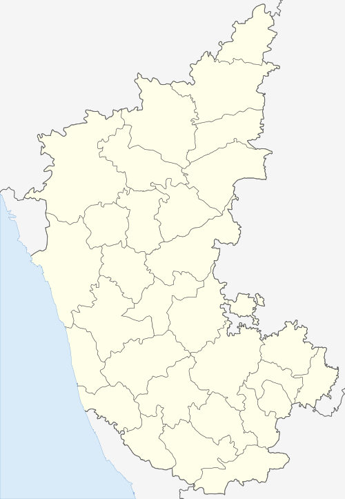
Aurad
| Aurad Aurad (B) ಔರಾದ | |
|---|---|
| City | |
|
Nickname(s): Crown of the Bidar District; Gateway of Northeast Karnataka; Togariya Nadu | |
 Aurad Location in Karnataka, India | |
| Coordinates: 18°15′N 77°26′E / 18.25°N 77.43°ECoordinates: 18°15′N 77°26′E / 18.25°N 77.43°E | |
| Country |
|
| State | Karnataka |
| Region | Hyderabad-Karnataka |
| District | Bidar District |
| Lok Sabha Constituency | Bidar (Lok Sabha constituency) |
| Named for | Inscriptions |
| Government | |
| • Type | Municipal Council |
| • Body | Aurad City Panchayat |
| • President of the Municipal Council | Kumara Deshmukh |
| • MLA | Prabhu Chauhan |
| Area | |
| • City | 7.06 km2 (2.73 sq mi) |
| • Urban | 23.73 km2 (9.16 sq mi) |
| • Rural | 1,209.27 km2 (466.90 sq mi) |
| Area rank | 90.52% |
| Elevation | 542 m (1,778 ft) |
| Highest elevation | 610 m (2,000 ft) |
| Population (2011) | |
| • City | 19,849 |
| • Estimate (2021) |
(Approx) 22,000 |
| • Rank |
4th: Bidar District 80th: Karnataka |
| • Density | 2,811/km2 (7,280/sq mi) |
| • Urban | 30,101 |
| • Rural | 2,48,299 |
| • Male | 10,058 |
| • Female | 9,791 |
| Demonym(s) | Auradkar, Auradavaru |
| Languages | |
| • Official | Kannada, Marathi, Urdu, Telugu, Hindi, Lambadi, Punjabi |
| Time zone | UTC+5:30 (IST) |
| PINCODE | 585326 |
| Vehicle registration | KA 38 |
| Distance from Bidar |
42 kilometres (26 mi) by (Road) |
| Distance from Bengaluru |
840 kilometres (520 mi) by (Road) |
| Website |
auradtown |
Aurad officially known as Aurad Barahalli & formerly known as the Awarawadi and Amareshwarawadi, Amarwadi, Awaradi, Awarad is a City and Taluka of the Bidar District in the Indian state of Karnataka and the city is the famous for the Shree Amreshwar Temple & birthplace of the Member of Parliament Bhagwanth Khuba.
Geography
Aurad is located at 18°15′N 77°26′E / 18.25°N 77.43°E.[1] It has an average elevation of 542 metres (1,778 ft). Aurad is 840 kilometres (520 mi) from Bengaluru and 42 kilometres (26 mi) from District Headquarters Bidar. The area of Aurad is 1,227.20 km2 having 6 circles, 149 villages and 177 thandas. It is located 542–610 metres (1,778–2,001 ft) above sea level. Aurad taluka is one of the five talukas of the Bidar District. It is bounded by Maharashtra on the North-west, Bhalki taluka on the south and Andhra Pradesh in the east. This is the largest taluka in the district.
River
Manjra is the tributary of Godavari, which enters into Aurad at Horandi and flows as taluka boundary through Sonal, Kalgapur, Hulsur, Khed, Halalli, Nidoda, Nittur, Babli, Bachepalli. Ladha, Koutha(B), Khanapur and at the end it leaves Aurad at Kandgul village.
Climate
The climate is generally dry and healthy. The average rainfall of the taluka is 840 mm. Average number of rainy days are about 51 days. Though the climate is dry throughout the year, summer months become very hot and the temperature goes as high as 40-43 degree Celsius. The minimum temperature during winter goes as low as 15-10 degree Celsius.
Demographics
According to the provisional census of 2011 India[2] Aurad had a population of 19,849. Males constitute 52% of the population and females 48%. Aurad has an average literacy rate of 61.6%, lower than the national average of 74.04%; with 68.7% of the males and 54.3% of females being literate. 17% of the population is under 6 years of age.
The total population of Aurad taluka as per (PCA) 2011 census is 2,78,400 consisting of 1,42,309 as males and 1,36,091 females. The density of population in the taluka is 200 persons per.km2; the sex ratio is 950.The scheduled caste population is about 88,683 accounting for about 32% of the total population and scheduled tribes with a population of 30,582 constitutes 11% of the total population of the taluka Kannada is the most widely spoken language in Aurad. Marathi is also spoken in the border villages of Aurad taluka.
References
- ↑ Falling Rain Genomics, Inc - Aurad
- ↑ "Census of India 2001: Data from the 2001 Census, including cities, villages and towns (Provisional)". Census Commission of India. Archived from the original on 2004-06-16. Retrieved 2008-11-01.
4.Provisional census 2011 by directorate census operations karnataka