Jaigaon
| Jaigaon জয়গাওঁ (Bengali) | |
|---|---|
| city | |
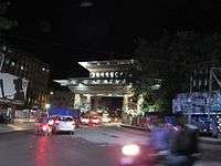
 Jaigaon from the kharbandi (Bhutan) | |
 Jaigaon Location in West Bengal, India,  Jaigaon Jaigaon (India) | |
| Coordinates: 26°50′N 89°23′E / 26.83°N 89.38°ECoordinates: 26°50′N 89°23′E / 26.83°N 89.38°E | |
| Country |
|
| State | West Bengal |
| District | Alipurduar |
| Government | |
| • Type | Democratic |
| • Body | Jaigaon Gram Panchayat and Jaigaon Development Authority |
| Population (2011)As per data.gov.in | |
| • Total | 42,254 |
| Languages | |
| • Official | Bengali and English |
| Time zone | UTC+5:30 (IST) |
| Lok Sabha Constituency | Alipurduar (ST) |
| Vidhan Sabha constituency | Kalchini (ST) |
| Website |
www www |
Jaigaon is a city in the Alipurduar district, West Bengal, India. It is located on the country's border with Bhutan. The main overland entrance to Bhutan is through Jaigaon and Bhutan Gate separates the two countries. Bhutan does not have domestic roads linking to all its towns, so Bhutan uses Indian roads passing through Jaigaon to reach such destinations as Samtse, Gomtu, Nganglam and Samdrup Jongkhar.
Bagdogra Airport (Siliguri) is the nearest airport, and Kolkata its nearest port, where goods to Bhutan are brought from. Hasimara is the nearest railway station. National Highway 317A in India connects Jaigaon to Hasimara. India offers a free flow of goods from Kolkata port to Bhutan. It lies on the banks of the Torsa River. It is a census town and a police station of Alipurduar subdivision.[1]
Environment

Jaigaon is in a small valley located near the low-lying hills of the Himalayan mountains. Jaigaon receives an abundant amount of rainfall throughout the year. The outskirts of the city are demarcated by tea gardens. The Torsa River flows at the lower end of the town. High levels of in-migration to Jaigaon from elsewhere in India has caused the environmental conditions of the city to deteriorate. To solve the problem of non-potable drinking water, various bore wells and pump stations operate around the town, adding to the problem of the decreasing water table below the town.
Geography
Jaigaon is located at 26°50′N 89°23′E / 26.83°N 89.38°E.[2] Jaigaon has a hilly and sloppy terrain. The town is situated at the India-Bhutan border with Phuentsholing. There are several streams coming from the uphills and joining the river Toorsa at the downtown.
Demographic
As of census 2011 India census,[3] Jaigaon had a population of 42,254. Males constitute 51.2% of the population and females 48.8%. Jaigaon has an average literacy rate of 60.52%.
Education

Jaigaon has several schools under various education board of the country. Schools such as Sunrise English School which is one of the oldest and the most popular school in town, St. Anthony's Convent, BD Memorial, and St. John's follow the ICSE and ISC curriculum. SHMD School is the only CBSE school in the town. Schools like Ved Vyas and St. Dominic's follow the state education board, whereas New Adarsh is an open board school. Recently Green View English School also start following the state board.
Nani Bhattacharya Smarak Mahavidyalaya is an affiliated college of North Bengal University located in the vicinity of Jaigaon, and offers degrees in a variety of fields.
Many students in Jaigaon opt to pursue higher education elsewhere in West Bengal, particularly Siliguri and Kolkata.
Culture
The lifestyle of Jaigaon is influenced by the town's diverse population of people from throughout India and Bhutan. The demand of Indian and Bhutanese consumers from nearby Phuentsholing has led to the development of the service sector in various fields.

A variety of festivals of various religions are celebrated in Jaigaon, reflecting the town's diverse demographics.
The diversity of Jaigaon can be seen in its food and clothing, which represents diverse segments of Indian culture. In addition, the town's proximity to Bhutan has led to the popularity of Tibetan-influenced cuisine such as momos. In addition, ghos and kiras, the
Every year various sports and other tournaments are organized in Jaigaon by various trusts and NGOs. A cricket tournament is organized every year, and a marathon is organized every January. Apart from these, various inter-school debates, quizzes and sports meets are organized. On Independence Day, students from various schools participate in events organized by the Indian Consulate to Bhutan. Also on Republic Day every year, parades and cultural programs are organized in the town.
See also
- Phuntsholing, border town of Bhutan
- Bhutan-India Border
References
- ↑ District-wise list of statutory towns Archived 2005-03-19 at the Wayback Machine.
- ↑ "Yahoo maps location of Jaigaon". Yahoo maps. Retrieved 2008-12-07.
- ↑ "Census of India 2001: Data from the 2001 Census, including cities, villages and towns (Provisional)". Census Commission of India. Archived from the original on 2004-06-16. Retrieved 2008-11-01.
| Wikimedia Commons has media related to Jaigaon. |
Cities, towns and locations in Alipurduar district | |||
|---|---|---|---|
| Cities, municipal and census towns |
| ||
| Locations other than cities and towns | |||
| Related Topics |
| ||