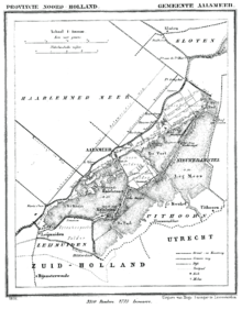
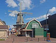
Aalsmeer
| Aalsmeer | |||
|---|---|---|---|
| Municipality | |||
 Aerial photo of Aalsmeer in 1977 | |||
| |||
| Nickname(s): Flower capital of the world | |||
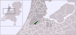 Location in North Holland | |||
| Coordinates: 52°16′N 4°45′E / 52.267°N 4.750°ECoordinates: 52°16′N 4°45′E / 52.267°N 4.750°E | |||
| Country | Netherlands | ||
| Province | North Holland | ||
| Government[1] | |||
| • Body | Municipal council | ||
| • Mayor | Jeroen Nobel (acting) (PvdA) | ||
| • Aldermen | |||
| Area[2] | |||
| • Total | 32.29 km2 (12.47 sq mi) | ||
| • Land | 20.44 km2 (7.89 sq mi) | ||
| • Water | 11.85 km2 (4.58 sq mi) | ||
| Elevation[3] | -0.1 m (−0.3 ft) | ||
| Population (August 2017)[4] | |||
| • Total | 31,430 | ||
| • Density | 1,538/km2 (3,980/sq mi) | ||
| Demonym(s) | Aalsmeerder | ||
| Time zone | UTC+1 (CET) | ||
| • Summer (DST) | UTC+2 (CEST) | ||
| Postcode | 1430–1433 | ||
| Area code | 0297 | ||
| Website | (in English) Aalsmeer.nl | ||


Aalsmeer (![]()
The town is sometimes referred to as the flower capital of the world, as the largest flower auction in the world is based in Aalsmeer, along with numerous nurseries and an experimental station for floriculture.
Population centres
The municipality of Aalsmeer consists of the following cities, towns, and villages: Aalsmeer, Kudelstaart, Oosteinde, as well as the hamlet Calslagen.
Geology
Aalsmeer is located on the border of the former Haarlem Lake. The older portion of town is built on peat, and is surrounded by polders. The polders consist of loamy soil and are 9–15 feet (2.7–4.6 m) below sea level.[6]
History
Aalsmeer is first referenced in a document from 1133 in which it is called "Alsmar" and is granted to the Abbey of Rijnsburg. Diederik VII van Kleef confirmed this grant in an act in 1199. The area was then a wilderness with alders and willow forests.
In its surroundings, large tracts of land were dug up for peat, creating large lakes and ponds such as Oosteinderpoel (East End Pool), Schinkelpoel (Schinkel Pool), Stommeer (Stom Lake), Hornmeer (Horn Lake), Legmeer (Leg Lake), and the Westeinderplassen (West End Ponds). This left little land for agriculture, causing Aalsmeer's inhabitants to switch to fishery. The land was cultivated intensely, mostly for tree nurseries.

The lack of dry land was countered by reclaiming some of the lakes, starting with Stom Lake in 1650, and followed by Horn Lake in 1674. In 1852, the large Haarlem Lake, bordering on Aalsmeer, was made into a polder. Then followed Schinkelpoel, Oosteinderpoel, and Legmeer. Peat was no longer dug up and the fishing business declined. Yet horticulture increased, especially strawberry cultivation, which peaked between 1850 and 1885. The strawberry became the symbol for the flag of Aalsmeer: red (fruit), green (leaf), and black (soil). The cultivation of flowers began circa 1880, first with roses in greenhouses.
The growers would sell their strawberries and flowers to distributors who would bring them with barges to the market in Amsterdam. But the trade shifted to Aalsmeer where auctions began to be held in local cafés. In 1912 two auction businesses were established: Centrale Aalsmeerse Veiling (Central Aalsmeer Auction) in the town's centre and Bloemenlust in Aalsmeer East.
World War II
During World War 2, Aalsmeer gained a reputation for its Nazi support, mostly because of its fanatical National Socialistic mayor and a handful of fascist supporters. The highest supreme commander of the German Wehrmacht in the Netherlands, Friedrich Christiansen, was a regular visitor. Following the war, more than a hundred court cases were held against Nazi supporters from Aalsmeer.
Post war
In 1950 Aalsmeer had 12,500 inhabitants. In 1968 the two auction businesses merged and formed the Verenigde Bloemenveilingen Aalsmeer (United Flower Auctions Aalsmeer). In 1972 a new large auction building was completed in South Aalsmeer and expanded in 1999.
Local government

The municipal council of Aalsmeer consists of 23 seats, which since 2018 are divided as follows:
- Christian Democratic Appeal (CDA) – 8 seats
- People's Party for Freedom and Democracy (VVD) – 6 seats
- Absoluut Aalsmeer (AA) – 4 seats
- Democrats 66 (D66) – 2 seats
- GreenLeft (GL) – 2 seats
- Labour Party (PvdA) – 1 seat
The executive board consists of CDA, VVD and D66.
The current acting mayor is Jeroen Nobel (PvdA).
Public transport
The bus interchange in Aalsmeer is called the Hortensiaplein, where the buses meet. These services are:
- 171 - Aalsmeer - Bovenkerk - Amstelveen - Amsterdam Bijlmer ArenA Station
- 198 - Aalsmeer - Amsterdam Schiphol Airport (Schiphol Sternet)
- 340 - (Mijdrecht 2x per hour) - Uithoorn - Aalsmeer - Hoofddorp Station - Hoofddorp - Heemstede - Haarlem - Haarlem Station
- 357 - (Kudelstaart 2x per hour) - Aalsmeer - Amstelveen - Amsterdam City Centre - Amsterdam Centraal
- 342 - Schiphol, Airport - Schipholgebouw Schiphol, - P30 Parkeerterrein Schiphol-Rijk, Beechavenue - Aalsmeer, Dorpsstraat - Aalsmeer, Zwarteweg/N196 - Uithoorn, Poelweg Uithoorn, - Noorddammerweg Uithoorn, - Burg. Kootlaan Uithoorn, - Uithoorn, Busstation
- N57 - Amsterdam Centraal - Amsterdam City Centre - Amstelveen - Bovenkerk - Aalsmeer (Nightbus)
All of these services are very frequent, half-hourly or more frequent.
Economy

Having 999,000 square metres (10,750,000 sq ft) of floor space, the flower auction building of FloraHolland is one of the largest commercial buildings in the world. Its close proximity to Schiphol Airport allows the growers access to markets worldwide. Since January 1, 2008 the Aalsmeer flower auction has merged with the united auctions of Naaldwijk and Rijnsburg under the name FloraHolland, and is the largest auction market in the world.[7] The flowers that are grown and sold here are carnations, roses, lilacs, freesias, chrysanthemums, cyclamens, and begonias.[6]
The Endemol television studios are located in the former Central Auction building. The Bloemenlust building is nowadays a sports, event, and congress centre. Dominating the Ringvaart canal are the large building halls of Royal De Vries Scheepsbouw.
Agriculture and manufacturing also play an important role in the economy of the locality. Dairy, beef, potatoes, vegetables, and fruit are the areas within agriculture, and the types of manufacturing in the city are farm products, sporting goods, boats, and packaging material.[8]
Culture

Events
Aalsmeer has always had a number of yearly recurring events and festivals. The most famous event has always been the Flower parade (Bloemencorso), every first Saturday in September. After 60 years, this tradition has been discontinued in 2007. Other annual events are the "Pramenrace", every second Saturday in September and the Bands Night (Bandjesavond) in June.
Music scene
Aalsmeer has always had a rich music scene. The best known groups and artists from Aalsmeer and Kudelstaart since 1970 are:
- Eton Crop
- Hobo String band
- The Whatts
- Livin' at A
- Madeliefjes
- Los Boundros
- Café Blue (later: Koel Bewaren)
- Ten Beers After
- Katelijne van Otterloo Group
- Social Animal
People from Aalsmeer
Born in Aalsmeer
- Anton Roosjen (1894–1978), politician
- Jacques van Tol (1897–1969), author
- J. F. Berghoef (1903–1994), architect
- IJke Buisma (1907–1994), high jumper
- Dirk Kastelein (1916–1993), politician
- Ada van Keulen (1920–2010), resistance member
- Jan de Pous (1920–1996), politician
- Jan Bol (1924), professional sailor
- Joop Borgman (1928–1999), politician
- Jan Jongkind (1932), professional sailor
- Piet Bon (1946), professional rower
- Fred Borgman (1946–1996), politician
- Theodore van Houten (1952–2016), author and journalist
- Peter R. de Vries (1956), journalist, author and television presenter
Current residents in Aalsmeer
- Joost Hoffscholte (1942), politician
- Marianne van Wijnkoop (1945), actress and casting director (Kudelstaart)
- André van Duin (1947), comedian, musician and actor (Kudelstaart)
- Bonnie St. Claire (1949), musician
- Frans Mulder (1952), actor
- Gerard Joling (1960), musician and television presenter
- Stefanie van Vliet (1967), politician
- Pieter Litjens (1968), politician
- Michael Buskermolen (1972), professional footballer (Kudelstaart)
Former residents in Aalsmeer
- Simon Bon (1904–1987), professional rower
- Corry Vonk (1901–1988), comedian (Kudelstaart)
- Wim Kan (1911–1983), comedian and musician (Kudelstaart)
- Marinus Ruppert (1911–1992), politician
- Piet Steenkamp (1925–2016), politician
- Ria Beckers (1938–2006), politician
- Jan Leliveld (1956–2017), musician
- Laidback Luke (1976), DJ and producer
- Bob de Jong (1976), professional speed skater (Kudelstaart)
Footnotes
References
- Anon (2013). "Postcodetool for 1431EH" [Zip Tool for 1431EH]. Actueel Hoogtebestand Nederland (in Dutch). Het Waterschapshuis. Retrieved 25 Feb 2014.
- Central Bureau of Statistics (2014). "Kerncijfers wijken en buurten 2009-2012" [Key figures and neighborhoods 2009-2012]. Statline.cbs.nl. Archived from the original on 2014-02-28. Retrieved 28 Feb 2014.
- Central Bureau of Statistics (2014a). "Bevolkingsontwikkeling; regio per maand" [Population Development; region by month]. Statline.cbs.nl. Archived from the original on 2014-02-28. Retrieved 28 Feb 2014.
- Cohen, Saul B., ed. (1998). "Aalsmeer". The Columbia Gazetteer of the World. New York, NY: Columbia University Press. ISBN 0-231-11040-5.
- Encyclopædia Britannica Online (2013). "Aalsmeer". Encyclopædia Britannica. Encyclopædia Britannica Online. Retrieved 10 Nov 2013.
- Hoiberg, Dale H., ed. (2010). "Aalsmeer". Encyclopædia Britannica. I: A-Ak - Bayes (15th ed.). Chicago, Illinois: Encyclopædia Britannica, Inc. ISBN 978-1-59339-837-8.
- Municipality of Aalsmeer (13 Jan 2014). "College van B en W" [Board of Mayor and Aldermen]. Gemeente Aalsmeer (in Dutch). Gemeente Aalsmeer. Retrieved 25 Feb 2014.
- Munro, David, ed. (1995). "Aalsmeer". The Oxford Dictionary of the World. Oxford, UK: Oxford University Press. ISBN 0-19-866184-3.
External links
| Wikimedia Commons has media related to Aalsmeer. |
- Official website
- Bloemencorso Aalsmeer (in Dutch)
Places adjacent to Aalsmeer | ||||||||||
|---|---|---|---|---|---|---|---|---|---|---|
| ||||||||||

| Authority control |
|---|