Laren, North Holland
- Not to be confused with Laren, Gelderland.
| Laren | |||
|---|---|---|---|
| Town and municipality | |||
.jpg) Laren town centre | |||
| |||
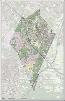
.svg.png) Location in North Holland | |||
| Coordinates: 52°15′N 5°14′E / 52.250°N 5.233°ECoordinates: 52°15′N 5°14′E / 52.250°N 5.233°E | |||
| Country | Netherlands | ||
| Province |
| ||
| Government[1] | |||
| • Body | Municipal council | ||
| • Mayor | Rinske Kruisinga (acting) (CDA) | ||
| Area[2] | |||
| • Total | 12.41 km2 (4.79 sq mi) | ||
| • Land | 12.41 km2 (4.79 sq mi) | ||
| • Water | 0.00 km2 (0.00 sq mi) | ||
| Elevation[3] | 5 m (16 ft) | ||
| Population (August 2017)[4] | |||
| • Total | 11,135 | ||
| • Density | 897/km2 (2,320/sq mi) | ||
| Demonym(s) | Laarder, Larenaar | ||
| Time zone | UTC+1 (CET) | ||
| • Summer (DST) | UTC+2 (CEST) | ||
| Postcode | 1250–1252 | ||
| Area code | 035 | ||
| Website |
www | ||

.svg.png)
Laren (![]()
Nationally, Laren is well known for its history as a late 20th-century art colony, preserved in the museum Singer Laren, as well as its wide array of shops. Laren is part of the Amsterdam metropolitan area, situated east of Amsterdam. The town has an homonym in Gelderland, which is the setting for the book "The War in the Corner", by Jan Braakman.
Government
The municipal council of Laren consists of 15 seats, which since 2014 are divided as follows:
Demographics
In 2007, Laren had the following demographic data:
- Birth rate: 7.29 per 1,000
- Death rate: 17.94 per 1,000
- NGR: -1.07% per year[5]
In August 2017, there were 11,135 inhabitants in Laren. The municipality has a population density of 897/km2 (2,320/sq mi).
Notable residents
- Willemien Aardenburg (born 1966), field hockey player
- Maurits Cornelis Escher (1898–1972), graphic artist, illustrator and printmaker
- Mona Louise Parsons (1901–1976), member of Dutch resistance
- Marcel van der Westen (born 1976), track and field athlete
- Johan Briede' Artist, Illustrator of H.G. Wells books
Gallery
 Laren, basilica: de Sint Jansbasiliek
 The Coeswaerde
 De Hervormde Kerk
 Town centre
References
- ↑ "drs. E.J. (Elbert) Roest" (in Dutch). Gemeente Laren. Archived from the original on 3 July 2013. Retrieved 18 March 2014.
- ↑ "Kerncijfers wijken en buurten" [Key figures for neighbourhoods]. CBS Statline (in Dutch). CBS. 2 July 2013. Retrieved 12 March 2014.
- ↑ "Postcodetool for 1251NA". Actueel Hoogtebestand Nederland (in Dutch). Het Waterschapshuis. Archived from the original on 21 September 2013. Retrieved 18 March 2014.
- ↑ "Bevolkingsontwikkeling; regio per maand" [Population growth; regions per month]. CBS Statline (in Dutch). CBS. 27 October 2017. Retrieved 27 October 2017.
- ↑ Statline.cbs.nl, Laren page.
External links

- Official website
