Schermer
| Schermer | |||
|---|---|---|---|
| Former municipality | |||
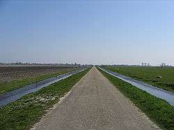 Polder in Schermer | |||
| |||
.svg.png) Location in North Holland | |||
| Coordinates: 52°37′N 4°49′E / 52.617°N 4.817°ECoordinates: 52°37′N 4°49′E / 52.617°N 4.817°E | |||
| Country | Netherlands | ||
| Province | North Holland | ||
| Municipality | Alkmaar | ||
| Area[1] | |||
| • Total | 64.39 km2 (24.86 sq mi) | ||
| • Land | 61.39 km2 (23.70 sq mi) | ||
| • Water | 3.00 km2 (1.16 sq mi) | ||
| Elevation[2] | −3 m (−10 ft) | ||
| Population (August 2017)[3] | |||
| • Total | data missing | ||
| Time zone | UTC+1 (CET) | ||
| • Summer (DST) | UTC+2 (CEST) | ||
| Postcode | 1636, 1840–1847 | ||
| Area code | 072 | ||
| Website |
www | ||

Schermer ![]()
The municipality of Schermer included not only the Schermer polder, but also the polders Oterleek, Mijzenpolder, and Eilandspolder.
History
Around 800 AD, the area that was the municipality of Schermer was covered in peat, and a small river called the Schermer flowed through it. Because of peat-digging by man, and storm floods, this small river had by 1250 developed into an inland lake with an open connection with the Zuyderzee. In the 17th century private investors started draining the largest part of the lake, leaving the southern part, the Alkmaardermeer, intact. In 1635, 47.7 km2 (18.4 sq mi) of polder was drained, whereupon the land was divided among the shareholders. In 1970, the village of Zuid- en Noord-Schermer was merged into Schermer.[4]
Population centres
The municipality of Schermer consisted of the following cities, towns, villages and/or districts: Driehuizen, Grootschermer, Oterleek, Schermerhorn, Stompetoren, Zuidschermer. The latter two are located in the Schermer polder.
Topography
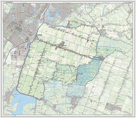
Dutch Topographic map of the municipality of Schermer, 2013.
Local government
The municipal council of Schermer consisted of eleven seats, which were divided as follows:
References
- ↑ "Kerncijfers wijken en buurten" [Key figures for neighbourhoods]. CBS Statline (in Dutch). CBS. 2 July 2013. Retrieved 12 March 2014.
- ↑ "Postcodetool for 1841GB". Actueel Hoogtebestand Nederland (in Dutch). Het Waterschapshuis. Retrieved 21 March 2014.
- ↑ "Bevolkingsontwikkeling; regio per maand" [Population growth; regions per month]. CBS Statline (in Dutch). CBS. 27 October 2017. Retrieved 27 October 2017.
- ↑ Ad van der Meer and Onno Boonstra, "Repertorium van Nederlandse gemeenten", KNAW, 2006. "Archived copy". Archived from the original on February 20, 2007. Retrieved December 3, 2009.
External links

- Official website
Places adjacent to Schermer | |
|---|---|