Castricum
| Castricum | |||
|---|---|---|---|
| Municipality | |||
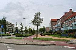 Street in Castricum | |||
| |||
.svg.png) Location in North Holland | |||
| Coordinates: 52°33′N 4°40′E / 52.550°N 4.667°ECoordinates: 52°33′N 4°40′E / 52.550°N 4.667°E | |||
| Country | Netherlands | ||
| Province | North Holland | ||
| Government[1] | |||
| • Body | Municipal council | ||
| • Mayor | Toon Mans (VVD) | ||
| Area[2] | |||
| • Total | 60.37 km2 (23.31 sq mi) | ||
| • Land | 49.67 km2 (19.18 sq mi) | ||
| • Water | 10.70 km2 (4.13 sq mi) | ||
| Elevation[3] | 0 m (0 ft) | ||
| Population (August 2017)[4] | |||
| • Total | 35,439 | ||
| • Density | 713/km2 (1,850/sq mi) | ||
| Demonym(s) | Castricummer | ||
| Time zone | UTC+1 (CET) | ||
| • Summer (DST) | UTC+2 (CEST) | ||
| Postcode | 1489, 1900–1906, 1920–1921 | ||
| Area code | 0251 | ||
| Website |
www | ||

Castricum (Dutch pronunciation: [ˈkɑstrikɵm] (![]()
Castricum is a seaside town in the province of North Holland. It draws in a fair share of tourists who mainly come to visit the beach and nearby dune landscape. In Castricum's vicinity there is also the lake of Alkmaar-Uitgeest which offers various sailing and windsurfing opportunities.
History

On 6 October 1799, a Franco-Dutch army under Guillaume Brune defeated an Anglo-Russian army under Ralph Abercromby and the Duke of York in the Battle of Castricum.
Population centres

The municipality of Castricum is made up of the following towns, villages and/or districts: Castricum, Akersloot, Bakkum, De Woude, Limmen.
Transportation
The town is served by Castricum railway station. From here there are 4 trains an hour to Amsterdam, with a journey time of 28 minutes.
Local government
The municipal council of Castricum consists of 23 seats, which are divided as follows:
- VVD - 5 seats
- Castricum Kern(en) Gezond (CKenG) - 4 seats
- GDB - 3 seats
- PvdA - 3 seats
- CDA - 3 seats
- GroenLinks - 2 seats
- D66 - 2 seats
- De Vrije Lijst - 1 seat
At the moment, the college van burgemeester en wethouders (the municipal board) is formed by the VVD, CKenG, CDA and D66.
See also
- Huis van Hilde, provincial archaeology centre in Castricum
References
- ↑ "Burgemeester Toon Mans" [Mayor Toon Mans] (in Dutch). Gemeente Castricum. Retrieved 26 February 2014.
- ↑ "Kerncijfers wijken en buurten" [Key figures for neighbourhoods]. CBS Statline (in Dutch). CBS. 2 July 2013. Retrieved 12 March 2014.
- ↑ "Postcodetool for 1902CA". Actueel Hoogtebestand Nederland (in Dutch). Het Waterschapshuis. Retrieved 26 February 2014.
- ↑ "Bevolkingsontwikkeling; regio per maand" [Population growth; regions per month]. CBS Statline (in Dutch). CBS. 27 October 2017. Retrieved 27 October 2017.
External links

- Official website
Places adjacent to Castricum | |
|---|---|
