Koggenland
| Koggenland | |||
|---|---|---|---|
| Municipality | |||
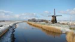 Wind mill in Koggenland | |||
| |||
.svg.png) Location in North Holland | |||
| Coordinates: 52°38′N 4°57′E / 52.633°N 4.950°ECoordinates: 52°38′N 4°57′E / 52.633°N 4.950°E | |||
| Country | Netherlands | ||
| Province | North Holland | ||
| Established | 1 January 2007[1] | ||
| Government[2] | |||
| • Body | Municipal council | ||
| • Mayor | Rob Posthumus (VVD) | ||
| Area[3] | |||
| • Total | 84.13 km2 (32.48 sq mi) | ||
| • Land | 80.52 km2 (31.09 sq mi) | ||
| • Water | 3.61 km2 (1.39 sq mi) | ||
| Elevation[4] | −3 m (−10 ft) | ||
| Population (August 2017)[5] | |||
| • Total | 22,647 | ||
| • Density | 281/km2 (730/sq mi) | ||
| Time zone | UTC+1 (CET) | ||
| • Summer (DST) | UTC+2 (CEST) | ||
| Postcode | Parts of 1600 and 1700 range | ||
| Area code | 0226, 0229, 072 | ||
| Website |
www | ||


Koggenland is a municipality in North Holland province and the region of West-Frisia of the Netherlands. It came into existence on 1 January 2007 upon the merger of the two former municipalities of Obdam and Wester-Koggenland.
The name of the municipality refers to the historic Kogge from the middle-ages. A kogge or cogge was a jurisdiction area of several villages or bannen (mostly around 4 or 5).
Population centres
Villages:
- Avenhorn
- Berkhout
- Bobeldijk
- De Goorn
- Grosthuizen
- Hensbroek
- Obdam
- Oostmijzen
- Oudendijk
- Rustenburg
- Scharwoude
- Spierdijk
- Ursem
- Wogmeer
- Zuid-Spierdijk
- Zuidermeer
Hamlets:
- Baarsdorpermeer
- Berkmeer
- De Hulk
- Kathoek
- Noord-Spierdijk
- Noorddijk
- Noordermeer
- Oosteinde
- Obdammerdijk
Topography
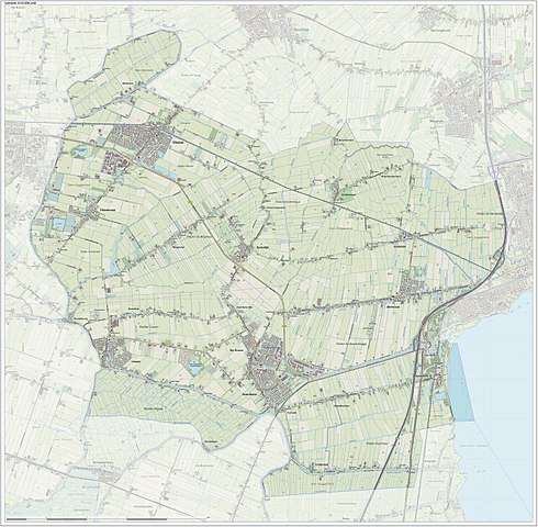
Dutch topographic map of the municipality of Koggenland, July 2015
References
- ↑ "Gemeentelijke indeling op 1 januari 2007" [Municipal divisions on 1 January 2007]. cbs.nl (in Dutch). CBS. Retrieved 12 March 2014.
- ↑ "College van B&W" [Board of mayor and aldermen] (in Dutch). Gemeente Koggenland. Archived from the original on 12 March 2014. Retrieved 12 March 2014.
- ↑ "Kerncijfers wijken en buurten" [Key figures for neighbourhoods]. CBS Statline (in Dutch). CBS. 2 July 2013. Retrieved 12 March 2014.
- ↑ "Postcodetool for 1648JG". Actueel Hoogtebestand Nederland (in Dutch). Het Waterschapshuis. Archived from the original on 21 September 2013. Retrieved 12 March 2014.
- ↑ "Bevolkingsontwikkeling; regio per maand" [Population growth; regions per month]. CBS Statline (in Dutch). CBS. 27 October 2017. Retrieved 27 October 2017.
External links

- Official website
Places adjacent to Koggenland | ||||||||||
|---|---|---|---|---|---|---|---|---|---|---|
| ||||||||||

This article is issued from
Wikipedia.
The text is licensed under Creative Commons - Attribution - Sharealike.
Additional terms may apply for the media files.