Alice, Texas
| Alice, Texas | |||
|---|---|---|---|
| City | |||
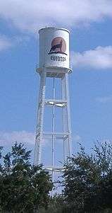 The water tower in Alice on Hwy 44 | |||
| |||
| Nickname(s): The Hub City of South Texas | |||
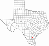 Location of Alice in Texas | |||
 | |||
| Coordinates: 27°45′2″N 98°4′14″W / 27.75056°N 98.07056°WCoordinates: 27°45′2″N 98°4′14″W / 27.75056°N 98.07056°W | |||
| Country |
| ||
| State |
| ||
| County | Jim Wells | ||
| Government | |||
| • Type | Council-Manager | ||
| • City Council |
Mayor Larry Martinez Michael Esparza Frank M Hinojosa Yvette Johnson Raul Chapa | ||
| • City Manager | Jesus Garcia | ||
| Area | |||
| • Total | 12.3 sq mi (31.9 km2) | ||
| • Land | 11.9 sq mi (30.8 km2) | ||
| • Water | 0.4 sq mi (1.0 km2) | ||
| Elevation | 200 ft (61.5696 m) | ||
| Population (2010)[1] | |||
| • Total | 19,104 | ||
| • Estimate (2013)[1] | 19,576 | ||
| • Density | 1,640/sq mi (630/km2) | ||
| Time zone | UTC-6 (CST) | ||
| • Summer (DST) | UTC-5 (CDT) | ||
| ZIP codes | 78332, 78333 | ||
| Area code(s) | 361 | ||
| FIPS code | 48-01852[2] | ||
| GNIS feature ID | 1329361[3] | ||
| Website | CityOfAlice.org | ||


Alice is a city in and the county seat of Jim Wells County, Texas, United States,[4] in the South Texas region of the state. The population was 19,104 at the 2010 census. Alice was established in 1888. First it was called Bandana, then Kleberg, and finally Alice after Alice Gertrudis King Kleberg, the daughter of Richard King, who established the King Ranch.
History
Alice originated from the defunct community of Collins, three miles to the east. Around 1880 the San Antonio and Aransas Pass Railway attempted to build a line through Collins, which then had about 2,000 inhabitants. The townspeople were not amenable to selling their land to the railroad company; consequently, the railroad site was moved three miles west, and in 1883 a depot called Bandana was established at its junction with the Corpus Christi, San Diego and Rio Grande Railway. Bandana soon became a thriving cattle-shipping point, and an application for a post office was made under the name Kleberg in honor of Robert Justus Kleberg. The petition was denied because a town named Kleberg already appeared on the post office list, so residents then chose the name Alice, in honor of Alice Gertrudis King Kleberg, Kleberg's wife and the daughter of Richard King. The Alice post office opened for business in 1888. Within a few years the remaining residents of Collins moved to Alice, which was by then a thriving community.
The City of Alice was known for its large cattle industry until the discovery of oil and petroleum beneath and around the town in the 1940s, which caused a slight population boom.
In 1948, an incident involving Lyndon B. Johnson's bid for the U.S. Senate took place at Alice's Precinct 13 where 202 ballots were cast in alphabetical order and all just at the close of polling in favor of Johnson. Johnson won the election against Coke Stevenson by 87 votes.[5]
Culture
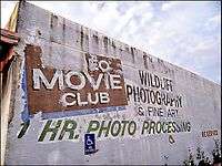
Alice has long been recognized as "The Birthplace of Tejano" dating back to the mid-1940s when Armando Marroquin, Sr. of Alice and partner Paco Betancourt of San Benito, Texas launched what was to be the first home-based recording company to record Tejano artists exclusively. Ideal Records, which was based in Alice,[6] the heart of South Texas and under the direction of Marroquin became the perfect vehicle for Tejano groups and artists to get their music to the public. Marroquin, who also owned and operated a jukebox company, ensured that Ideal recordings would be distributed throughout South Texas. The songs recorded, which were contributed by Tejano and Mexican composers became very popular through jukeboxes placed in restaurants, cantinas or any other establishment that would have them, and the then very scarce Spanish language radio programs. In addition to Ideal, Alice was also the home of Freddie Records and Hacienda Records, who were dominant players in tejano music in the 1970s and 1980s.[7] Alice is also the birthplace of two Nobel Peace Prize winners. Robert F. Curl Jr. was honored with a Nobel Prize in chemistry in 1996 and James P. Allison won a Nobel for his work in medicine in 2018.
Geography
Alice is located at 27°45′02″N 98°04′14″W / 27.750652°N 98.070460°W (27.750652, -98.070460).[8] According to the United States Census Bureau, the city has a total area of 12.3 square miles (32 km2), of which 11.9 square miles (31 km2) is land and 0.4 square miles (1.0 km2) (3.25%) is water. Alice falls within the boundaries of South Texas as well as the Texas Coastal Bend.
The nearest Metropolitan areas within 100 miles are:
- Corpus Christi, Texas (45 miles)
- Victoria, Texas (79 miles)
- Laredo, Texas (86 miles)
- Nuevo Laredo, Tamaulipas, Mexico (90 miles)
Climate
- Annual Average Temperature: 71.4 °F (21.9 °C)
- January Average Temperature: 55.1 °F (12.8 °C)
- July Average Temperature: 84.1 °F (28.9 °C)
- Average Annual Rainfall: 30.13 inches
- Wettest Month: September (5.52 inches)
- Driest Month: March (0.94 inches)
- Growing Season: 289 days
- The last snowfall was during the 2004 Christmas Eve Snowstorm where up to 12 inches (300 mm) fell in the city.
- 115 °F was the highest temperature ever recorded in the city.
- 12 °F was the lowest temperature ever recorded in the city.
- Alice has very little seismic activity, with only two small earthquakes happening in recent history—a 3.8 magnitude quake on March 24, 1997 and a 4.0 magnitude quake on April 24, 2010.[9]
The data below are from the Western Regional Climate Center, recorded over the period from 1893 to 2008.[10]
| Climate data for Alice, TX | |||||||||||||
|---|---|---|---|---|---|---|---|---|---|---|---|---|---|
| Month | Jan | Feb | Mar | Apr | May | Jun | Jul | Aug | Sep | Oct | Nov | Dec | Year |
| Record high °F (°C) | 93 (34) |
100 (38) |
104 (40) |
107 (42) |
108 (42) |
111 (44) |
111 (44) |
110 (43) |
110 (43) |
102 (39) |
97 (36) |
94 (34) |
111 (44) |
| Average high °F (°C) | 67.4 (19.7) |
71.9 (22.2) |
78.0 (25.6) |
84.3 (29.1) |
89.0 (31.7) |
93.9 (34.4) |
96.5 (35.8) |
97.4 (36.3) |
92.4 (33.6) |
85.9 (29.9) |
76.8 (24.9) |
69.2 (20.7) |
83.6 (28.7) |
| Average low °F (°C) | 44.8 (7.1) |
48.2 (9) |
54.1 (12.3) |
61.6 (16.4) |
68.0 (20) |
72.7 (22.6) |
73.9 (23.3) |
74.0 (23.3) |
70.4 (21.3) |
62.1 (16.7) |
53.6 (12) |
46.6 (8.1) |
60.8 (16) |
| Record low °F (°C) | 12 (−11) |
15 (−9) |
21 (−6) |
31 (−1) |
43 (6) |
52 (11) |
61 (16) |
61 (16) |
45 (7) |
28 (−2) |
22 (−6) |
12 (−11) |
12 (−11) |
| Average precipitation inches (mm) | 1.30 (33) |
1.49 (37.8) |
1.31 (33.3) |
1.54 (39.1) |
3.10 (78.7) |
3.12 (79.2) |
2.23 (56.6) |
2.32 (58.9) |
4.56 (115.8) |
2.87 (72.9) |
1.56 (39.6) |
1.43 (36.3) |
26.83 (681.2) |
| Average snowfall inches (cm) | 0 (0) |
0 (0) |
0 (0) |
0 (0) |
0 (0) |
0 (0) |
0 (0) |
0 (0) |
0 (0) |
0 (0) |
0 (0) |
0.1 (0.3) |
0.1 (0.3) |
| Source: https://wrcc.dri.edu/cgi-bin/cliMAIN.pl?tx0144 | |||||||||||||
Demographics
| Historical population | |||
|---|---|---|---|
| Census | Pop. | %± | |
| 1910 | 2,136 | — | |
| 1920 | 1,880 | −12.0% | |
| 1930 | 4,239 | 125.5% | |
| 1940 | 7,792 | 83.8% | |
| 1950 | 16,449 | 111.1% | |
| 1960 | 20,861 | 26.8% | |
| 1970 | 20,121 | −3.5% | |
| 1980 | 20,961 | 4.2% | |
| 1990 | 19,788 | −5.6% | |
| 2000 | 19,010 | −3.9% | |
| 2010 | 19,104 | 0.5% | |
| Est. 2016 | 19,285 | [11] | 0.9% |
| U.S. Decennial Census[12] | |||
At the 2000 census,[2] there were 19,010 people, 6,400 households and 4,915 families residing in the city. The population density was 1,597.4 per square mile (616.8/km2). There were 6,998 housing units at an average density of 588.0 per square mile (227.1/km2). The racial makeup of the city was 77.44% White, 0.86% African American, 0.53% Native American, 0.75% Asian, 0.08% Pacific Islander, 17.92% from other races, and 2.41% from two or more races. Hispanic or Latino of any race were 78.05% of the population.
There were 6,400 households of which 39.0% had children under the age of 18 living with them, 54.5% were married couples living together, 17.6% had a female householder with no husband present, and 23.2% were non-families. 20.9% of all households were made up of individuals and 10.8% had someone living alone who was 65 years of age or older. The average household size was 2.92 and the average family size was 3.39.
Age distribution was 30.3% under the age of 18, 9.3% from 18 to 24, 26.2% from 25 to 44, 20.5% from 45 to 64, and 13.7% who were 65 years of age or older. The median age was 33 years. For every 100 females, there were 91.0 males. For every 100 females age 18 and over, there were 85.8 males.
The median household income was $30,365, and the median family income was $34,276. Males had a median income of $32,409 versus $17,101 for females. The per capita income for the city was $13,118. About 17.9% of families and 21.9% of the population were below the poverty line, including 28.4% of those under age 18 and 20.2% of those age 65 or over.
Economy
Today, Alice's economy is centered on the drilling industry with more than 100 different oil field companies located around the Alice area. Alice is called the "Hub City" due to its geographical location between Corpus Christi, McAllen, Laredo and San Antonio. Alice's location between these cities makes it an ideal center for distribution. Some major oil companies in Alice are Schlumberger, Halliburton, Baker Hughes, Inc., Weatherford International, Grey Wolf Drilling Company, south division and Alice serves as the headquarters for Dixie iron Works - MSI. As of 2009, Alice has an unemployment rate of 6.30 percent when the U.S. average was 8.50 percent. Recent job growth has been negative and the number of jobs in Alice has decreased by 1.10 percent.[13]
Transportation
Highways


Air travel
- Alice International Airport – General aviation airports with no scheduled service.
Railways
Now owned by Kansas City Southern, which connects Monterrey, Mexico via Laredo, to the Port of Corpus Christi.
Education
The City of Alice is served by the Alice Independent School District.
Higher education
- Coastal Bend College provides vocational and academic courses for certification or associate degrees. The college also works with local business and industry to customize training and education classes for employees.
Public
- High School - grades 9-12
- Jr. High - grades 7-8
- William Adams Middle School
- Intermediate Schools - grades 5-6
- Dubose and Memorial Intermediate Schools
- Elementary Schools - grades K-4
- Noonan Elementary, Saenz Elementary, Mary R. Garcia Elementary, Salazar Elementary, Schallert Elementary, and Hillcrest Elementary.
Private
- St. Elizabeth School, Grades PreK3 through 6th
- St. Joseph School, Grades PreK3 through 6th
- Alice Christian School, Grades K through 12
- Agape House, Grades PreK through 12
- Texas Migrant Council, head start
Notable people
- James P. Allison Immunologist, winner of the 2018 Nobel Prize in Physiology or Medicine, the Lasker Prize, and the Breakthrough Prize for his development of Cancer Immunotherapy
- Chris Brazzell - Canadian Football League(CFL) Player and ex NFL player, was born May 22, 1976, and played on the Alice High School football team. He was drafted to the NFL in 1998 to the New York Jets as the 174th overall pick in the 6th round.
- Marv Brown - ex-NFL player with the Detroit Lions in 1957.
- Sonny Brown - ex-Houston Oiler, MVP of the 1985 Orange Bowl that earned his team the Oklahoma Sooners a national championship; graduated from Alice High in 1982 where he was 2nd-team all-state quarterback.
- Lois Chiles, born April 15, 1947, who was a top 1970s fashion model and actress, most famous for her role as Bond girl "Holly Goodhead" in Moonraker.
- Robert F. Curl Jr., Nobel Prize winner, was born on August 23, 1933 in Alice, Texas. Robert Curl Jr. is an emeritus professor of chemistry at Rice University. He was awarded the Nobel Prize in Chemistry in 1996 for the discovery of fullerene (with the late Richard Smalley, also of Rice University, and Harold Kroto of the University of Sussex).
- J. Frank Dobie, award-winning author who taught at UT Austin moved to Alice at 16 until he graduated from WAHS.
- Bill Henry is a former Major League Baseball pitcher from 1952-1969 who played on six clubs including the Houston Astros and Boston Red Sox.
- Richard Raymond was born in Alice on October 27, 1960. Raymond is a Democratic member of the Texas House of Representatives. He currently represents District 42, which encompasses western Webb County and includes most of the city of Laredo.
- Brigadier General Angela Salinas is the commanding general of the Marine Corps Recruit Depot San Diego. She assumed command on August 4, 2006, becoming the first woman to command the Recruit Depot.
- Raul G. Salinas, the current mayor of Laredo, was born in Alice on November 8, 1947.
- Brothers Jim and Wayne Tyrone, both born in Alice, were Major League Baseball outfielders.
- John Donald Wesley Corley (born 1951 and Alice High School graduate of 1969) is a retired four-star general in the United States Air Force. He previously served as the commander of Air Combat Command from October 2007 to September 10, 2009 and as the 32nd Vice Chief of Staff of the Air Force from September 2005 to September 2007.
- Ruben Naranjo (1945-1998), Tex-Mex conjunto musician.
- Reality Winner (born 1991), American intelligence specialist alleged to have illegally leaked top secret reports
Outdoors
Alice and its surrounding areas have an abundance of wildlife, so hunting, fishing and bird watching are favorite activities, and there are wild game hunting leases available through Texas Parks and Wildlife. Golfers have two courses to choose from in the Hub City, with the Alice Municipal Golf Course being the larger with 18 holes, long fairways and water hazards. The other is the 9-hole Alice Country Club golf course east of town.
References
- 1 2 "State and County Quick Facts". United States Census Bureau. Archived from the original on March 27, 2015. Retrieved January 6, 2015.
- 1 2 "American FactFinder". United States Census Bureau. Archived from the original on 2013-09-11. Retrieved 2008-01-31.
- ↑ "US Board on Geographic Names". United States Geological Survey. 2007-10-25. Retrieved 2008-01-31.
- ↑ "Find a County". National Association of Counties. Archived from the original on 2011-05-31. Retrieved 2011-06-07.
- ↑ ALICIA, SALINAS, (9 June 2010). "ALICE, TX". www.tshaonline.org. Retrieved 23 April 2018.
- ↑ Ragland, Cathy (2009). Música Norteña: Mexican Migrants Creating a Nation Between Nations. Philadelphia: Temple University Press. p. 69. ISBN 978-1-59213-746-6.
- ↑ San Miguel, Guadalupe (2002). Tejano Proud: Tex-Mex Music in the Twentieth Century. College Station, Texas: Texas A&M University Press. p. 6. ISBN 1-58544-159-7.
- ↑ "US Gazetteer files: 2010, 2000, and 1990". United States Census Bureau. 2011-02-12. Retrieved 2011-04-23.
- ↑ "Corpus Christi Caller-Times". Corpus Christi Caller-Times. Retrieved 23 April 2018.
- ↑ "ALICE, TEXAS - Climate Summary". wrcc.dri.edu. Retrieved 2018-01-02.
- ↑ "Population and Housing Unit Estimates". Retrieved June 9, 2017.
- ↑ "Census of Population and Housing". Census.gov. Archived from the original on May 12, 2015. Retrieved June 4, 2015.
- ↑ "Page Not Found". www.bestplaces.net. Retrieved 23 April 2018.
External links
| Wikivoyage has a travel guide for Alice. |
The Hub City of South Texas | ||
| Parks & Recreation | | |
| Transportation | ||
| Education | ||
Municipalities and communities of Jim Wells County, Texas, United States | ||
|---|---|---|
| Cities | 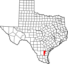 | |
| Village | ||
| CDPs | ||
| Other unincorporated communities | ||
| Footnotes | ‡This populated place also has portions in an adjacent county or counties | |
