Seymour, Texas
| Seymour, Texas | |
|---|---|
| City | |
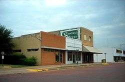 A row of businesses in Seymour | |
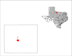
 Location of Seymour, Texas | |
 | |
| Coordinates: 33°35′30″N 99°15′39″W / 33.59167°N 99.26083°WCoordinates: 33°35′30″N 99°15′39″W / 33.59167°N 99.26083°W | |
| Country | United States |
| State | Texas |
| County | Baylor |
| Incorporated (town) | 1890 (dissolved 1892) |
| Incorporated (city) | 1906 |
| Government | |
| • Type | Mayor-Council |
| • Mayor | Nan Gilbert-Mathis |
| • City Council |
Les Hons David Horton Jon Hrncirik Billy Henricks Monty Glass |
| • City Administrator | Steve Beidermann |
| • Chamber of Commerce Director | Myra Busby |
| Area | |
| • Total | 2.9 sq mi (7.6 km2) |
| • Land | 2.9 sq mi (7.6 km2) |
| • Water | 0.004 sq mi (0.01 km2) |
| Elevation | 1,289 ft (393 m) |
| Population (2010) | |
| • Total | 2,740 |
| • Density | 930/sq mi (360/km2) |
| Time zone | UTC-6 (Central (CST)) |
| • Summer (DST) | UTC-5 (CDT) |
| ZIP code | 76380 |
| Area code(s) | 940 |
| FIPS code | 48-66968[1] |
| GNIS feature ID | 1368006[2] |
| Website |
www |

Seymour is a city in and the county seat of Baylor County, Texas, United States.[3] The population was 2,740 as of the 2010 Census.[4]
Geography
Seymour is located at 33°35′30″N 99°15′39″W / 33.59167°N 99.26083°W (33.591552, −99.260968),[5] on the Brazos River. It is 52 miles (84 km) southwest of Wichita Falls and 102 miles (164 km) north-northeast of Abilene. According to the United States Census Bureau, the city has a total area of 2.9 square miles (7.6 km2), of which 0.004 square miles (0.01 km2), or 0.20%, is water.[4]
Geology
Seymour is part of the Texas Red Beds, which are a strata of red-colored sedimentary rock from the Early Permian. The fossils of Permian-era vertebrates in the Texas Red Beds were first discovered by Edward Drinker Cope in 1877.[6][7] Subsequent research has revealed rare fossils of Permian-era amphibians like Trimerorhachis,[8] as well as rich deposits of other Permian tetrapods such as Dimetrodon and Diadectes.[9] The order Seymouriamorpha and genus Seymouria, which were first discovered in the Seymour area, are named after the city.[10]
Demographics
| Historical population | |||
|---|---|---|---|
| Census | Pop. | %± | |
| 1880 | 183 | — | |
| 1890 | 1,125 | 514.8% | |
| 1910 | 2,029 | — | |
| 1920 | 2,121 | 4.5% | |
| 1930 | 2,626 | 23.8% | |
| 1940 | 3,328 | 26.7% | |
| 1950 | 3,779 | 13.6% | |
| 1960 | 3,789 | 0.3% | |
| 1970 | 3,469 | −8.4% | |
| 1980 | 3,657 | 5.4% | |
| 1990 | 3,185 | −12.9% | |
| 2000 | 2,908 | −8.7% | |
| 2010 | 2,740 | −5.8% | |
| Est. 2016 | 2,719 | [11] | −0.8% |
| U.S. Decennial Census[12] | |||

2010 census
As of the census of 2010, there were 2,740 people, a decrease of 5.78% since 2000 (168 people). The racial makeup of the town was 91.28% White (2,501 people), 3.61% Hispanic or Latino of any race (373 people), 2.45% African American (67 people), 0.22% Native American (6 people), 0.11% Asian (3 people), 0.11% Pacific Islander (3 people), 4.11% from other races (104 people), and 3.80% from two or more races (56 people).
There were 1,451 housing units, 249 of which were vacant.
2000 census
As of the census[1] of 2000, 2,908 people, 1,273 households, and 790 families resided in the city. The population density was 1,067.5 people per square mile (412.8/km²). The 1,534 housing units averaged 563.1 per square mile (217.8/km²). The racial makeup of the city was 89.24% White (2,595 people), 10.45% Hispanic or Latino of any race (304 people), 4.57% African American (133 people), 0.48% Native American (14 people), 0.72% Asian (21 people), 0.10% Pacific Islander (3 people), 3.44% from other races (100 people), and 1.44% from two or more races (42 people).
Of the 1,273 households, 26.0% had children under the age of 18 living with them, 49.1% were married couples living together, 10.0% had a female householder with no husband present, and 37.9% were not families; 35.7% of all households were made up of individuals and 21.9% had someone living alone who was 65 years of age or older. The average household size was 2.25 and the average family size was 2.90.
In the city, the population was distributed as 24.3% under the age of 18, 6.1% from 18 to 24, 20.9% from 25 to 44, 23.9% from 45 to 64, and 24.8% who were 65 years of age or older. The median age was 44 years. For every 100 females, there were 83.2 males. For every 100 females age 18 and over, there were 79.6 males.
The median income for a household in the city was $23,662, and for a family was $32,917. Males had a median income of $21,891 versus $19,292 for females. The per capita income for the city was $16,062. About 15.6% of families and 19.5% of the population were below the poverty line, including 31.8% of those under age 18 and 10.7% of those age 65 or over.
Businesses and organizations
The local Seymour Chamber of Commerce, Seymour Council for the Arts & Enrichment, Rodeo Association, Lions Club, and Garden Club are amongst the many organizations in Seymour, as well as an active Relay for Life Event.
Seymour is also home to the Whiteside Museum of Natural History, a small museum which displays fossils collected from the surrounding area. The museum also employs a team of paleontologists to analyze new findings, with the help of volunteers from the community.[13][14]
History
Seymour was founded by settlers from Oregon, who called the town Oregon City; it was originally located where the Western Trail crossed the Brazos River, which flows just south of the townsite. A post office was established in 1879, when the town's name was changed to honor local cowboy Seymour Munday, after whom nearby Munday was also named.
Commerce, a newspaper, a hotel, and the county courthouse all followed soon after, as did violence between cowboys and settlers. The town experienced two distinct economic booms: the first, short-lived, was with the construction of the Wichita Valley rail line in 1880, and the second was due to the discovery of oil in 1906. The population grew from 500 in 1884 to almost 3800 in 1950; it remained at about that level for more than 30 years, but has declined since to 2,740 in the 2010 census. Agribusiness, as well as some tourism from nearby Lake Kemp, has overtaken oil as the driving factor of the local economy. The Old Settlers Reunion and Rodeo has been held each July since 1896.[15]
The town calls itself "the crossroads of North Texas" because it is located at the junction of five highways: U.S. highways 82, 277, 183, and 283, and State Highway 114.[16]
On August 12, 1936, the temperature at Seymour reached 120 °F (49 °C), the highest temperature ever recorded in the state of Texas.[17]
The Seymour Division of La Escalera Ranch is located north of Seymour in Baylor County and consists of 34,000 contiguous acres (120 km²) in Baylor and Archer Counties. Previously known as Circle Bar Ranch, La Escalera Limited Partnership purchased the ranch from the Claude Cowan, Sr. Trust in January 2005. La Escalera partner Jo Lyda Granberg and husband K. G. Granberg manage the cow-calf operation. The ranch is known for its reputation herd of Black Angus cattle and its abundant wildlife, including white-tailed deer, white-winged dove, mourning dove, northern bobwhite quail, Rio Grande wild turkey, and feral pigs.
Climate
The climate in this area is characterized by hot, humid summers and generally mild to cool winters. According to the Köppen climate classification system, Seymour has a humid subtropical climate, Cfa on climate maps.[18] On August 12, 1936, Seymour witnessed the record highest temperature in Texas (120 °F), a record that was tied by the city of Monahans on June 28, 1994.[19]
| Climate data for Seymour, TX | |||||||||||||
|---|---|---|---|---|---|---|---|---|---|---|---|---|---|
| Month | Jan | Feb | Mar | Apr | May | Jun | Jul | Aug | Sep | Oct | Nov | Dec | Year |
| Record high °F (°C) | 89 (32) |
93 (34) |
100 (38) |
103 (39) |
107 (42) |
115 (46) |
114 (46) |
120 (49) |
112 (44) |
106 (41) |
92 (33) |
90 (32) |
120 (49) |
| Average high °F (°C) | 54.1 (12.3) |
58.5 (14.7) |
67.2 (19.6) |
77.3 (25.2) |
84.5 (29.2) |
92.6 (33.7) |
97.6 (36.4) |
97.7 (36.5) |
89.3 (31.8) |
78.8 (26) |
65.4 (18.6) |
55.5 (13.1) |
76.5 (24.8) |
| Average low °F (°C) | 27.1 (−2.7) |
31.4 (−0.3) |
38.8 (3.8) |
48.9 (9.4) |
58.4 (14.7) |
67.3 (19.6) |
71.2 (21.8) |
70.2 (21.2) |
62.4 (16.9) |
50.9 (10.5) |
38.1 (3.4) |
29.7 (−1.3) |
49.5 (9.8) |
| Record low °F (°C) | −14 (−26) |
−9 (−23) |
5 (−15) |
22 (−6) |
30 (−1) |
47 (8) |
54 (12) |
50 (10) |
34 (1) |
20 (−7) |
7 (−14) |
−8 (−22) |
−14 (−26) |
| Average precipitation inches (mm) | 0.99 (25.1) |
1.41 (35.8) |
1.57 (39.9) |
2.18 (55.4) |
3.79 (96.3) |
3.20 (81.3) |
2.21 (56.1) |
2.30 (58.4) |
3.09 (78.5) |
2.61 (66.3) |
1.55 (39.4) |
1.36 (34.5) |
26.26 (667) |
| Average snowfall inches (cm) | 0.8 (2) |
0.6 (1.5) |
0.2 (0.5) |
0 (0) |
0 (0) |
0 (0) |
0 (0) |
0 (0) |
0 (0) |
0 (0) |
0.3 (0.8) |
0.4 (1) |
2.3 (5.8) |
| Source: http://www.wrcc.dri.edu/cgi-bin/cliMAIN.pl?tx8221 | |||||||||||||
Education
Seymour is served by the Seymour Independent School District.
References
- 1 2 "American FactFinder". United States Census Bureau. Retrieved 2008-01-31.
- ↑ "US Board on Geographic Names". United States Geological Survey. 2007-10-25. Retrieved 2008-01-31.
- ↑ "Find a County". National Association of Counties. Retrieved 2011-06-07.
- 1 2 "Geographic Identifiers: 2010 Demographic Profile Data (G001): Seymour city, Texas". U.S. Census Bureau, American Factfinder. Retrieved April 9, 2014.
- ↑ "US Gazetteer files: 2010, 2000, and 1990". United States Census Bureau. 2011-02-12. Retrieved 2011-04-23.
- ↑ Cope, E. D. Descriptions of extinct vertebrata from the Permian and Triassic formations of the United States. Proceedings of the American Philosophical Society, 1877. Volume 17:182–195. JSTOR. Accessed on August 28, 2017.
- ↑ Case, E.C.The Red Beds between Wichita Falls, Texas, and Las Vegas, New Mexico, in Relation to Their Vertebrate Fauna. The Journal of Geology, vol. 22, no. 3, 1914, pp. 243–259. JSTOR. Accessed on August 28, 2017.
- ↑ Henry, Randy. NRCS and Landowner Team Up With Houston Museum after Rare Species Discovery. Natural Resources Conservation Service. Accessed on August 28, 2017.
- ↑ Caulfield, Dave. Prehistoric Predators: Fossil Findings in Seymour 'Redefining'. Newschannel 6: October 25, 2015. Accessed on August 28, 2017.
- ↑ Williston, S. W. Restoration of Seymouria Baylorensis Broili, an American Cotylosaur. The Journal of Geology: 1911, vol. 19, no. 3, pp. 232–237. JSTOR. Accessed on August 28, 2017.
- ↑ "Population and Housing Unit Estimates". Retrieved June 9, 2017.
- ↑ "Census of Population and Housing". Census.gov. Retrieved June 4, 2015.
- ↑ Hanna, Bill. Remains of the day: Seymour Researchers Unearth Prehistoric Skeleton. Fort Worth Star Telegram: February 9, 2015. Accessed on August 28, 2017.
- ↑ Touring Texoma: Ancient Treasures. KDFX News. Accessed on August 28, 2017.
- ↑ "Handbook of Texas Online – Seymour, TX". Retrieved January 15, 2009.
- ↑ "City of Seymour, Texas website". Retrieved November 7, 2007.
- ↑ Hodge, Larry; Syers, Ed (2000). Backroads of Texas (4th ed.). Lanham, MD: Lone Star Books.
- ↑ Climate Summary for Seymour, Texas
- ↑ Enloe. "State Climate Extremes Committee (SCEC) | Extremes | National Centers for Environmental Information (NCEI)". www.ncdc.noaa.gov. Retrieved 2017-04-12.
External links
| Wikimedia Commons has media related to Seymour, Texas. |
Municipalities and communities of Baylor County, Texas, United States | ||
|---|---|---|
| City | 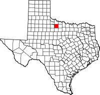 | |
| Unincorporated community | ||
