Vale View, Queensland
Vale View is a rural locality south of the Toowoomba Region, Queensland, Australia, 14 kilometres (9 mi) from the Toowoomba central business district.[2] At the 2016 Australian Census, Vale View recorded a population of 472.[1]
| Vale View Toowoomba, Queensland | |||||||||||||||
|---|---|---|---|---|---|---|---|---|---|---|---|---|---|---|---|
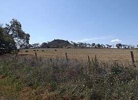 Paddocks along Franks Road at Vale View, 2014 | |||||||||||||||
 Vale View | |||||||||||||||
| Coordinates | 27.661°S 151.904°E | ||||||||||||||
| Population | 472 (2016 census)[1] | ||||||||||||||
| Postcode(s) | 4352 | ||||||||||||||
| Location | 14 km (9 mi) SSW of Toowoomba | ||||||||||||||
| LGA(s) | Toowoomba Region | ||||||||||||||
| State electorate(s) | Condamine | ||||||||||||||
| Federal Division(s) | Groom | ||||||||||||||
| |||||||||||||||
The Southern railway line marks a small section of the northwest boundary of Vale View. The New England Highway is aligned with the southeast boundary.
References
- Australian Bureau of Statistics (27 June 2017). "Vale View (State Suburb)". 2016 Census QuickStats. Retrieved 25 March 2018.

- "Vale View (entry 48085)". Queensland Place Names. Queensland Government. Retrieved 28 August 2015.
This article is issued from Wikipedia. The text is licensed under Creative Commons - Attribution - Sharealike. Additional terms may apply for the media files.