Broxburn, Queensland
Broxburn is a locality in the Toowoomba Region of the Darling Downs in southern Queensland, Australia.[2] At the 2016 Australian Census Broxburn and surrounds recorded a population of 153.[1]
| Broxburn Queensland | |||||||||||||||
|---|---|---|---|---|---|---|---|---|---|---|---|---|---|---|---|
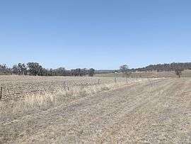 Farms along Southbrook Road, 2014 | |||||||||||||||
 Broxburn | |||||||||||||||
| Coordinates | 27°43′S 151°41′E | ||||||||||||||
| Population | 153 (2016 census)[1] | ||||||||||||||
| Postcode(s) | 4356 | ||||||||||||||
| LGA(s) | Toowoomba Region | ||||||||||||||
| State electorate(s) | Condamine | ||||||||||||||
| Federal Division(s) | |||||||||||||||
| |||||||||||||||
Geography
The northwest boundary follows the Gore Highway. Close to the northern boundary is the Millmerran railway line which had a stop at Broxburn.
History
The Broxburn Provisional School opened on 13 June 1898. In 1909, it became Broxburn State School. It closed in 1959.[3][4]
References
- Australian Bureau of Statistics (27 June 2017). "Broxburn (State Suburb)". 2016 Census QuickStats. Retrieved 25 March 2018.

- "Broxburn (entry 47899)". Queensland Place Names. Queensland Government. Retrieved 5 August 2015.47899
- "Opening and closing dates of Queensland Schools". Queensland Government. Retrieved 4 August 2015.
- "Agency ID5926, Broxburn State School". Queensland State Archives. Retrieved 5 August 2015.
This article is issued from Wikipedia. The text is licensed under Creative Commons - Attribution - Sharealike. Additional terms may apply for the media files.