Hirstglen, Queensland
Hirstglen is a rural locality in the Toowoomba Region on the Darling Downs, Queensland, Australia.[2] In the 2016 census, Hirstglen had a population of 83 people.[1]
| Hirstglen Queensland | |||||||||||||||
|---|---|---|---|---|---|---|---|---|---|---|---|---|---|---|---|
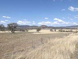 Fields along Greenmount Hirstvale Road, 2014 | |||||||||||||||
 Hirstglen | |||||||||||||||
| Coordinates | 27.8361°S 152.0855°E | ||||||||||||||
| Population | 83 (2016 census)[1] | ||||||||||||||
| • Density | 1.939/km2 (5.02/sq mi) | ||||||||||||||
| Postcode(s) | 4359 | ||||||||||||||
| Area | 42.8 km2 (16.5 sq mi) | ||||||||||||||
| Time zone | AEST (UTC+10:00) | ||||||||||||||
| LGA(s) | Toowoomba Region | ||||||||||||||
| State electorate(s) | Condamine | ||||||||||||||
| Federal Division(s) | Groom | ||||||||||||||
| |||||||||||||||
Geography
Part of the southern boundary is marked by Kings Creek, a tributary of the Condamine River. The northern and eastern boundary roughly follows a ridge which marks the watershed of the Condamine.
History
Hirstglen State School opened on 6 May 1930 and closed on 22 February 1948.[3]
Education
There are no schools in Hirstglen. The nearest primary school is in neighbouring Pilton. The nearest secondary school is in Clifton.[4]
References
- Australian Bureau of Statistics (27 June 2017). "Hirstglen (SSC)". 2016 Census QuickStats. Retrieved 20 October 2018.

- "Hirstglen - locality in Toowoomba Region (entry 47970)". Queensland Place Names. Queensland Government. Retrieved 17 November 2019.
- Queensland Family History Society (2010), Queensland schools past and present (Version 1.01 ed.), Queensland Family History Society, ISBN 978-1-921171-26-0
- "Queensland Globe". State of Queensland. Retrieved 17 November 2019.
This article is issued from Wikipedia. The text is licensed under Creative Commons - Attribution - Sharealike. Additional terms may apply for the media files.