Gowrie Little Plain, Queensland
Gowrie Little Plain is a rural locality in the Toowoomba Region, Queensland, Australia.[2] In the 2016 census, Gowrie Little Plain had a population of 65 people.[1]
| Gowrie Little Plain Queensland | |||||||||||||||
|---|---|---|---|---|---|---|---|---|---|---|---|---|---|---|---|
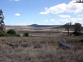 Farms along Yalangur Lilyvale Road, 2014 | |||||||||||||||
 Gowrie Little Plain | |||||||||||||||
| Coordinates | 27.4308°S 151.8458°E | ||||||||||||||
| Population | 65 (2016 census)[1] | ||||||||||||||
| • Density | 5.56/km2 (14.39/sq mi) | ||||||||||||||
| Postcode(s) | 4352 | ||||||||||||||
| Area | 11.7 km2 (4.5 sq mi) | ||||||||||||||
| Time zone | AEST (UTC+10:00) | ||||||||||||||
| LGA(s) | Toowoomba Region | ||||||||||||||
| State electorate(s) | Condamine | ||||||||||||||
| Federal Division(s) | Groom | ||||||||||||||
| |||||||||||||||
Geography
Gowrie Little Plain is on the Darling Downs. In the south of the locality are a series of hills which rise to around 600 metres (2,000 ft) above sea level.
History
The locality takes its name from the nearby town of Gowrie. The town takes its name from a pastoral run which was named pastoralists Henry Hughes and Frederick N. Isaac, who initially called the property Stanbrook, but renamed it Gowrie in 1847. The name Gowrie is probably a corruption of cowarie, Aboriginal name for Gowrie Creek, which in turn possibly means freshwater mussel.[2]
Education
There are no schools in Gowrie Little Plain. The nearest primary school is in Kingsthorpe and Meringandan West. The nearest secondary schools are in Oakey and Highfields.[3]
References
| Wikimedia Commons has media related to Gowrie Little Plain, Queensland. |
- Australian Bureau of Statistics (27 June 2017). "Gowrie Little Plain (SSC)". 2016 Census QuickStats. Retrieved 20 October 2018.

- "Gowrie Little Plain - locality in Toowoomba Region (entry 47954)". Queensland Place Names. Queensland Government. Retrieved 5 November 2019.
- "Queensland Globe". State of Queensland. Retrieved 14 November 2019.