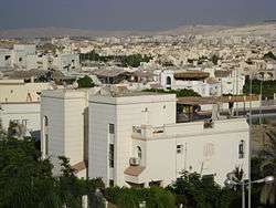
Sheikh Zayed City
Sheikh Zayed City (Arabic: مدينة الشيخ زايد) is a city in Giza Governorate in Egypt and part of the Greater Cairo urban area. It was established in 1995 and is named after Zayed bin Sultan Al Nahyan.
Sheikh Zayed City مدينة الشيخ زايد | |
|---|---|
 | |
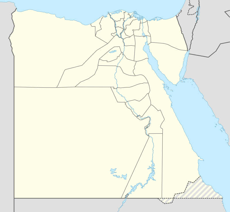 Sheikh Zayed City Location in Egypt | |
| Coordinates: 30°03′N 31°0′E | |
| Country | Egypt |
| Governorate | Giza |
| Government | |
| • Chairman Of City Development Authority | Moustafa Fahmey [1] |
| Area | |
| • Total | 19 sq mi (49 km2) |
| Population (January 2019) | |
| • Total | 90,000 Residents with Sheikh Zayed IDs 375,000 Total Residents living in Sheikh Zayed (estimated based on electric meter installation figures) |
| Time zone | UTC+2 (EST) |
20th anniversary
In 2014, during the celebration of its 20th anniversary, the Minister of Housing, Mostafa Madbouly, said 'the Urban Communities Authority’s budget had been expanded for the 2014/2015 fiscal year so that all plans may be implemented and completed'. A technology center opened that day in Sheikh Zayed City but residents complained about the lack of other facilities.[1]
Geography
Sheikh Zayed City is situated about 20 km (12 mi) from Lebanon Square in the Mohandiseen district of Giza. It is bordered to the north by the Cairo-Alexandria desert road, to the south by the 26 July Corridor, and to the west by the neighboring 6th of October.
The city forms part of the Giza Governorate, and is divided into 17 residential districts, with four neighborhoods in each district .
Sheikh Zayed City sits 226 meters above mean sea level.
Climate
Köppen-Geiger climate classification system classifies its climate as hot desert (BWh). Its climate is very similar to Giza and Cairo, owing to its proximity to them.
| Climate data for Sheikh Zayed City | |||||||||||||
|---|---|---|---|---|---|---|---|---|---|---|---|---|---|
| Month | Jan | Feb | Mar | Apr | May | Jun | Jul | Aug | Sep | Oct | Nov | Dec | Year |
| Average high °C (°F) | 18.7 (65.7) |
20.4 (68.7) |
23.4 (74.1) |
27.7 (81.9) |
31.7 (89.1) |
34.2 (93.6) |
34.4 (93.9) |
34.2 (93.6) |
32 (90) |
29.8 (85.6) |
25 (77) |
20.4 (68.7) |
27.7 (81.8) |
| Daily mean °C (°F) | 12.3 (54.1) |
13.5 (56.3) |
16.3 (61.3) |
19.7 (67.5) |
23.5 (74.3) |
26.3 (79.3) |
27.2 (81.0) |
27.1 (80.8) |
25 (77) |
22.8 (73.0) |
18.7 (65.7) |
14.2 (57.6) |
20.5 (69.0) |
| Average low °C (°F) | 6 (43) |
6.6 (43.9) |
9.2 (48.6) |
11.7 (53.1) |
15.4 (59.7) |
18.4 (65.1) |
20.1 (68.2) |
20 (68) |
18.1 (64.6) |
15.9 (60.6) |
12.4 (54.3) |
8 (46) |
13.5 (56.3) |
| Average precipitation mm (inches) | 4 (0.2) |
5 (0.2) |
3 (0.1) |
2 (0.1) |
1 (0.0) |
0 (0) |
0 (0) |
0 (0) |
0 (0) |
1 (0.0) |
3 (0.1) |
5 (0.2) |
24 (0.9) |
| Source: Climate-Data.org[3] | |||||||||||||
Education
Schools
- The American International School in Egypt West Campus is located in Sheikh Zayed City.[4]
- Beverly Hills Schools (Deutsche Schule Beverly Hills Kairo, American Beverly Hills School, English Beverly Hills School)
- The Maharat Super Global School
- Elsheikh Zayed Secondary Schools For boys
- Elsheikh Zayed Secondary Schools For girls
- New Manor House School
- Ethos International School
- Greenland international school
- American international school
- The British School, CAIRO (BISC)[5]
List of universities
- The Canadian International University
- Faculty of engineering Cairo University
- Faculty of commerce English Section
- Nile University
- National Training Academy
See also
References
- Al-Shuwekhi, Abdel Razek (November 15, 2014). "EGP 4bn real estate investments in Sheikh Zayed: City chairman". Daily News Egypt. Retrieved 30 October 2016.
- manchikoni.com https://manchikoni.com/housing-begins-delivery-of-336-units-project-house-egypt-sheikh-zayed-9-october-next/. Retrieved 2019-01-22. Missing or empty
|title=(help) - "Climate: Al-Sheikh Zayed - Climate graph, Temperature graph, Climate table". Climate-Data.org. Retrieved 16 August 2013.
- "Home." American International School in Egypt West Campus. Retrieved on January 25, 2015. "AMERICAN INTERNATIONAL SCHOOL IN EGYPT WEST CAMPUS Sheikh Zayed City Entrance 2 Greens Compound"
- "BISC website" Check
|url=value (help).
External links
Districts and suburbs of Greater Cairo-Giza | ||||||||||
|---|---|---|---|---|---|---|---|---|---|---|
| Cairo Governorate |
|   | ||||||||
| Giza Governorate |
| |||||||||
| Qalyubia Governorate |
| |||||||||