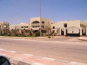
Badr, Egypt
Badr (Arabic: بدر pronounced [bædɾ]) is a city located north east in the Cairo Governorate, Egypt. Badr is planned as an industrial city and includes 129 factories. In addition to this, 350 factories are still under construction. Most factories are built with the aim of exporting to Arab, African and world markets.
Badr بدر | |
|---|---|
city | |
 | |
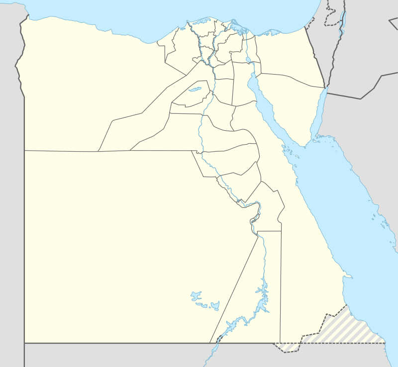 Badr Location in Egypt | |
| Coordinates: 30.135923°N 31.731552°E | |
| Country | |
| Governorate | Cairo |
| Time zone | UTC+2 (EST) |
Description
It is the nearest industrial city to Cairo International Airport, Suez Port, it is also close to the Delta and the Suez Canal.
Projects in Badr are exempted from taxes for up to 10 years from the date at which their operation commenced.
Education
The city houses three universities, namely the Egyptian-Russian University, Future University in Egypt، the Egyptian E-Learning University and Badr University in Cairo BUC.
Health care
The city has a central national hospital, Badr Hospital. The hospital was founded in the early 2005 and started working in 2009. Badr Hospital is owned by Helwan University and is now assigned to be a University Hospital.
Climate
Badr City essentially has a hot desert climate ([1]). The climate is generally extremely dry all over the year except some sporadic rain during the winter months. In addition to rarity of rain, extreme heat during summer months is also a general climate feature of Badr although daytime temperatures are milder during autumn and winter. [[Köppen-Geiger climate classificatioate as hot desert (BWh),[2] as the rest of Egypt. n system]] classifies its clim
| Climate data for Badr City | |||||||||||||
|---|---|---|---|---|---|---|---|---|---|---|---|---|---|
| Month | Jan | Feb | Mar | Apr | May | Jun | Jul | Aug | Sep | Oct | Nov | Dec | Year |
| Average high °C (°F) | 18.1 (64.6) |
19.8 (67.6) |
23.2 (73.8) |
27.8 (82.0) |
32 (90) |
34.4 (93.9) |
34.9 (94.8) |
34.6 (94.3) |
31.8 (89.2) |
29.8 (85.6) |
24.9 (76.8) |
20.1 (68.2) |
27.6 (81.7) |
| Daily mean °C (°F) | 12.8 (55.0) |
14 (57) |
16.7 (62.1) |
20.3 (68.5) |
24.2 (75.6) |
26.9 (80.4) |
27.8 (82.0) |
27.9 (82.2) |
25.4 (77.7) |
23.5 (74.3) |
19.4 (66.9) |
14.7 (58.5) |
21.1 (70.0) |
| Average low °C (°F) | 7.6 (45.7) |
8.2 (46.8) |
10.2 (50.4) |
12.9 (55.2) |
16.4 (61.5) |
19.4 (66.9) |
20.8 (69.4) |
21.2 (70.2) |
19.1 (66.4) |
17.2 (63.0) |
13.9 (57.0) |
9.4 (48.9) |
14.7 (58.5) |
| Average precipitation mm (inches) | 6 (0.2) |
4 (0.2) |
4 (0.2) |
2 (0.1) |
0 (0) |
0 (0) |
0 (0) |
0 (0) |
0 (0) |
1 (0.0) |
4 (0.2) |
5 (0.2) |
26 (1.1) |
| Source: Climate-Data.org (altitude: 216m)[2] | |||||||||||||
See also
- List of cities and towns in Egypt
- Shorouk City
- New Heliopolis
- Greater Cairo
References
- Köppen climate classification BWh
- "Climate: Badr City - Climate graph, Temperature graph, Climate table". Climate-Data.org. Retrieved 2013-12-14.
| 1,000,000 and more | |
|---|---|
| 300,000–999,999 | |
| 100,000–299,999 | |
| <99,999 | |
Districts and suburbs of Greater Cairo-Giza | ||||||||||
|---|---|---|---|---|---|---|---|---|---|---|
| Cairo Governorate |
|   | ||||||||
| Giza Governorate |
| |||||||||
| Qalyubia Governorate |
| |||||||||