Girga
Girga (Egyptian Arabic: جرجا pronounced [ˈɡeɾɡæ], Coptic: ⲧⲓⲛ Din?) is a city in the Sohag Governorate of Upper Egypt. It is located on the west bank of the Nile River.
Girga ⲧⲓⲛ? جرجا | |
|---|---|
City | |
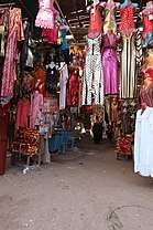 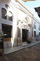 Suq Market (left) - Mitwalli Mosque Entrance (right) | |
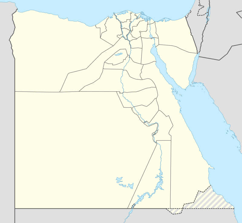 Girga Location in Egypt | |
| Coordinates: 26°20′N 31°54′E | |
| Country | |
| Governorate | Sohag |
| Population (2006) | |
| • Total | 102,701 |
| Time zone | UTC+2 (EST) |
Name
| grg[1][2] in hieroglyphs |
|---|
It is viewed by some Egyptologists such as Brugsch that the name of the city derives from the ancient Egyptian word grg miri-amoun Ramessou which means "The establishment of Ramesses II",[3] although Daressy and Budge identify the name with Coptic Balyana near Abydos.[1][2]
| grg mrj jmn rꜥmsw[2][3] in hieroglyphs |
|---|
Overview
Girga was the capital of the Girga Governorate until 1960, when the capital was moved to Sohag and the name of the governorate changed accordingly.[4] Girga has an estimated population of 71,564 (as of 1986) and has various economic industries which include cane sugar manufacturing and pottery. Near the city there is a monastery dedicated to St. George from which local folklore derives the name of the city. Also the city has another monastery, the el-Sini is reportedly the oldest Roman Catholic monastery ever built in Egypt. Girga has also been famed for its landscape, the beautiful paved Suq, and the el-Sini (Porcelain Mosque), which is reportedly the oldest known Roman Catholic monastery and was almost swept away by the Nile at one time.
History
The city was home and headquarters of the first Pharaoh of a unified Egypt, Narmer. As of today, it is unconfirmed to whether this is the site of the ancient city of This (Thinis) or the nearby village of Birba which was the capital of Egypt during the 1st and 2nd dynasties. Also neighbouring Girga is the ancient sites including Beit Khallaf, a necropolis where tourists can find mudbrick tombs dating back to the 3rd dynasty. The city has been known as Dgerja (Arabic: دجرجا) or Gerga (Arabic: جرجا) in medieval times. At one time, it was the center of Ottoman rule in the South Egypt, one of the largest cities of the Ottoman Empire.
In 1791, Saint Yousab El Abah (also Joseph el-Abbah) was the bishop of the city.
Climate
Köppen-Geiger climate classification system classifies its climate as hot desert (BWh).
| Climate data for Girga | |||||||||||||
|---|---|---|---|---|---|---|---|---|---|---|---|---|---|
| Month | Jan | Feb | Mar | Apr | May | Jun | Jul | Aug | Sep | Oct | Nov | Dec | Year |
| Average high °C (°F) | 22.3 (72.1) |
24.3 (75.7) |
28.1 (82.6) |
33.5 (92.3) |
36.9 (98.4) |
38.3 (100.9) |
37.9 (100.2) |
38.1 (100.6) |
34.9 (94.8) |
32.4 (90.3) |
28.8 (83.8) |
23.8 (74.8) |
31.6 (88.9) |
| Daily mean °C (°F) | 13.7 (56.7) |
15.3 (59.5) |
18.7 (65.7) |
23.9 (75.0) |
27.8 (82.0) |
29.5 (85.1) |
29.5 (85.1) |
29.9 (85.8) |
27.7 (81.9) |
25.1 (77.2) |
20.4 (68.7) |
15.5 (59.9) |
23.1 (73.6) |
| Average low °C (°F) | 5.1 (41.2) |
6.1 (43.0) |
9.4 (48.9) |
14.3 (57.7) |
18.7 (65.7) |
20.8 (69.4) |
21.2 (70.2) |
21.8 (71.2) |
20.5 (68.9) |
17.9 (64.2) |
12.2 (54.0) |
7.3 (45.1) |
14.6 (58.3) |
| Average precipitation mm (inches) | 0 (0) |
0 (0) |
0 (0) |
0 (0) |
0 (0) |
0 (0) |
0 (0) |
0 (0) |
0 (0) |
0 (0) |
0 (0) |
1 (0.0) |
1 (0) |
| Source: Climate-Data.org[5] | |||||||||||||
See also
- Thinis
- List of cities in Egypt
References
- Wallis Budge, E. A. (1920). An Egyptian hieroglyphic dictionary: with an index of English words, king list and geological list with indexes, list of hieroglyphic characters, coptic and semitic alphabets, etc. Vol II. John Murray. p. 1049.
- Gauthier, Henri (1928). Dictionnaire des Noms Géographiques Contenus dans les Textes Hiéroglyphiques Dictionnaire des Noms Géographiques Contenus dans les Textes Hiéroglyphiques Dictionnaire des Noms Géographiques Contenus dans les Textes Hiéroglyphiques Vol. 5. pp. 217, 218.
- Brugsch, Heinrich (1879). Dictionnaire géographique de l'ancienne Egypte: contenant par ordre alphabétique la nomenclature comparée des noms propres géographiques qui se rencontrent sur les monuments et dans les papyrus. J. C. Hinrichs. pp. 853–854.
- Law, Gwillim (1999). Administrative Subdivisions of Countries: A Comprehensive World Reference, 1900 through 1998 (snippet view). Jefferson, NC: McFarland. p. 114. ISBN 978-0-7864-0729-3. Retrieved 2010-08-07.
- "Climate: Girga - Climate graph, Temperature graph, Climate table". Climate-Data.org. Retrieved 14 August 2013.
External links
| Wikimedia Commons has media related to Girga. |
- (in German) Girga on Wikivoyage
- Usepigraphy Stele Marble Relief - Brown University
| Regions | ||
|---|---|---|
| Important sites | ||
| ||