Rafah, Egypt
Rafah (Arabic: رفح, IPA: [ˈɾɑfɑħ]) is an important city in North Sinai and Egypt's eastern border with the Gaza Strip. It is the capital of Rafah center in North Sinai Governorate, and is situated on the eastern Mediterranean coast of Egypt.
Rafah رفح | |
|---|---|
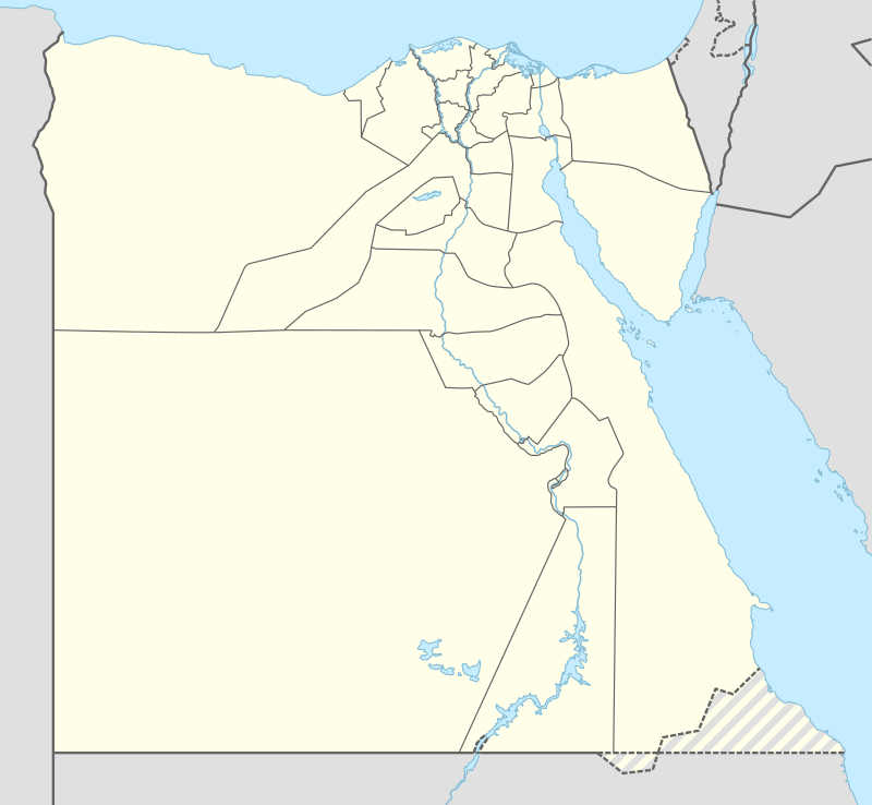 Rafah Location in Egypt | |
| Coordinates: 31°17′19″N 34°14′28″E | |
| Country | |
| Governorate | North Sinai |
| Population | |
| • Ethnicities | Bedouin Arabs and Egyptians |
| Time zone | UTC+2 (EST) |
Rafah is the site of the Rafah Border Crossing, the sole crossing point between Egypt and the Gaza Strip. The Egyptian government announced in early 2015 that it would raze the entire city and build a new settlement for its residents, in order to expand a security buffer between Egypt and Gaza Strip. The Egyptian military reportedly began bulldozing sections of Rafah in late 2014.[1]
History
In the Egyptian language of Ancient Egypt, the city was known as Rapia. The city has for significant periods been a part of the Egyptian Empire since the Pharaonic period. It was also a major location on the battle route towards Egyptian settlements in Anatolia and Levant.
When Israel withdrew from the Sinai in 1982, Rafah was split into a Gazan part and an Egyptian part, dividing families, separated by barbed-wire barriers.[2][3] The core of the city was destroyed by Israel[4][5][6] and Egypt[7][8] to create a large buffer zone.
During the 2011 Egyptian protests, anti-government rioters attacked and killed three police officers in the town.[9]
In October 2014, the Egyptian government announced plans to relocate the population and completely demolish the city in order to enlarge the buffer zone between Egypt and Gaza.[10] Between July 2013 and August 2015, Egyptian authorities demolished at least 3,255 residential, commercial, administrative, and community buildings along the border, forcibly evicting thousands of people.[11]
In June 2015 Egypt completed the digging of a ditch at the Rafah Crossing Point, 20 meters wide by 10 meters deep. It is located two kilometers from the border with Gaza outside of Rafah City and part of the enlarged buffer zone. Expansion of the trench along with watchtowers was planned.[12]
Economy
Rafah is in a Mediterranean climate zone and agriculture thrives. Due to rain, hail and sleet; the city has plentiful sources of water for agriculture. Mediterranean fruits and crops are dominant, such as: peaches, olives, apples, citrus fruits, dates, grapes, vegetables, strawberries and peppers.
Smuggling to the Gaza Strip has been a major source of income for Bedouin tribesmen, using over 1,200 smuggling tunnels to smuggle food, weapons and other goods into Gaza.[13]
Climate
Like east Mediterranean cities and Egypt's north coast but wetter, it is characterised by hot dry summers and mild rainy winters. The temperature during summer can be around 30 °C (86 °F) during daytime, and rarely exceeds 35 °C (95 °F) due to the influence of the sea. Winters range from mild to cool during the day and chilly during the night and temperatures dip below 6 °C (43 °F) very often. Rainfall is average with sometimes hail, sleet and rarely snow takes place.
Köppen-Geiger climate classification system classifies its climate as hot semi-arid (BSh).[14][15]
Rafah, Alexandria, Abu Qir, Rosetta, Baltim, Kafr el-Dawwar and Mersa Matruh are the wettest places in Egypt.
| Climate data for Rafah, North Sinai | |||||||||||||
|---|---|---|---|---|---|---|---|---|---|---|---|---|---|
| Month | Jan | Feb | Mar | Apr | May | Jun | Jul | Aug | Sep | Oct | Nov | Dec | Year |
| Average high °C (°F) | 17.2 (63.0) |
18.0 (64.4) |
20.3 (68.5) |
22.9 (73.2) |
25.8 (78.4) |
28.2 (82.8) |
29.6 (85.3) |
30.5 (86.9) |
29.0 (84.2) |
27.4 (81.3) |
23.7 (74.7) |
19.3 (66.7) |
24.3 (75.8) |
| Daily mean °C (°F) | 12.7 (54.9) |
13.5 (56.3) |
15.4 (59.7) |
18.0 (64.4) |
20.8 (69.4) |
23.5 (74.3) |
25.2 (77.4) |
25.9 (78.6) |
24.5 (76.1) |
22.4 (72.3) |
18.6 (65.5) |
14.7 (58.5) |
19.6 (67.3) |
| Average low °C (°F) | 8.2 (46.8) |
9.0 (48.2) |
10.6 (51.1) |
13.2 (55.8) |
15.9 (60.6) |
18.8 (65.8) |
20.8 (69.4) |
21.4 (70.5) |
20.0 (68.0) |
17.4 (63.3) |
13.5 (56.3) |
10.1 (50.2) |
14.9 (58.8) |
| Average precipitation mm (inches) | 49 (1.9) |
37 (1.5) |
28 (1.1) |
6 (0.2) |
4 (0.2) |
0 (0) |
0 (0) |
0 (0) |
0 (0) |
8 (0.3) |
39 (1.5) |
54 (2.1) |
225 (8.8) |
| Source: Climate-Data.org (altitude: 78m)[14] | |||||||||||||
References
- "Egypt Moves to Eradicate Town Near Gaza Strip". The New York Times. 8 January 2015. Retrieved 8 January 2015.
- Cinderella in Rafah. Al-Ahram, Issue No. 761, 22–28 September 2005
- The Evolution of the Egypt-Israel Boundary: From Colonial Foundations to Peaceful Borders, pp. 3, 9, 18. Nurit Kliot, Boundary and Territory Briefing, Volume 1 Number 8. At Google books
- Razing Rafah — Mass Home Demolitions in the Gaza Strip, pp. 27-28 and 52-66 (PDF text version) on , Summary:. The report on refworld:. Human Rights Watch (HRW), October 2004
- Supplementary Appeal for Rafah. UNWRA, May 2004
- PCHR, Uprooting Palestinian Trees And Leveling Agricultural Land – The tenth Report on Israeli Land Sweeping and Demolition of Palestinian Buildings and Facilities in the Gaza Strip 1 April 2003 – 30 April 2004 On
- Egyptian military doubling buffer zone with Gaza , demolishing nearly 1,220 more homes. Associated Pres, 8 January 2015
- “Look for Another Homeland”. Human Rights Watch, September 2015
- "Pyramids closed as deadly riots spread". Herald Sun. 30 January 2011. Retrieved 3 February 2011.
- Laura Dean (February 2, 2015). "An entire city is going to be wiped off the map in Egypt". GlobalPost.
- “Look for Another Homeland”. Human Rights Watch, September 2015
- Egypt builds trench along Gaza border to prevent smuggling. Ma'an News Agency, 22 June 2015
- Egypt bans Hamas activities in Egypt. Reuters. 4 March 2014
- "Climate: Rafah - Climate graph, Temperature graph, Climate table". Climate-Data.org. Archived from the original on 2014-02-23. Retrieved 2014-02-21.
- "Climate: Rafiah - Climate graph, Temperature graph, Climate table". Climate-Data.org. Retrieved 2014-02-21.
| 1,000,000 and more | |
|---|---|
| 300,000–999,999 | |
| 100,000–299,999 | |
| <99,999 | |